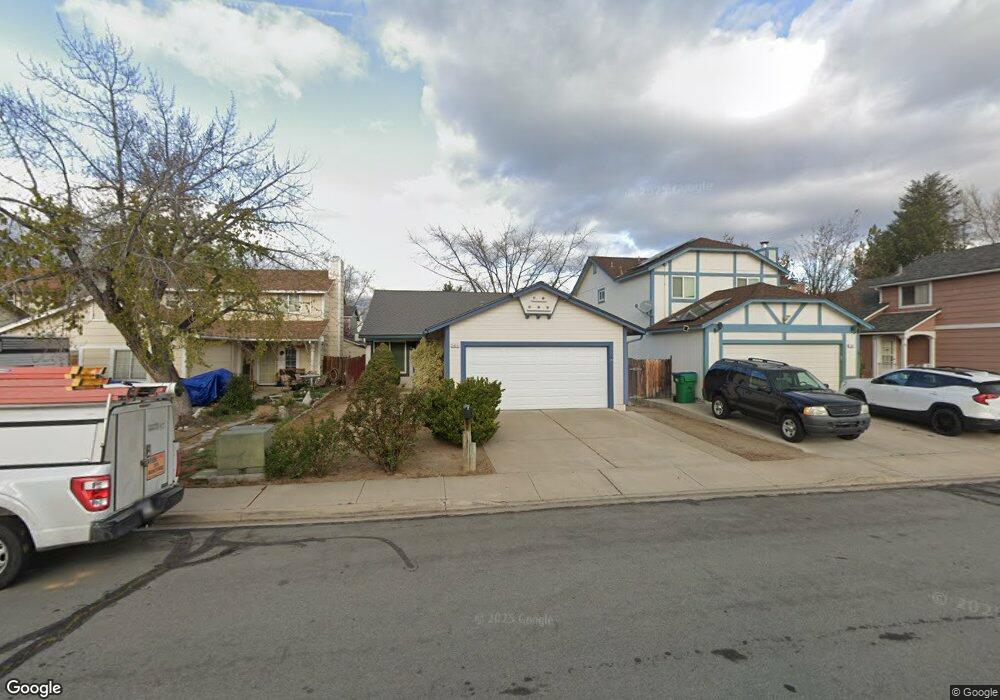
1421 Burnside Ct Sparks, NV 89434
O'Callaghan NeighborhoodEstimated Value: $414,868 - $462,000
3
Beds
2
Baths
1,250
Sq Ft
$348/Sq Ft
Est. Value
About This Home
This home is located at 1421 Burnside Ct, Sparks, NV 89434 and is currently estimated at $435,217, approximately $348 per square foot. 1421 Burnside Ct is a home located in Washoe County with nearby schools including Katherine Dunn Elementary School, George L Dilworth Middle School, and Edward C Reed High School.
Ownership History
Date
Name
Owned For
Owner Type
Purchase Details
Closed on
Aug 29, 2024
Sold by
Cole John W
Bought by
John William Cole Revocable Living Trust and Cole
Current Estimated Value
Purchase Details
Closed on
Nov 7, 2002
Sold by
Cole John W
Bought by
Cole John W
Home Financials for this Owner
Home Financials are based on the most recent Mortgage that was taken out on this home.
Original Mortgage
$87,990
Interest Rate
5.95%
Purchase Details
Closed on
Apr 25, 1997
Sold by
Cole Julie
Bought by
Cole John W
Home Financials for this Owner
Home Financials are based on the most recent Mortgage that was taken out on this home.
Original Mortgage
$18,300
Interest Rate
7.96%
Purchase Details
Closed on
Jan 21, 1994
Sold by
Cole John W and Cole Julie
Bought by
Cole John W and Cole Julie
Home Financials for this Owner
Home Financials are based on the most recent Mortgage that was taken out on this home.
Original Mortgage
$91,008
Interest Rate
7.21%
Mortgage Type
FHA
Create a Home Valuation Report for This Property
The Home Valuation Report is an in-depth analysis detailing your home's value as well as a comparison with similar homes in the area
Home Values in the Area
Average Home Value in this Area
Purchase History
| Date | Buyer | Sale Price | Title Company |
|---|---|---|---|
| John William Cole Revocable Living Trust | -- | None Listed On Document | |
| Cole John W | $151,000 | First Centennial Title Co | |
| Cole John W | -- | Founders Title Co | |
| Cole John W | -- | First American Title Company |
Source: Public Records
Mortgage History
| Date | Status | Borrower | Loan Amount |
|---|---|---|---|
| Previous Owner | Cole John W | $87,990 | |
| Previous Owner | Cole John W | $18,300 | |
| Previous Owner | Cole John W | $91,008 |
Source: Public Records
Tax History Compared to Growth
Tax History
| Year | Tax Paid | Tax Assessment Tax Assessment Total Assessment is a certain percentage of the fair market value that is determined by local assessors to be the total taxable value of land and additions on the property. | Land | Improvement |
|---|---|---|---|---|
| 2025 | $1,472 | $65,229 | $34,580 | $30,649 |
| 2024 | $1,472 | $64,057 | $32,725 | $31,332 |
| 2023 | $1,430 | $62,405 | $32,305 | $30,100 |
| 2022 | $1,389 | $51,449 | $26,005 | $25,444 |
| 2021 | $1,348 | $45,514 | $19,845 | $25,669 |
| 2020 | $1,308 | $45,807 | $19,775 | $26,032 |
| 2019 | $1,270 | $44,475 | $18,935 | $25,540 |
| 2018 | $1,233 | $39,243 | $13,965 | $25,278 |
| 2017 | $1,190 | $37,761 | $12,670 | $25,091 |
| 2016 | $1,160 | $37,267 | $11,410 | $25,857 |
| 2015 | $1,158 | $35,742 | $9,625 | $26,117 |
| 2014 | $1,124 | $33,604 | $8,225 | $25,379 |
| 2013 | -- | $30,097 | $6,090 | $24,007 |
Source: Public Records
Map
Nearby Homes
- 1770 Burnside Dr
- 1332 Coachman Ct
- 1728 Bluehaven Dr
- 1990 Fargo Way
- 1544 Woodhaven Ln
- 1752 Wabash Cir
- 1218 Junction Dr
- 2252 Sycamore Glen Dr
- 1970 Woodhaven Ln
- 2435 Sycamore Glen Dr Unit 2
- 2002 Wabash Cir
- 2407 Sunny Slope Dr Unit 1
- 1897 Bonita Vista Dr
- 2688 Laguna Way
- 2763 Blossom View Dr
- 2070 Avella Dr
- 1688 Round Mountain Cir
- 1973 Rio Tinto Dr
- 675 Parlanti Ln Unit 52
- 675 Parlanti Ln Unit 124
- 1391 Burnside Ct
- 1441 Burnside Ct
- 1461 Burnside Ct
- 1371 Burnside Ct
- 1412 Union St
- 1362 Union St
- 1432 Union St
- 1481 Burnside Ct
- 1351 Burnside Ct
- 1322 Union St
- 1472 Union St
- 1420 Burnside Ct
- 1511 Burnside Ct
- 1440 Burnside Ct
- 1331 Burnside Ct
- 1390 Burnside Ct
- 1460 Burnside Ct
- 1370 Burnside Ct
- 1302 Union St
- 1531 Burnside Ct