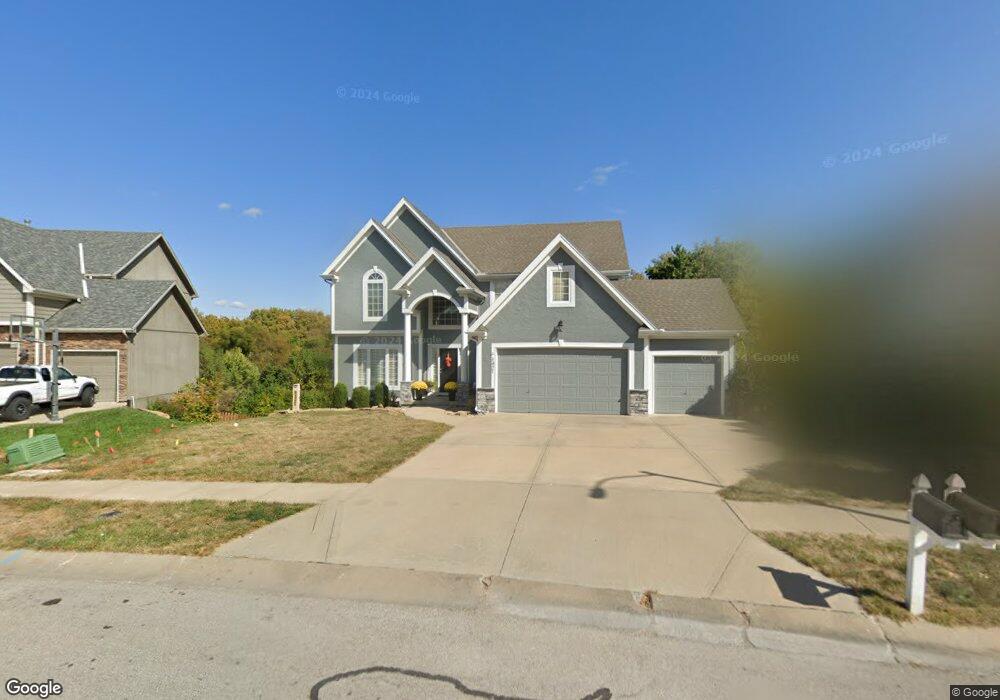
1421 Duncan Dr Liberty, MO 64068
Estimated Value: $523,503 - $545,000
4
Beds
3
Baths
3,003
Sq Ft
$178/Sq Ft
Est. Value
About This Home
This home is located at 1421 Duncan Dr, Liberty, MO 64068 and is currently estimated at $533,376, approximately $177 per square foot. 1421 Duncan Dr is a home located in Clay County with nearby schools including Ridgeview Elementary School, Heritage Middle School, and Liberty North High School.
Ownership History
Date
Name
Owned For
Owner Type
Purchase Details
Closed on
Jun 21, 2005
Sold by
Robertson Construction Llc
Bought by
Frigon Chad N and Frigon Julie A
Current Estimated Value
Purchase Details
Closed on
Feb 9, 2005
Sold by
Robertson Properties Inc
Bought by
Robertson Construction Llc
Home Financials for this Owner
Home Financials are based on the most recent Mortgage that was taken out on this home.
Original Mortgage
$278,200
Interest Rate
5.85%
Mortgage Type
Purchase Money Mortgage
Create a Home Valuation Report for This Property
The Home Valuation Report is an in-depth analysis detailing your home's value as well as a comparison with similar homes in the area
Home Values in the Area
Average Home Value in this Area
Purchase History
| Date | Buyer | Sale Price | Title Company |
|---|---|---|---|
| Frigon Chad N | -- | Thomson Title Corporation | |
| Robertson Construction Llc | -- | Thomson Title Corporation |
Source: Public Records
Mortgage History
| Date | Status | Borrower | Loan Amount |
|---|---|---|---|
| Previous Owner | Robertson Construction Llc | $278,200 |
Source: Public Records
Tax History
| Year | Tax Paid | Tax Assessment Tax Assessment Total Assessment is a certain percentage of the fair market value that is determined by local assessors to be the total taxable value of land and additions on the property. | Land | Improvement |
|---|---|---|---|---|
| 2025 | $6,456 | $82,610 | -- | -- |
| 2024 | $6,456 | $83,940 | -- | -- |
| 2023 | $6,565 | $83,940 | $0 | $0 |
| 2022 | $5,771 | $72,850 | $0 | $0 |
| 2021 | $5,726 | $72,846 | $7,220 | $65,626 |
| 2020 | $5,448 | $65,090 | $0 | $0 |
| 2019 | $5,447 | $65,094 | $6,650 | $58,444 |
Source: Public Records
Map
Nearby Homes
- 1303 Telford Dr
- 0 Rush Creek Pkwy
- 619 N Gallatin St
- 960 Ellis St
- 907 N Forest Ln
- 316 E Doniphan St
- 1014 N Forest Ln
- 440 N Grover St
- 439 Grover St
- 1007 Wyckwood Dr
- 425 Maple St
- 402 N Leonard St
- 427 N Fairview Ave
- 1963 Harvest Rd
- 320 N Fairview Ave
- 1513 Lake Rd
- 130 N Morse Ave
- 521 Ellas Way
- 517 Ellas Way
- 604 Izzy Way
Your Personal Tour Guide
Ask me questions while you tour the home.