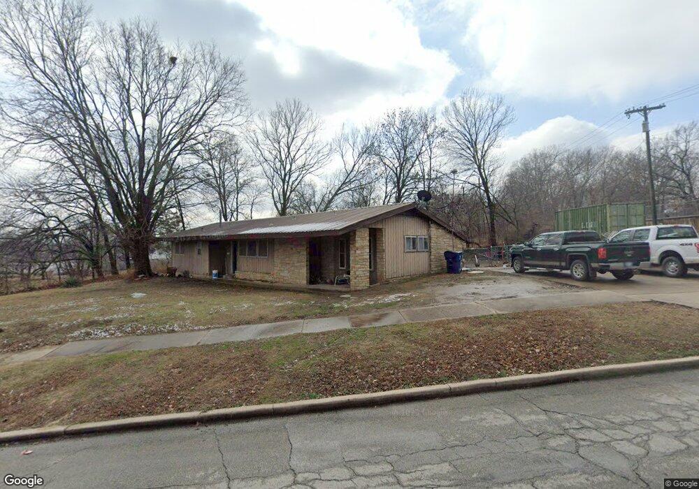
1421 Revard Ave Pawhuska, OK 74056
Estimated Value: $90,000 - $119,000
3
Beds
2
Baths
1,240
Sq Ft
$85/Sq Ft
Est. Value
About This Home
This home is located at 1421 Revard Ave, Pawhuska, OK 74056 and is currently estimated at $105,932, approximately $85 per square foot. 1421 Revard Ave is a home located in Osage County with nearby schools including Indian Camp Elementary School, Pawhuska Elementary School, and Pawhuska Middle School.
Ownership History
Date
Name
Owned For
Owner Type
Purchase Details
Closed on
Sep 26, 2005
Sold by
Herrmann Eugene J and Herrmann Hazel Marie
Bought by
Sheridan Michelle M
Current Estimated Value
Home Financials for this Owner
Home Financials are based on the most recent Mortgage that was taken out on this home.
Original Mortgage
$130,000
Outstanding Balance
$94,382
Interest Rate
4.87%
Mortgage Type
USDA
Estimated Equity
$11,550
Purchase Details
Closed on
Jan 13, 2003
Sold by
Coats Michelle
Bought by
Sheridan Michelle
Purchase Details
Closed on
Sep 13, 2001
Sold by
Gates Brenda
Bought by
Coats Michelle
Purchase Details
Closed on
Jun 14, 2001
Sold by
Gates Brenda Etal
Bought by
Gates Brenda
Purchase Details
Closed on
Feb 10, 1999
Sold by
Gates Brenda June
Bought by
Gates Brenda Etal
Create a Home Valuation Report for This Property
The Home Valuation Report is an in-depth analysis detailing your home's value as well as a comparison with similar homes in the area
Home Values in the Area
Average Home Value in this Area
Purchase History
| Date | Buyer | Sale Price | Title Company |
|---|---|---|---|
| Sheridan Michelle M | $130,000 | None Available | |
| Sheridan Michelle | -- | -- | |
| Coats Michelle | $32,500 | -- | |
| Gates Brenda | -- | -- | |
| Gates Brenda Etal | -- | -- |
Source: Public Records
Mortgage History
| Date | Status | Borrower | Loan Amount |
|---|---|---|---|
| Open | Sheridan Michelle M | $130,000 |
Source: Public Records
Tax History Compared to Growth
Tax History
| Year | Tax Paid | Tax Assessment Tax Assessment Total Assessment is a certain percentage of the fair market value that is determined by local assessors to be the total taxable value of land and additions on the property. | Land | Improvement |
|---|---|---|---|---|
| 2024 | $496 | $6,375 | $674 | $5,701 |
| 2023 | $496 | $6,189 | $674 | $5,515 |
| 2022 | $447 | $5,834 | $674 | $5,160 |
| 2021 | $433 | $5,834 | $674 | $5,160 |
| 2020 | $425 | $5,834 | $674 | $5,160 |
| 2019 | $404 | $5,664 | $674 | $4,990 |
| 2018 | $400 | $5,499 | $674 | $4,825 |
| 2017 | $390 | $5,339 | $674 | $4,665 |
| 2016 | $377 | $5,184 | $674 | $4,510 |
| 2015 | $376 | $5,033 | $674 | $4,359 |
| 2014 | $370 | $4,886 | $674 | $4,212 |
| 2013 | $451 | $4,744 | $674 | $4,070 |
Source: Public Records
Map
Nearby Homes
- 1419 Leahy Ave
- 0 Prudom Ave
- 1700 Grandview Ave
- 208 E 12th St
- 421 E 11th St
- 1715 Grandview Ave
- 312 E 11th St
- 101 E 11th St
- 321 E 10th St
- 1815 Grandview Ave
- 906 Rogers Ave
- 1721 Bighill Ave
- 1205 Brenner Ave
- 501 W 17th St
- 320 E 7th St
- 225 E 6th St
- 2019 Mckenzie Rd
- 1322 Boundary Ave
- 1318 Boundary Ave
- 2125 Mckenzie Rd
- 1419 Revard Ave
- 1501 Revard Ave
- 1420 Prudom Ave
- 315 E 14th St
- 321 E 14th St
- 321 E 14th St
- 1500 Prudom Ave
- 1500 Revard Ave
- 309 E 14th St
- 1515 Revard Ave
- 1504 Revard Ave
- 1402 Revard Ave
- 301 E 14th St
- 1506 Revard Ave
- 412 E 15th St
- 407 E 14th St
- 1516 Revard Ave
- 411 E 14th St
- 1521 Revard Ave
- 222 E 15th St