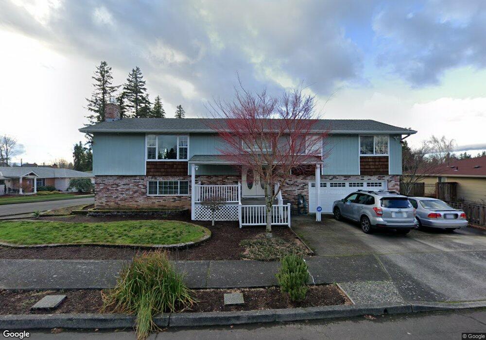
1421 SE 208th Ave Gresham, OR 97030
Northwest Gresham NeighborhoodEstimated Value: $464,000 - $522,000
4
Beds
3
Baths
2,570
Sq Ft
$192/Sq Ft
Est. Value
About This Home
This home is located at 1421 SE 208th Ave, Gresham, OR 97030 and is currently estimated at $493,698, approximately $192 per square foot. 1421 SE 208th Ave is a home located in Multnomah County with nearby schools including North Gresham Elementary School, Clear Creek Middle School, and Gresham High School.
Ownership History
Date
Name
Owned For
Owner Type
Purchase Details
Closed on
Jun 27, 2000
Sold by
Equivantage Inc
Bought by
Steele Joe A and Steele Annette M
Current Estimated Value
Home Financials for this Owner
Home Financials are based on the most recent Mortgage that was taken out on this home.
Original Mortgage
$105,000
Outstanding Balance
$37,658
Interest Rate
8.67%
Mortgage Type
Purchase Money Mortgage
Estimated Equity
$456,040
Create a Home Valuation Report for This Property
The Home Valuation Report is an in-depth analysis detailing your home's value as well as a comparison with similar homes in the area
Home Values in the Area
Average Home Value in this Area
Purchase History
| Date | Buyer | Sale Price | Title Company |
|---|---|---|---|
| Steele Joe A | $158,000 | First American Title Co |
Source: Public Records
Mortgage History
| Date | Status | Borrower | Loan Amount |
|---|---|---|---|
| Open | Steele Joe A | $105,000 |
Source: Public Records
Tax History
| Year | Tax Paid | Tax Assessment Tax Assessment Total Assessment is a certain percentage of the fair market value that is determined by local assessors to be the total taxable value of land and additions on the property. | Land | Improvement |
|---|---|---|---|---|
| 2025 | $5,422 | $266,450 | -- | -- |
| 2024 | $5,190 | $258,690 | -- | -- |
| 2023 | $4,729 | $251,160 | $0 | $0 |
| 2022 | $4,597 | $243,850 | $0 | $0 |
| 2021 | $4,481 | $236,750 | $0 | $0 |
| 2020 | $4,216 | $229,860 | $0 | $0 |
| 2019 | $4,233 | $223,170 | $0 | $0 |
| 2018 | $3,915 | $216,670 | $0 | $0 |
| 2017 | $3,756 | $210,360 | $0 | $0 |
| 2016 | $3,312 | $204,240 | $0 | $0 |
Source: Public Records
Map
Nearby Homes
- 2013 NW Bella Vista Dr
- 1811 NW 19th St
- 1861 NW Wonderview Ave
- 21033 SE Clay Ct
- 1596 NW Riverview Ave
- 21016 SE Stark St Unit 71
- 21016 SE Stark St Unit 69
- 70 NW Birdsdale Ave
- 21260 SE Stark St
- 21400 SE Stark St Unit 2
- 21532 SE Alder St
- 0 SE Burnside St
- 1325 NW 9th St
- 970 NW Wonderview Ct Unit 980
- 19776 SE Stark St Unit 147
- 805 SE 197th Ave
- 209 SE 214th Ave
- 522 SE 199th Ave
- 765 NW Angeline Ave
- 1745 NW 7th Place
- 1411 SE 208th Ave
- 1410 SE 207th Ave
- 1413 SE 208th Ave
- 20732 SE Hawthorne St
- 20803 SE Hawthorne St
- 1407 SE 208th Ave
- 1414 SE 208th Ave
- 1348 SE 207th Ave
- 20816 SE Hawthorne St
- 1425 SE 207th Ave
- 1419 SE 207th Ave
- 1409 SE 207th Ave
- 1400 SE 208th Ave
- 1345 SE 208th Ave
- 1357 SE 207th Ave
- 20718 SE Burnside Ct
- 1429 SE 209th Ave
- 1417 SE 209th Ave
- 1342 SE 208th Ave
- 1401 SE 209th Ave
Your Personal Tour Guide
Ask me questions while you tour the home.