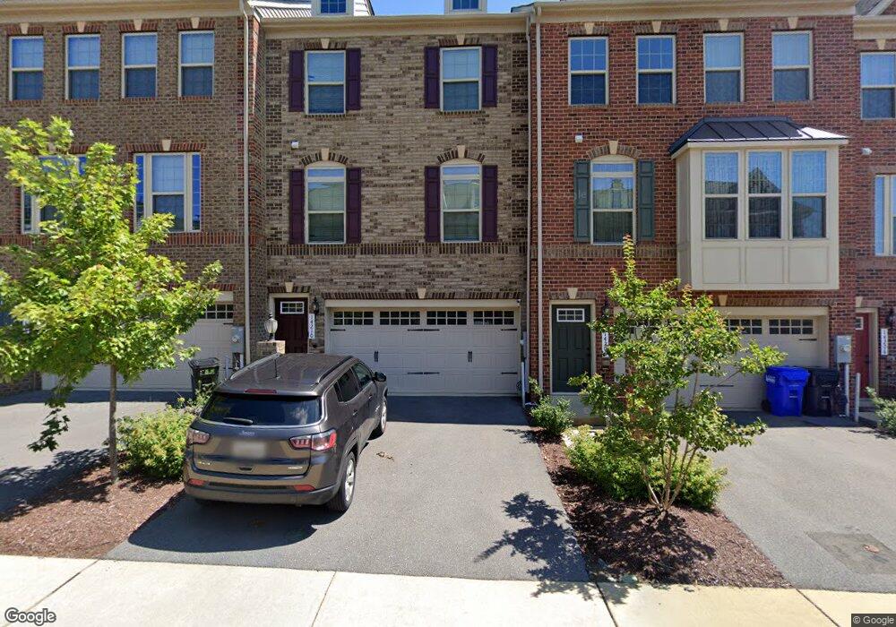
14210 Westside Ridge Dr Laurel, MD 20707
Estimated Value: $525,000 - $597,000
Studio
3
Baths
1,848
Sq Ft
$302/Sq Ft
Est. Value
About This Home
This home is located at 14210 Westside Ridge Dr, Laurel, MD 20707 and is currently estimated at $557,482, approximately $301 per square foot. 14210 Westside Ridge Dr is a home located in Prince George's County with nearby schools including Bond Mill Elementary, Martin Luther King Jr. Middle School, and Laurel High School.
Ownership History
Date
Name
Owned For
Owner Type
Purchase Details
Closed on
May 10, 2018
Sold by
Nvr Inc
Bought by
Aidara Cheikhna H and Seck Fatimetou
Current Estimated Value
Home Financials for this Owner
Home Financials are based on the most recent Mortgage that was taken out on this home.
Original Mortgage
$418,394
Outstanding Balance
$359,477
Interest Rate
4.4%
Mortgage Type
New Conventional
Estimated Equity
$198,005
Purchase Details
Closed on
Apr 28, 2016
Sold by
Strittmatter Land Llc
Bought by
Gudmar Westside Llc
Create a Home Valuation Report for This Property
The Home Valuation Report is an in-depth analysis detailing your home's value as well as a comparison with similar homes in the area
Home Values in the Area
Average Home Value in this Area
Purchase History
| Date | Buyer | Sale Price | Title Company |
|---|---|---|---|
| Aidara Cheikhna H | $431,335 | Stewart Title Guaranty Co | |
| Gudmar Westside Llc | $3,360,000 | First American Title Ins Co |
Source: Public Records
Mortgage History
| Date | Status | Borrower | Loan Amount |
|---|---|---|---|
| Open | Aidara Cheikhna H | $418,394 |
Source: Public Records
Tax History
| Year | Tax Paid | Tax Assessment Tax Assessment Total Assessment is a certain percentage of the fair market value that is determined by local assessors to be the total taxable value of land and additions on the property. | Land | Improvement |
|---|---|---|---|---|
| 2025 | $9,165 | $517,300 | $140,000 | $377,300 |
| 2024 | $9,165 | $488,300 | -- | -- |
| 2023 | $8,686 | $459,300 | $0 | $0 |
| 2022 | $8,126 | $430,300 | $100,000 | $330,300 |
| 2021 | $7,655 | $406,200 | $0 | $0 |
| 2020 | $14,693 | $382,100 | $0 | $0 |
| 2019 | $7,013 | $358,000 | $75,000 | $283,000 |
| 2018 | $0 | $355,167 | $0 | $0 |
| 2017 | $134 | $9,000 | $0 | $0 |
| 2016 | -- | $9,000 | $0 | $0 |
Source: Public Records
Map
Nearby Homes
- 14847 Willow Run Ln
- 14730 Spring Haven Ln
- 14502 Star View Ln
- 6947 Mayfair Terrace
- 1106 Overlook Way
- 1023 Highpoint Trail
- 1024 Flester Ln
- 1023 Flester Ln
- 1016 Flester Ln
- 1012 Flester Ln
- 1027 Overlook Way
- 13901 Anderson Garden Rd
- 7234 Contee Rd
- 7238 Contee Rd
- 7240 Contee Rd
- 7254 Contee Rd
- 7256 Contee Rd
- 7260 Contee Rd
- 13947 Anderson Garden Rd
- 7266 Contee Rd
- 14208 Westside Ridge Dr
- 14206 Westside Ridge Dr
- 14206 Laurel Ridge Dr
- 14212 Westside Ridge Dr
- 14204 Westside Ridge Dr
- 14214 Westside Ridge Dr
- 14214 Laurel Ridge Dr
- 14202 Westside Ridge Dr
- 14202 Laurel Ridge Dr
- 14218 Westside Ridge Dr
- 14216 Westside Ridge Dr
- 14200 Westside Ridge Dr
- 14209 Westside Ridge Dr
- 14207 Westside Ridge Dr
- 14205 Westside Ridge Dr
- 14203 Westside Ridge Dr
- 14201 Westside Ridge Dr
- 6901 Ironbridge Ln
- 6823 Ironbridge Ln
- 14220 Westside Ridge Dr
Your Personal Tour Guide
Ask me questions while you tour the home.