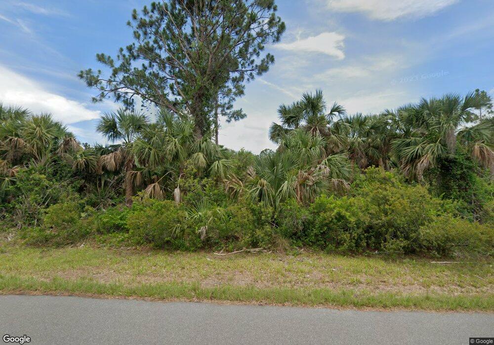
14211 Nevada Ave Port Charlotte, FL 33953
Northwest Port Charlotte NeighborhoodEstimated Value: $12,000 - $36,076
--
Bed
--
Bath
--
Sq Ft
10,019
Sq Ft Lot
About This Home
This home is located at 14211 Nevada Ave, Port Charlotte, FL 33953 and is currently estimated at $24,038. 14211 Nevada Ave is a home located in Charlotte County with nearby schools including Liberty Elementary School, Murdock Middle School, and Port Charlotte High School.
Ownership History
Date
Name
Owned For
Owner Type
Purchase Details
Closed on
Nov 30, 2020
Sold by
Dephillipo R J
Bought by
Fmo Realty 401K Plan & Trust
Current Estimated Value
Purchase Details
Closed on
Mar 12, 2010
Sold by
Charlotte State Bank
Bought by
Dephillipo R J
Purchase Details
Closed on
Jul 8, 2005
Sold by
Mohr Terry M
Bought by
Hadar Noy
Home Financials for this Owner
Home Financials are based on the most recent Mortgage that was taken out on this home.
Original Mortgage
$155,680
Interest Rate
5.54%
Mortgage Type
Balloon
Create a Home Valuation Report for This Property
The Home Valuation Report is an in-depth analysis detailing your home's value as well as a comparison with similar homes in the area
Home Values in the Area
Average Home Value in this Area
Purchase History
| Date | Buyer | Sale Price | Title Company |
|---|---|---|---|
| Fmo Realty 401K Plan & Trust | $5,349 | None Available | |
| Fmo Realty-401K Plan & Trust | $5,349 | None Listed On Document | |
| Dephillipo R J | $12,400 | Attorney | |
| Hadar Noy | $194,500 | West Charlotte Title Inc |
Source: Public Records
Mortgage History
| Date | Status | Borrower | Loan Amount |
|---|---|---|---|
| Previous Owner | Hadar Noy | $155,680 |
Source: Public Records
Tax History Compared to Growth
Tax History
| Year | Tax Paid | Tax Assessment Tax Assessment Total Assessment is a certain percentage of the fair market value that is determined by local assessors to be the total taxable value of land and additions on the property. | Land | Improvement |
|---|---|---|---|---|
| 2024 | $440 | $10,328 | $10,328 | -- |
| 2023 | $440 | $3,456 | $0 | $0 |
| 2022 | $411 | $8,466 | $8,466 | $0 |
| 2021 | $374 | $2,856 | $2,856 | $0 |
| 2020 | $358 | $2,678 | $2,678 | $0 |
| 2019 | $353 | $2,678 | $2,678 | $0 |
| 2018 | $344 | $2,321 | $2,321 | $0 |
| 2017 | $340 | $2,237 | $2,237 | $0 |
| 2016 | $336 | $1,533 | $0 | $0 |
| 2015 | $330 | $1,394 | $0 | $0 |
| 2014 | $228 | $1,384 | $0 | $0 |
Source: Public Records
Map
Nearby Homes
- 14171 Carney Ave
- 14228 Pittenger Ave
- 14188 Guadalcanal Ave
- 2122 Atterbury St
- 14212 Guadalcanal Ave
- 2154 Atterbury St
- 14252 Guadalcanal Ave
- 14211 Strader Ave
- 14219 Strader Ave
- 2135 Meetze St
- 14019 Nevada Ave
- 14179 Nevada Ave
- 14113 Nevada Ave
- 2330 Meetze St
- 14228 Nevada Ave
- 2267 Meetze St
- 14114 Carney Ave
- 14297 Rothschild Ave
- 14312 Rothschild Ave
- 2130 Rickover St
- 14203 Nevada Ave
- 14219 Nevada Ave
- 14212 Pittenger Ave
- 14195 Nevada Ave
- 14196 Nevada Ave
- 14236 Nevada Ave
- 14211 Pittenger Ave
- 14219 Pittenger Ave
- 14203 Corona Ave
- 14203 Carney Ave
- 14203 Pittenger Ave
- 14227 Pittenger Ave
- 14195 Pittenger Ave
- 14180 Pittenger Ave
- 14235 Carney Ave
- 14187 Pittenger Ave
- 14251 Nevada Ave
- 14180 Carney Ave
- 14188 Carney Ave
- 14156 Carney Ave
