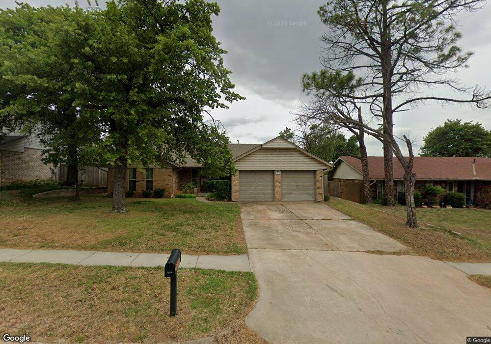
14213 Scott St Edmond, OK 73013
Chisholm NeighborhoodEstimated Value: $199,000 - $250,000
3
Beds
2
Baths
1,457
Sq Ft
$154/Sq Ft
Est. Value
About This Home
This home is located at 14213 Scott St, Edmond, OK 73013 and is currently estimated at $224,206, approximately $153 per square foot. 14213 Scott St is a home located in Oklahoma County with nearby schools including Chisholm Elementary School, Cimarron Middle School, and Memorial High School.
Ownership History
Date
Name
Owned For
Owner Type
Purchase Details
Closed on
Mar 19, 2024
Sold by
Woolston Joseph H and Woolston Christine
Bought by
Woolston Christine
Current Estimated Value
Home Financials for this Owner
Home Financials are based on the most recent Mortgage that was taken out on this home.
Original Mortgage
$81,908
Outstanding Balance
$80,268
Interest Rate
6.77%
Mortgage Type
FHA
Estimated Equity
$143,938
Purchase Details
Closed on
Jan 9, 2004
Sold by
Alexander D Craig and Alexander Sharon C
Bought by
Woolston Joseph H and Woolston Christine
Create a Home Valuation Report for This Property
The Home Valuation Report is an in-depth analysis detailing your home's value as well as a comparison with similar homes in the area
Home Values in the Area
Average Home Value in this Area
Purchase History
| Date | Buyer | Sale Price | Title Company |
|---|---|---|---|
| Woolston Christine | -- | Timios | |
| Woolston Joseph H | $98,500 | Capitol Abstract & Title |
Source: Public Records
Mortgage History
| Date | Status | Borrower | Loan Amount |
|---|---|---|---|
| Open | Woolston Christine | $81,908 |
Source: Public Records
Tax History
| Year | Tax Paid | Tax Assessment Tax Assessment Total Assessment is a certain percentage of the fair market value that is determined by local assessors to be the total taxable value of land and additions on the property. | Land | Improvement |
|---|---|---|---|---|
| 2025 | $1,981 | $18,042 | $3,104 | $14,938 |
| 2023 | $1,905 | $17,007 | $3,106 | $13,901 |
| 2022 | $1,863 | $16,511 | $2,729 | $13,782 |
| 2021 | $1,787 | $16,030 | $2,965 | $13,065 |
| 2020 | $1,757 | $15,564 | $3,165 | $12,399 |
| 2019 | $1,712 | $15,111 | $3,126 | $11,985 |
| 2018 | $1,669 | $14,671 | $0 | $0 |
| 2017 | $1,607 | $14,243 | $2,808 | $11,435 |
| 2016 | $1,548 | $13,828 | $2,833 | $10,995 |
| 2015 | $1,508 | $13,426 | $2,804 | $10,622 |
| 2014 | $1,456 | $13,034 | $2,722 | $10,312 |
Source: Public Records
Map
Nearby Homes
- 14301 Canterbury Dr
- 13920 Plantation Way
- 13823 Oxford Dr
- 13821 Oxford Dr
- 13812 Kirkland Ridge
- 13810 Oxford Dr
- 13810 Oxford Dr Unit 13810 & 13808
- 13808 Oxford Dr
- 1913 Walking Sky Rd
- 14204 Smithurst Rd
- 3712 Windover Dr
- 4013 NE 137th St
- 2401 Crossing Dr
- 3505 Walking Sky Rd
- 3300 Rock Creek Rd
- 3317 Hunting Hawk Cir
- 2908 Village Cir
- 3117 Colton Dr
- 4004 Oakdale Farm Cir
- 3500 E 44th St
- 14217 Scott St
- 14209 Scott St
- 14212 Oxford Dr
- 14221 Scott St
- 14208 Oxford Dr
- 14205 Scott St
- 14212 Scott St
- 14216 Oxford Dr
- 3600 NE 142nd Ct
- 14301 Scott St
- 14301 S Scott St
- 14201 Scott St
- 14300 Oxford Dr
- 14208 Scott St
- 14200 Oxford Dr
- 14305 Scott St
- 3609 NE 141st Ct
- 3604 NE 141st Ct
- 3601 NE 142nd Ct
- 3608 NE 142nd Ct
Your Personal Tour Guide
Ask me questions while you tour the home.