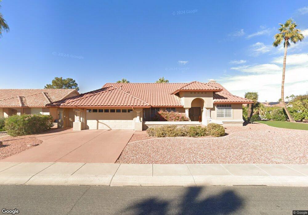
14214 W White Rock Dr Sun City West, AZ 85375
Estimated Value: $554,975 - $917,000
2
Beds
2
Baths
2,404
Sq Ft
$280/Sq Ft
Est. Value
About This Home
This home is located at 14214 W White Rock Dr, Sun City West, AZ 85375 and is currently estimated at $673,744, approximately $280 per square foot. 14214 W White Rock Dr is a home located in Maricopa County with nearby schools including Paradise Honors Elementary, Arizona Charter Academy, and FourteenSix Christian Academy.
Ownership History
Date
Name
Owned For
Owner Type
Purchase Details
Closed on
Oct 9, 2024
Sold by
Paulsen Carol A
Bought by
Paulsen Family Trust and Paulsen
Current Estimated Value
Purchase Details
Closed on
Sep 19, 2011
Sold by
Ludwig Jeannien A
Bought by
Paulsen James H and Paulsen Carol A
Home Financials for this Owner
Home Financials are based on the most recent Mortgage that was taken out on this home.
Original Mortgage
$225,000
Interest Rate
3.95%
Mortgage Type
Purchase Money Mortgage
Purchase Details
Closed on
Aug 23, 1994
Sold by
Sorensen George A
Bought by
Grossman Jeannien A
Purchase Details
Closed on
Feb 1, 1994
Sold by
Sorensen Joan W
Bought by
Sorensen George A
Home Financials for this Owner
Home Financials are based on the most recent Mortgage that was taken out on this home.
Original Mortgage
$50,000
Interest Rate
8.53%
Create a Home Valuation Report for This Property
The Home Valuation Report is an in-depth analysis detailing your home's value as well as a comparison with similar homes in the area
Home Values in the Area
Average Home Value in this Area
Purchase History
| Date | Buyer | Sale Price | Title Company |
|---|---|---|---|
| Paulsen Family Trust | -- | None Listed On Document | |
| Paulsen James H | $275,000 | First American Title Ins Co | |
| Grossman Jeannien A | $305,000 | Chicago Title Insurance Co | |
| Sorensen George A | -- | Stewart Title & Trust |
Source: Public Records
Mortgage History
| Date | Status | Borrower | Loan Amount |
|---|---|---|---|
| Previous Owner | Paulsen James H | $225,000 | |
| Previous Owner | Sorensen George A | $50,000 |
Source: Public Records
Tax History Compared to Growth
Tax History
| Year | Tax Paid | Tax Assessment Tax Assessment Total Assessment is a certain percentage of the fair market value that is determined by local assessors to be the total taxable value of land and additions on the property. | Land | Improvement |
|---|---|---|---|---|
| 2025 | $2,927 | $40,318 | -- | -- |
| 2024 | $2,644 | $38,398 | -- | -- |
| 2023 | $2,644 | $46,380 | $9,270 | $37,110 |
| 2022 | $2,476 | $37,570 | $7,510 | $30,060 |
| 2021 | $2,581 | $35,070 | $7,010 | $28,060 |
| 2020 | $2,517 | $33,830 | $6,760 | $27,070 |
| 2019 | $2,466 | $30,730 | $6,140 | $24,590 |
| 2018 | $2,374 | $29,570 | $5,910 | $23,660 |
| 2017 | $2,284 | $29,270 | $5,850 | $23,420 |
| 2016 | $1,340 | $27,370 | $5,470 | $21,900 |
| 2015 | $2,098 | $25,970 | $5,190 | $20,780 |
Source: Public Records
Map
Nearby Homes
- 19611 N Trail Ridge Dr
- 14402 W Trading Post Dr
- 14222 W Yosemite Dr
- 14419 W Yosemite Dr
- 14426 W Antelope Dr
- 14423 W Trading Post Dr
- 14170 W Desert Glen Dr
- 14123 W Yosemite Dr
- 14122 W Cavalcade Dr
- 14134 W Desert Glen Dr Unit 34
- 19539 N 141st Ave
- 19403 N Trail Ridge Dr Unit 26
- 20007 N Alta Loma Dr
- 19921 N Greenview Dr
- 19814 N White Rock Dr
- 14610 W Trading Post Dr
- 19951 N Greenview Dr
- 14215 W Parkland Dr
- 14627 W Trading Post Dr
- 14626 W Trading Post Dr
- 14211 W Ravenswood Dr
- 14222 W White Rock Dr
- 14215 W Ravenswood Dr
- 14226 W White Rock Dr
- 14219 W White Rock Dr
- 14215 W White Rock Dr
- 14223 W White Rock Dr
- 14206 W White Rock Dr
- 14211 W White Rock Dr
- 14227 W White Rock Dr
- 14219 W Ravenswood Dr
- 14230 W White Rock Dr
- 14210 W Ravenswood Dr
- 14207 W White Rock Dr
- 14214 W Ravenswood Dr
- 14231 W White Rock Dr
- 14202 W White Rock Dr
- 14223 W Ravenswood Dr
- 14218 W Ravenswood Dr
- 14203 W White Rock Dr