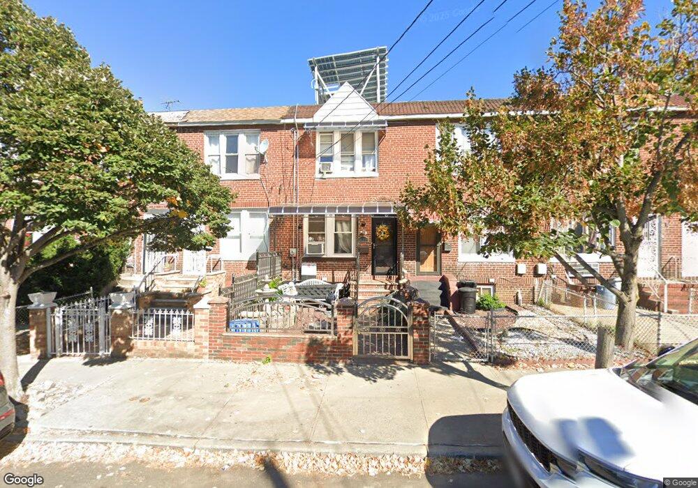
14219 Sutter Ave Jamaica, NY 11436
South Jamaica NeighborhoodEstimated Value: $526,942 - $612,000
--
Bed
--
Bath
880
Sq Ft
$641/Sq Ft
Est. Value
About This Home
This home is located at 14219 Sutter Ave, Jamaica, NY 11436 and is currently estimated at $564,486, approximately $641 per square foot. 14219 Sutter Ave is a home located in Queens County with nearby schools including P.S. 223 - Lyndon B. Johnson, J.H.S. 226 Virgil I. Grisson, and John Adams High School.
Ownership History
Date
Name
Owned For
Owner Type
Purchase Details
Closed on
Dec 18, 2014
Sold by
Capers C Alston Executor
Bought by
Vargas Miguel A
Current Estimated Value
Home Financials for this Owner
Home Financials are based on the most recent Mortgage that was taken out on this home.
Original Mortgage
$222,323
Outstanding Balance
$170,737
Interest Rate
3.99%
Mortgage Type
New Conventional
Estimated Equity
$393,749
Create a Home Valuation Report for This Property
The Home Valuation Report is an in-depth analysis detailing your home's value as well as a comparison with similar homes in the area
Home Values in the Area
Average Home Value in this Area
Purchase History
| Date | Buyer | Sale Price | Title Company |
|---|---|---|---|
| Vargas Miguel A | $230,000 | -- |
Source: Public Records
Mortgage History
| Date | Status | Borrower | Loan Amount |
|---|---|---|---|
| Open | Vargas Miguel A | $222,323 |
Source: Public Records
Tax History Compared to Growth
Tax History
| Year | Tax Paid | Tax Assessment Tax Assessment Total Assessment is a certain percentage of the fair market value that is determined by local assessors to be the total taxable value of land and additions on the property. | Land | Improvement |
|---|---|---|---|---|
| 2025 | $4,174 | $20,780 | $5,175 | $15,605 |
| 2024 | $1,924 | $20,780 | $5,675 | $15,105 |
| 2023 | $4,025 | $20,042 | $5,159 | $14,883 |
| 2022 | $3,775 | $25,260 | $7,800 | $17,460 |
| 2021 | $3,863 | $27,060 | $7,800 | $19,260 |
| 2020 | $3,666 | $26,640 | $7,800 | $18,840 |
| 2019 | $3,623 | $22,800 | $7,800 | $15,000 |
| 2018 | $3,405 | $16,702 | $7,461 | $9,241 |
| 2017 | $3,212 | $15,758 | $6,524 | $9,234 |
| 2016 | $3,058 | $15,758 | $6,524 | $9,234 |
| 2015 | $1,573 | $14,431 | $7,215 | $7,216 |
| 2014 | $1,573 | $14,431 | $8,271 | $6,160 |
Source: Public Records
Map
Nearby Homes
- 14225 Sutter Ave
- 14234 Bascom Ave
- 127-11 143rd St
- 141-08 Rockaway Blvd
- 126-19 144th St
- 142-22 122nd Ave
- 13111 142nd St
- 137-04 130th Ave
- 12902 145th St
- 13116 140th St
- 135-40 Alwick Rd
- 12033 144th St
- 120-09 143rd St
- 145-08 123rd Ave
- 129-13 135th Place
- 145-03 123rd Ave
- 124-23 135th Place
- 13016 Inwood St
- 145-14 Sutter Ave
- 12337 Inwood St Unit 1
- 14217 Sutter Ave
- 14221 Sutter Ave
- 14215 Sutter Ave
- 14223 Sutter Ave
- 14213 Sutter Ave
- 14225 Sutter Ave
- 14211 Sutter Ave
- 14227 Sutter Ave
- 142-11 Sutter Ave
- 14229 Sutter Ave
- 14220 Bascom Ave
- 14222 Bascom Ave
- 12717 142nd St
- 12719 142nd St
- 14226 Bascom Ave
- 12721 142nd St
- 12715 142nd St
- 14216 Bascom Ave
- 14231 Sutter Ave
- 12713 142nd St