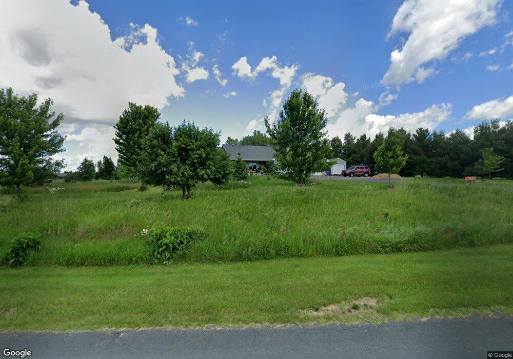
1422 133rd Ave New Richmond, WI 54017
Richmond NeighborhoodEstimated Value: $515,000 - $539,000
5
Beds
3
Baths
3,480
Sq Ft
$152/Sq Ft
Est. Value
About This Home
This home is located at 1422 133rd Ave, New Richmond, WI 54017 and is currently estimated at $528,416, approximately $151 per square foot. 1422 133rd Ave is a home located in St. Croix County with nearby schools including New Richmond High School.
Ownership History
Date
Name
Owned For
Owner Type
Purchase Details
Closed on
Jan 18, 2021
Sold by
Kluesner Michael R and Kluesner Nancy J
Bought by
Kluesner Michael R and Kluesner Nancy J
Current Estimated Value
Purchase Details
Closed on
Jun 14, 2019
Sold by
Fuller Aaron C and Fuller Monica D
Bought by
Kluesner Michael R and Kluesner Nancy J
Home Financials for this Owner
Home Financials are based on the most recent Mortgage that was taken out on this home.
Original Mortgage
$180,000
Interest Rate
4.1%
Mortgage Type
New Conventional
Purchase Details
Closed on
Feb 1, 2012
Sold by
The Secretary Of Veterans Affairs
Bought by
Fuller Aaron C
Home Financials for this Owner
Home Financials are based on the most recent Mortgage that was taken out on this home.
Original Mortgage
$162,244
Interest Rate
4.01%
Mortgage Type
New Conventional
Purchase Details
Closed on
May 11, 2011
Sold by
Wells Fargo Bank N A
Bought by
The Secretary Of Veterans Affairs
Purchase Details
Closed on
May 10, 2011
Sold by
Glenn Kelly D
Bought by
Wells Fargo Bank N A
Purchase Details
Closed on
Jun 6, 2007
Sold by
Cartus Financial Corp
Bought by
Glenn Robert W and Glenn Kelly D
Home Financials for this Owner
Home Financials are based on the most recent Mortgage that was taken out on this home.
Original Mortgage
$294,950
Interest Rate
6.2%
Mortgage Type
VA
Purchase Details
Closed on
Apr 21, 2007
Sold by
Marshall Jeffery M and Marshall Kristen S
Bought by
Cartus Financial Corp
Home Financials for this Owner
Home Financials are based on the most recent Mortgage that was taken out on this home.
Original Mortgage
$294,950
Interest Rate
6.2%
Mortgage Type
VA
Purchase Details
Closed on
Jul 22, 2005
Sold by
Stensgaard David and Stensgard David
Bought by
Marshall Jeffery M and Marshall Kristen S
Home Financials for this Owner
Home Financials are based on the most recent Mortgage that was taken out on this home.
Original Mortgage
$207,960
Interest Rate
6.37%
Mortgage Type
New Conventional
Create a Home Valuation Report for This Property
The Home Valuation Report is an in-depth analysis detailing your home's value as well as a comparison with similar homes in the area
Home Values in the Area
Average Home Value in this Area
Purchase History
| Date | Buyer | Sale Price | Title Company |
|---|---|---|---|
| Kluesner Michael R | -- | None Listed On Document | |
| Kluesner Michael R | $330,000 | None Available | |
| Fuller Aaron C | -- | Land Title Inc | |
| The Secretary Of Veterans Affairs | $156,500 | None Available | |
| Wells Fargo Bank N A | -- | None Available | |
| Glenn Robert W | $285,400 | River Valley Abstract & Titl | |
| Cartus Financial Corp | $285,400 | River Valley Abstract & Titl | |
| Marshall Jeffery M | $260,000 | Burnet Title |
Source: Public Records
Mortgage History
| Date | Status | Borrower | Loan Amount |
|---|---|---|---|
| Previous Owner | Kluesner Michael R | $180,000 | |
| Previous Owner | Fuller Aaron C | $162,244 | |
| Previous Owner | Glenn Robert W | $294,950 | |
| Previous Owner | Marshall Jeffery M | $207,960 |
Source: Public Records
Tax History Compared to Growth
Tax History
| Year | Tax Paid | Tax Assessment Tax Assessment Total Assessment is a certain percentage of the fair market value that is determined by local assessors to be the total taxable value of land and additions on the property. | Land | Improvement |
|---|---|---|---|---|
| 2024 | $51 | $407,600 | $45,000 | $362,600 |
| 2023 | $4,708 | $407,600 | $45,000 | $362,600 |
| 2022 | $4,030 | $407,600 | $45,000 | $362,600 |
| 2021 | $3,972 | $402,000 | $45,000 | $357,000 |
| 2020 | $4,563 | $252,500 | $26,400 | $226,100 |
| 2019 | $4,411 | $252,500 | $26,400 | $226,100 |
| 2018 | $4,237 | $252,500 | $26,400 | $226,100 |
| 2017 | $4,142 | $252,500 | $26,400 | $226,100 |
| 2016 | $4,142 | $252,500 | $26,400 | $226,100 |
| 2015 | $4,297 | $252,500 | $26,400 | $226,100 |
| 2014 | $4,153 | $252,500 | $26,400 | $226,100 |
| 2013 | $3,974 | $252,500 | $26,400 | $226,100 |
Source: Public Records
Map
Nearby Homes
- 1258 150th St
- 1448 142nd St
- 1417 146th Ave
- 1318 146th Ave
- 1314 130th Ave
- 1438 129th St
- TBD 119th Ave
- 1193 121st St
- xxx Lot #5 110th Ave
- xxx Lot #13 110th Ave
- xxx Lot#18 110th Ave
- xxx Lot #2 110th Ave
- xxx Lot #7 110th Ave
- xxx Lot #4 110th Ave
- xxx Lot#15 110th Ave
- xxx Lot#20 110th Ave
- xxx Lot#19 110th Ave
- xxx Lot#26 110th Ave
- xxx Lot#16 110th Ave
- xxx Lot#22 110th Ave
- 1426 133rd Ave
- 1423 1423 134th-Avenue-
- 1423 134th Ave
- 1416 133rd Ave
- 1427 134th Ave
- 1415 133rd Ave
- 1425 133rd Ave
- 1417 134th Ave
- 1434 1434 133rd Ave
- 1434 133rd Ave
- 1330 141st St
- 1417 131st Ave
- 1414 131st Ave
- 1331 141st St
- 1438 131st Ave
- 1433 133rd Ave
- 1435 134th Ave
- 1424 134th Ave
- 1336 1336 141st-Street-
- 1436 131st Ave