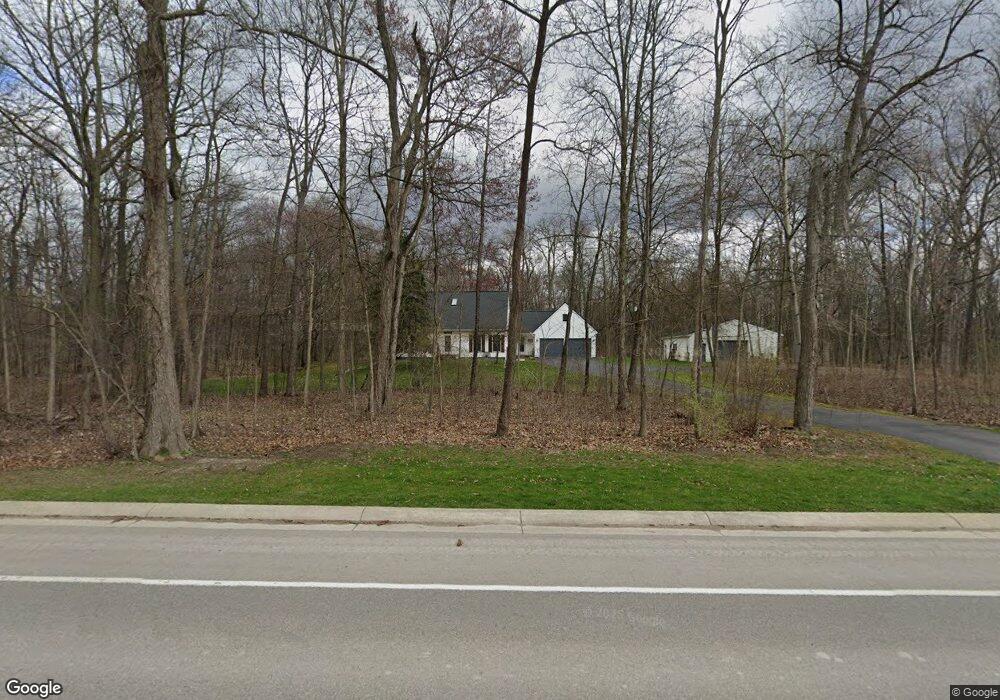
1422 N Hacker Rd Unit Bldg-Unit Howell, MI 48843
Estimated Value: $580,000 - $599,256
3
Beds
5
Baths
2,532
Sq Ft
$231/Sq Ft
Est. Value
About This Home
This home is located at 1422 N Hacker Rd Unit Bldg-Unit, Howell, MI 48843 and is currently estimated at $586,064, approximately $231 per square foot. 1422 N Hacker Rd Unit Bldg-Unit is a home located in Livingston County with nearby schools including Hartland High School, Charyl Stockwell Academy, and Shepherd of the Lakes Lutheran School.
Ownership History
Date
Name
Owned For
Owner Type
Purchase Details
Closed on
Feb 25, 2019
Sold by
Callhan Robert and Callahan Jessica
Bought by
Grooms Brent and Grooms Diana
Current Estimated Value
Purchase Details
Closed on
Jan 12, 2018
Sold by
Lagowski Jason J and Lagowski Crystal R
Bought by
Callahan Robert and Callahan Jessica
Purchase Details
Closed on
Oct 29, 2004
Sold by
Mcnally Karen P
Bought by
Lagowski Jason J and Lagowski Crystal R
Home Financials for this Owner
Home Financials are based on the most recent Mortgage that was taken out on this home.
Original Mortgage
$318,250
Interest Rate
5.85%
Mortgage Type
Purchase Money Mortgage
Purchase Details
Closed on
Dec 5, 2003
Sold by
Calkins Robert E and Calkins Toni M
Bought by
Mcnally Karen P
Purchase Details
Closed on
Dec 11, 1998
Sold by
Brown J David J and Brown Pamela Jean
Bought by
Calkins Robert E and Calkins Toni M
Create a Home Valuation Report for This Property
The Home Valuation Report is an in-depth analysis detailing your home's value as well as a comparison with similar homes in the area
Home Values in the Area
Average Home Value in this Area
Purchase History
| Date | Buyer | Sale Price | Title Company |
|---|---|---|---|
| Grooms Brent | $390,000 | -- | |
| Callahan Robert | $340,000 | -- | |
| Lagowski Jason J | $335,000 | -- | |
| Mcnally Karen P | $356,500 | -- | |
| Calkins Robert E | $272,000 | -- |
Source: Public Records
Mortgage History
| Date | Status | Borrower | Loan Amount |
|---|---|---|---|
| Previous Owner | Lagowski Jason J | $318,250 |
Source: Public Records
Tax History Compared to Growth
Tax History
| Year | Tax Paid | Tax Assessment Tax Assessment Total Assessment is a certain percentage of the fair market value that is determined by local assessors to be the total taxable value of land and additions on the property. | Land | Improvement |
|---|---|---|---|---|
| 2025 | $2,615 | $252,700 | $0 | $0 |
| 2024 | $2,542 | $235,600 | $0 | $0 |
| 2023 | $2,429 | $209,300 | $0 | $0 |
| 2022 | $5,103 | $178,100 | $0 | $0 |
| 2021 | $5,103 | $193,900 | $0 | $0 |
| 2020 | $5,103 | $176,200 | $0 | $0 |
| 2019 | $4,914 | $178,100 | $0 | $0 |
| 2018 | $3,248 | $148,900 | $0 | $0 |
| 2017 | $3,200 | $148,900 | $0 | $0 |
| 2016 | $3,182 | $146,900 | $0 | $0 |
| 2014 | $2,713 | $117,300 | $0 | $0 |
| 2012 | $2,713 | $111,000 | $0 | $0 |
Source: Public Records
Map
Nearby Homes
- Parcel N N Hacker Rd
- 1928 Mist Wood Dr
- 8477 Mist Field Ct
- 2500 Walnut View Dr
- 535 N Hacker Rd
- 2400 N Hacker Rd
- 1544 Four Seasons Dr
- 2715 Cullen Rd
- 1623 Andover Blvd Unit 7
- 1815 Andover Blvd Unit 31
- 2233 Chase Dr Unit 105
- 2221 Chase Dr Unit 103
- 2270 Chase Dr Unit 112
- 2245 Chase Dr Unit 107
- 2264 Chase Dr Unit 114
- 2240 Chase Dr Unit 119
- 2280 Chase Dr Unit 110
- 2260 Chase Dr Unit 115
- 2250 Chase Dr Unit 117
- 2249 Chase Dr Unit 108
- 1422 N Hacker Rd
- 1421 N Hacker Rd
- 0 Hacker Rd Unit 215117693
- 0 Hacker Rd Unit 218075402
- 0 Hacker Rd Unit 218033091
- 0 Hacker Rd Unit 30042874
- Parcel I N Hacker Rd
- Parcel 3 N Hacker Rd
- Parcel 2 N Hacker Rd
- PARCEL A&B N Hacker Rd
- Parcel Q N Hacker Rd
- Parcel P N Hacker Rd
- 1409 N Hacker Rd
- 1534 N Hacker Rd
- 1478 N Hacker Rd
- 1435 N Hacker Rd
- 1369 N Hacker Rd
- 1300 N Hacker Rd
- 1558 N Hacker Rd
- 1288 N Hacker Rd