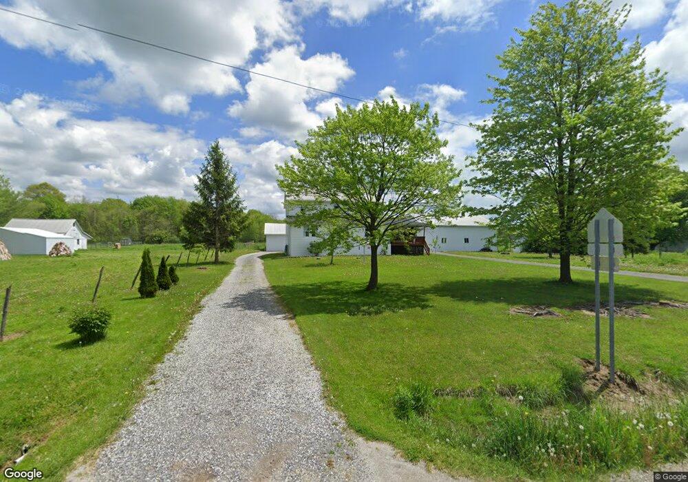
14221 Hayes Rd Middlefield, OH 44062
Estimated Value: $218,000 - $327,000
6
Beds
1
Bath
2,520
Sq Ft
$101/Sq Ft
Est. Value
About This Home
This home is located at 14221 Hayes Rd, Middlefield, OH 44062 and is currently estimated at $253,313, approximately $100 per square foot. 14221 Hayes Rd is a home located in Geauga County with nearby schools including Jordak Elementary School, Cardinal Middle School, and Cardinal High School.
Ownership History
Date
Name
Owned For
Owner Type
Purchase Details
Closed on
Feb 9, 2022
Bought by
Billy A Tod Mullet
Current Estimated Value
Home Financials for this Owner
Home Financials are based on the most recent Mortgage that was taken out on this home.
Interest Rate
3.55%
Purchase Details
Closed on
Aug 24, 2001
Sold by
Miller Levi A and Miller Anna D
Bought by
Miller Joe M and Miller Catherine D
Home Financials for this Owner
Home Financials are based on the most recent Mortgage that was taken out on this home.
Original Mortgage
$101,247
Interest Rate
7.03%
Purchase Details
Closed on
Feb 8, 1997
Sold by
Mullet Eli E and Mullet Sara A
Bought by
Miller Levi A and Miller Anna D
Purchase Details
Closed on
Feb 8, 1996
Sold by
Miller Albert A and Miller Lizzie J
Bought by
Mullet Eli E and Mullet Sara A
Purchase Details
Closed on
Jan 1, 1990
Bought by
Mullet Eli E
Create a Home Valuation Report for This Property
The Home Valuation Report is an in-depth analysis detailing your home's value as well as a comparison with similar homes in the area
Home Values in the Area
Average Home Value in this Area
Purchase History
| Date | Buyer | Sale Price | Title Company |
|---|---|---|---|
| Billy A Tod Mullet | $160,000 | -- | |
| Miller Joe M | $100,000 | Western Reserve Title Co Ltd | |
| Miller Levi A | $20,000 | -- | |
| Mullet Eli E | -- | -- | |
| Mullet Eli E | -- | -- |
Source: Public Records
Mortgage History
| Date | Status | Borrower | Loan Amount |
|---|---|---|---|
| Closed | Billy A Tod Mullet | -- | |
| Previous Owner | Billy A Tod Mullet | $88,269 | |
| Previous Owner | Miller Joe M | $101,247 |
Source: Public Records
Tax History Compared to Growth
Tax History
| Year | Tax Paid | Tax Assessment Tax Assessment Total Assessment is a certain percentage of the fair market value that is determined by local assessors to be the total taxable value of land and additions on the property. | Land | Improvement |
|---|---|---|---|---|
| 2024 | $2,532 | $60,100 | $7,770 | $52,330 |
| 2023 | $2,532 | $60,100 | $7,770 | $52,330 |
| 2022 | $2,499 | $49,600 | $6,480 | $43,120 |
| 2021 | $2,493 | $49,600 | $6,480 | $43,120 |
| 2020 | $2,567 | $49,600 | $6,480 | $43,120 |
| 2019 | $239 | $44,630 | $6,480 | $38,150 |
| 2018 | $2,497 | $44,630 | $6,480 | $38,150 |
| 2017 | $2,387 | $44,630 | $6,480 | $38,150 |
| 2016 | $2,013 | $43,230 | $6,480 | $36,750 |
| 2015 | $1,814 | $43,230 | $6,480 | $36,750 |
| 2014 | $1,814 | $43,230 | $6,480 | $36,750 |
| 2013 | $1,797 | $43,230 | $6,480 | $36,750 |
Source: Public Records
Map
Nearby Homes
- 14753 Madison Rd
- 13407 Madison Rd
- 16298 Weathervane Dr
- 14706 Steeplechase Dr
- 13105 Madison Rd
- 16008 Button St
- 0 Old State Rd Unit 5157703
- 13689 Old State Rd
- 15990 Old State Rd
- 15111 Timber Ridge Dr
- 15410 High Pointe Cir
- V/L High Pointe Cir
- 12342 Madison Rd
- 12175 Hunt Rd
- 15243 Woodsong Dr
- S/L 189 Oak Hill Dr
- 16510 Bundysburg Rd
- 16270 Mayfield Rd
- 16310 Madison Rd
- 16765 Old State Rd
- 14249 Hayes Rd
- 14195 Hayes Rd
- 14175 Hayes Rd
- 17346 Nauvoo Rd
- 17344 Nauvoo Rd
- 17432 Nauvoo Rd
- 17440 Nauvoo Rd
- 17480 Nauvoo Rd
- 17500 Nauvoo Rd
- 17433 Nauvoo Rd
- 14343 Hayes Rd
- 17510 Nauvoo Rd
- 17281 Nauvoo Rd
- 17505 Nauvoo Rd
- 14414 Hayes Rd
- 17261 Nauvoo Rd
- 14410 Hayes Rd
- 17231 Nauvoo Rd
- 17202 Nauvoo Rd
- 14026 Hayes Rd