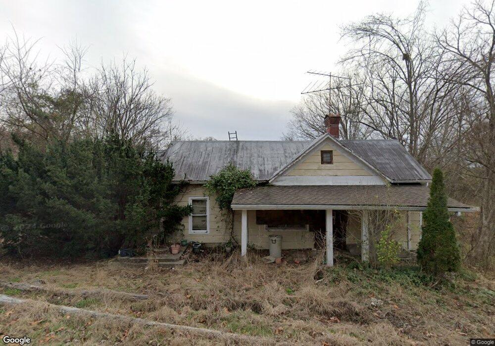
14224 State Route 217 Scottown, OH 45678
Estimated Value: $72,000 - $133,000
3
Beds
1
Bath
926
Sq Ft
$101/Sq Ft
Est. Value
About This Home
This home is located at 14224 State Route 217, Scottown, OH 45678 and is currently estimated at $93,633, approximately $101 per square foot. 14224 State Route 217 is a home located in Lawrence County with nearby schools including Fairland East Elementary School, Fairland West Elementary School, and Fairland Middle School.
Ownership History
Date
Name
Owned For
Owner Type
Purchase Details
Closed on
Apr 28, 2014
Sold by
Bame Rhonda
Bought by
Bame David E
Current Estimated Value
Home Financials for this Owner
Home Financials are based on the most recent Mortgage that was taken out on this home.
Original Mortgage
$201,000
Outstanding Balance
$61,989
Interest Rate
4.41%
Mortgage Type
New Conventional
Estimated Equity
$31,644
Purchase Details
Closed on
Dec 15, 1998
Sold by
Bame David E
Bought by
Bame Rhonda and Bame David E
Purchase Details
Closed on
Aug 8, 1995
Sold by
Hite Mildred Henson and Hite Mildred
Bought by
Bame David E
Create a Home Valuation Report for This Property
The Home Valuation Report is an in-depth analysis detailing your home's value as well as a comparison with similar homes in the area
Home Values in the Area
Average Home Value in this Area
Purchase History
| Date | Buyer | Sale Price | Title Company |
|---|---|---|---|
| Bame David E | -- | None Available | |
| Bame Rhonda | $49,000 | -- | |
| Bame David E | $28,500 | -- |
Source: Public Records
Mortgage History
| Date | Status | Borrower | Loan Amount |
|---|---|---|---|
| Open | Bame David E | $201,000 |
Source: Public Records
Tax History Compared to Growth
Tax History
| Year | Tax Paid | Tax Assessment Tax Assessment Total Assessment is a certain percentage of the fair market value that is determined by local assessors to be the total taxable value of land and additions on the property. | Land | Improvement |
|---|---|---|---|---|
| 2024 | -- | $8,820 | $6,960 | $1,860 |
| 2023 | $190 | $8,820 | $6,960 | $1,860 |
| 2022 | $188 | $8,820 | $6,960 | $1,860 |
| 2021 | $175 | $8,820 | $6,960 | $1,860 |
| 2020 | $199 | $8,820 | $6,960 | $1,860 |
| 2019 | $199 | $8,820 | $6,960 | $1,860 |
| 2018 | $200 | $8,820 | $6,960 | $1,860 |
| 2017 | $196 | $8,820 | $6,960 | $1,860 |
| 2016 | $179 | $8,820 | $6,960 | $1,860 |
| 2015 | $180 | $8,790 | $6,950 | $1,840 |
| 2014 | $180 | $8,790 | $6,950 | $1,840 |
| 2013 | $272 | $12,210 | $8,160 | $4,050 |
Source: Public Records
Map
Nearby Homes
- 11904 State Route 217
- 0 County Road 12
- 1263 County Road 73
- State Route 790
- 0 Ohio 217
- 00 Ohio 217
- 2255 County Road 66
- 1805 Long Creek Rd E
- 751 County Road 9
- State Route 790
- 0 Dillon Ridge Unit 23651508
- 0 Dillon Ridge Unit 181305
- 2202 County Road 66
- 1101 Tinker Ln
- 1080 Tinker Ln
- 1432 County Road 42
- 1024 Amanda St
- 126 Crown St
- 146 Williams St
- 0 Township Road 1057 Unit 182524
- 14025 State Route 217
- 13563 Ohio 217 Unit 13535 ST RT 217
- 13535 Ohio 217 Unit 13563 ST RT 217
- 13563 State Route 217
- 532 Township Road 235
- 371 State Route 218
- 13535 State Route 217
- 13535 State Route 217
- 13492 State Route 217
- 235 Township Road 235
- 14614 State Route 217
- 153 Township Road 235
- 14735 State Route 217
- 13212 State Route 217
- 854 State Route 218
- 13139 State Route 217
- 39 Township Road 235
- 14874 St Rt 217
- 14874 State Route 217
- 13039 State Route 217