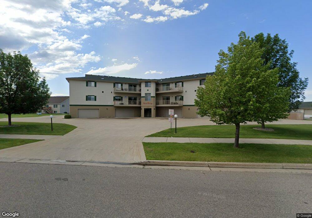
1423 10th Ave E Unit 202 West Fargo, ND 58078
Estimated Value: $329,162 - $350,000
2
Beds
2
Baths
1,812
Sq Ft
$188/Sq Ft
Est. Value
About This Home
This home is located at 1423 10th Ave E Unit 202, West Fargo, ND 58078 and is currently estimated at $341,291, approximately $188 per square foot. 1423 10th Ave E Unit 202 is a home located in Cass County with nearby schools including Eastwood Elementary School, Cheney Middle School, and West Fargo High School.
Ownership History
Date
Name
Owned For
Owner Type
Purchase Details
Closed on
Jul 23, 2020
Sold by
Meyhuber Heinz R and Meyhuber Charlotte M
Bought by
Henke Barbara J and Henke Paul A
Current Estimated Value
Home Financials for this Owner
Home Financials are based on the most recent Mortgage that was taken out on this home.
Original Mortgage
$145,000
Outstanding Balance
$128,815
Interest Rate
3.2%
Mortgage Type
New Conventional
Estimated Equity
$212,476
Create a Home Valuation Report for This Property
The Home Valuation Report is an in-depth analysis detailing your home's value as well as a comparison with similar homes in the area
Home Values in the Area
Average Home Value in this Area
Purchase History
| Date | Buyer | Sale Price | Title Company |
|---|---|---|---|
| Henke Barbara J | $255,000 | Fm Title |
Source: Public Records
Mortgage History
| Date | Status | Borrower | Loan Amount |
|---|---|---|---|
| Open | Henke Barbara J | $145,000 |
Source: Public Records
Tax History Compared to Growth
Tax History
| Year | Tax Paid | Tax Assessment Tax Assessment Total Assessment is a certain percentage of the fair market value that is determined by local assessors to be the total taxable value of land and additions on the property. | Land | Improvement |
|---|---|---|---|---|
| 2024 | $3,509 | $139,900 | $20,000 | $119,900 |
| 2023 | $3,966 | $137,550 | $20,000 | $117,550 |
| 2022 | $3,919 | $130,500 | $20,000 | $110,500 |
| 2021 | $3,840 | $121,700 | $10,000 | $111,700 |
| 2020 | $3,633 | $117,100 | $10,000 | $107,100 |
| 2019 | $3,423 | $113,200 | $10,000 | $103,200 |
| 2018 | $3,183 | $108,300 | $10,000 | $98,300 |
| 2017 | $3,153 | $108,300 | $10,000 | $98,300 |
| 2016 | $2,666 | $99,900 | $10,000 | $89,900 |
| 2015 | $2,933 | $92,900 | $9,200 | $83,700 |
| 2014 | $2,881 | $86,800 | $9,200 | $77,600 |
| 2013 | $2,869 | $86,800 | $9,200 | $77,600 |
Source: Public Records
Map
Nearby Homes
- 1511 11th Ave E
- 1041 Meyer Blvd
- 1059 Sommerset Place
- 906 9th St E Unit 8
- 851 12th Ave E
- 987 14th Ave E
- 1115 4th Ave E
- 763 49th St S
- 1221 Cedar Way
- 1511 14 1 2 Ave E
- 806 49th St S
- 681 Pheasant Run
- 237 Suntree Ct
- 670 13th Ave E
- 4768 8th Ave S
- 502 8th St E
- 1438 Suntree Dr
- 1815 3rd Ave E
- 4704 8th Ave S
- 1460 Maple Ln
- 1423 10th Ave E Unit 306
- 1423 10th Ave E Unit 305
- 1423 10th Ave E Unit 303
- 1423 10th Ave E Unit 302
- 1423 10th Ave E Unit 301
- 1423 10th Ave E Unit 206
- 1423 10th Ave E Unit 205
- 1423 10th Ave E Unit 204
- 1423 10th Ave E Unit 203
- 1423 10th Ave E Unit 201
- 1423 10th Ave E Unit 3
- 1423 10th Ave E Unit 2
- 1423 10th Ave E
- 1423 10th Ave E Unit 304
- 1512 11th Ave E
- 1513 10th Ave E
- 1516 11th Ave E
- 1517 10th Ave E
- 1520 11th Ave E
- 1361 11th Ave E