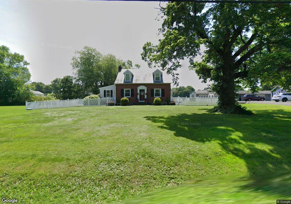
1423 Ferry Rd Doylestown, PA 18901
Estimated Value: $680,000 - $913,000
4
Beds
3
Baths
2,565
Sq Ft
$304/Sq Ft
Est. Value
About This Home
This home is located at 1423 Ferry Rd, Doylestown, PA 18901 and is currently estimated at $780,692, approximately $304 per square foot. 1423 Ferry Rd is a home located in Bucks County with nearby schools including Groveland Elementary School, Tohickon Middle School, and Central Bucks High School-West.
Ownership History
Date
Name
Owned For
Owner Type
Purchase Details
Closed on
Jul 20, 1988
Bought by
Landes Robert M and Landes Katherine A
Current Estimated Value
Create a Home Valuation Report for This Property
The Home Valuation Report is an in-depth analysis detailing your home's value as well as a comparison with similar homes in the area
Home Values in the Area
Average Home Value in this Area
Purchase History
| Date | Buyer | Sale Price | Title Company |
|---|---|---|---|
| Landes Robert M | $100,000 | -- |
Source: Public Records
Tax History Compared to Growth
Tax History
| Year | Tax Paid | Tax Assessment Tax Assessment Total Assessment is a certain percentage of the fair market value that is determined by local assessors to be the total taxable value of land and additions on the property. | Land | Improvement |
|---|---|---|---|---|
| 2025 | $7,438 | $42,030 | $8,910 | $33,120 |
| 2024 | $7,438 | $42,030 | $8,910 | $33,120 |
| 2023 | $7,092 | $42,030 | $8,910 | $33,120 |
| 2022 | $7,013 | $42,030 | $8,910 | $33,120 |
| 2021 | $6,594 | $40,350 | $8,910 | $31,440 |
| 2020 | $6,564 | $40,350 | $8,910 | $31,440 |
| 2019 | $6,493 | $40,350 | $8,910 | $31,440 |
| 2018 | $6,473 | $40,350 | $8,910 | $31,440 |
| 2017 | $6,423 | $40,350 | $8,910 | $31,440 |
| 2016 | $6,382 | $40,350 | $8,910 | $31,440 |
| 2015 | -- | $40,350 | $8,910 | $31,440 |
| 2014 | -- | $38,800 | $8,920 | $29,880 |
Source: Public Records
Map
Nearby Homes
- 301 Windy Run Rd
- 3711 Jacob Stout Rd Unit 5
- 3723 William Daves Rd
- 3765 William Daves Rd
- 3838 Jacob Stout Rd
- 4748 Bishop Cir
- 5437 Rinker Cir Unit 283
- 100 Bishops Gate Ln Unit 67
- 114 Blackfriars Cir
- 194 Victoria Ct Unit 143
- 3923 Ferry Rd
- Lot 6 Henry Ct
- 157 Pine Run Rd
- 4263 Kleinot Dr
- 4317 Kleinot Dr
- 4464 Kleinot Dr
- 4330 Kleinot Dr
- 4246 Kleinot Dr
- 4298 Kleinot Dr
- 4306 Kleinot Dr
- 15 Allen Dr
- 15 Allen Dr
- 200 Tedwill Rd
- 1422 Ferry Rd
- 180 Tedwill Rd
- 1426 Ferry Rd
- 195 Tedwill Dr
- 195 Tedwill Rd
- 12 Allen Dr
- 177 Tedwill
- 177 Tedwill Rd
- 150 Tedwill Rd
- 1334 Ferry Rd
- 161 Tedwill Rd
- 145 Tedwill Rd
- 1375 Ferry Rd
- 1456 Ferry Rd
- 1456 Ferry Rd Unit 403
- 1456 Ferry Rd Unit 305B
- 1456 Ferry Rd Unit 305A