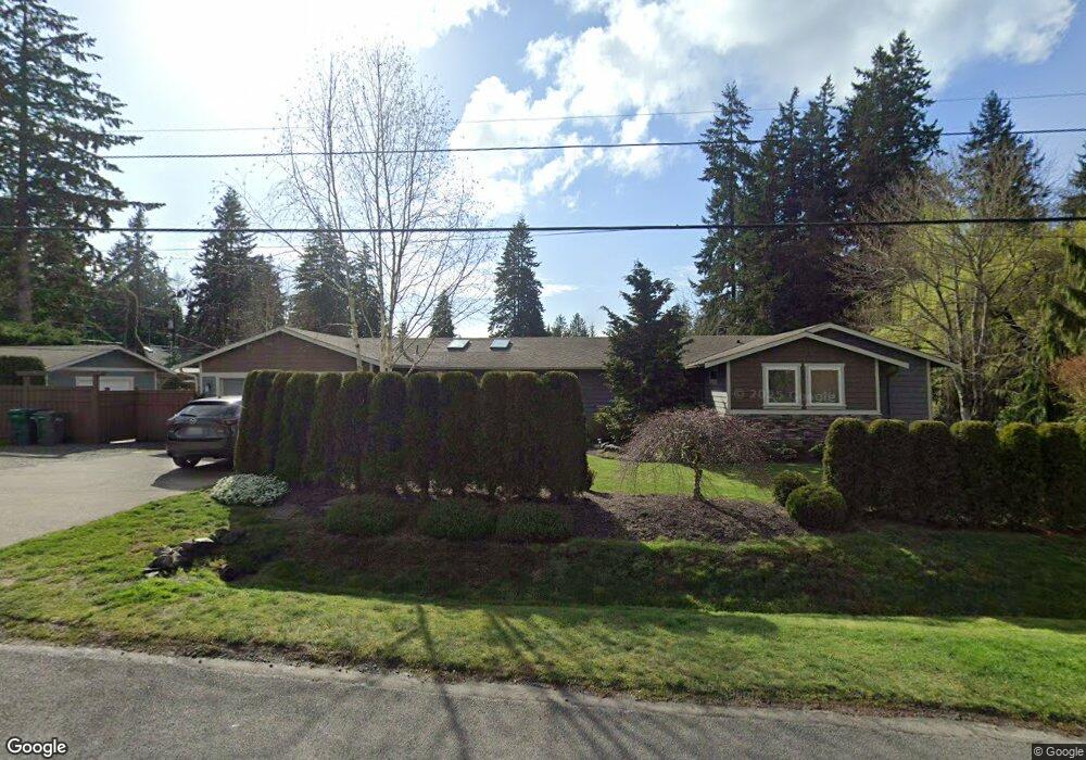
14232 55th Ave W Edmonds, WA 98026
Estimated Value: $775,000 - $1,036,000
3
Beds
2
Baths
1,936
Sq Ft
$466/Sq Ft
Est. Value
About This Home
This home is located at 14232 55th Ave W, Edmonds, WA 98026 and is currently estimated at $902,404, approximately $466 per square foot. 14232 55th Ave W is a home located in Snohomish County with nearby schools including Picnic Point Elementary School, Harbour Pointe Middle School, and Kamiak High School.
Ownership History
Date
Name
Owned For
Owner Type
Purchase Details
Closed on
Aug 23, 1996
Sold by
Howard Steve and Howard Casey
Bought by
Haugstad Brock E and Haugstad Shelley L
Current Estimated Value
Home Financials for this Owner
Home Financials are based on the most recent Mortgage that was taken out on this home.
Original Mortgage
$147,291
Outstanding Balance
$11,664
Interest Rate
8.23%
Mortgage Type
FHA
Estimated Equity
$890,740
Create a Home Valuation Report for This Property
The Home Valuation Report is an in-depth analysis detailing your home's value as well as a comparison with similar homes in the area
Home Values in the Area
Average Home Value in this Area
Purchase History
| Date | Buyer | Sale Price | Title Company |
|---|---|---|---|
| Haugstad Brock E | $150,000 | -- |
Source: Public Records
Mortgage History
| Date | Status | Borrower | Loan Amount |
|---|---|---|---|
| Open | Haugstad Brock E | $147,291 |
Source: Public Records
Tax History Compared to Growth
Tax History
| Year | Tax Paid | Tax Assessment Tax Assessment Total Assessment is a certain percentage of the fair market value that is determined by local assessors to be the total taxable value of land and additions on the property. | Land | Improvement |
|---|---|---|---|---|
| 2025 | $6,273 | $729,500 | $455,000 | $274,500 |
| 2024 | $6,273 | $743,400 | $470,000 | $273,400 |
| 2023 | $6,386 | $791,500 | $480,000 | $311,500 |
| 2022 | $5,818 | $609,700 | $345,000 | $264,700 |
| 2020 | $5,030 | $512,200 | $279,000 | $233,200 |
| 2019 | $4,804 | $491,100 | $262,000 | $229,100 |
| 2018 | $4,842 | $431,700 | $227,000 | $204,700 |
| 2017 | $4,357 | $397,400 | $205,000 | $192,400 |
| 2016 | $4,086 | $370,000 | $185,000 | $185,000 |
| 2015 | $3,890 | $322,100 | $154,000 | $168,100 |
| 2013 | $3,270 | $252,800 | $116,000 | $136,800 |
Source: Public Records
Map
Nearby Homes
- 5015 144th St SW Unit B1
- 5015 144th St SW Unit A4
- 5015 144th St SW Unit B3
- 5015 144th St SW Unit C1
- 14714 53rd Ave W Unit 116
- 14714 53rd Ave W Unit 119
- 14019 52nd Ave W Unit B
- 14224 Beverly Park Rd Unit A
- 5020 148th St SW Unit E1
- 4726 Picnic Point Rd
- 6104 145th St SW
- 4630 143rd Place SW
- 6122 144th St SW
- 13802 60th Ave W
- 5119 136th St SW
- 6306 141st St SW
- 14913 48th Ave W Unit C-4
- 6420 141st St SW
- 15217 48th Ave W
- 13303 48th Place W
- 5503 143rd St SW
- 5625 143rd St SW
- 5511 143rd St SW
- 14231 55th Ave W
- 14202 55th Ave W
- 14300 55th Ave W
- 5519 143rd St SW
- 14311 55th Ave W Unit 1
- 5504 143rd St SW
- 14126 55th Ave W
- 14131 55th Ave W
- 14319 55th Ave W Unit 2
- 5514 143rd St SW
- 14206 55th Ave W
- 5431 143rd Place SW Unit 3
- 14320 55th Ave W Unit 11
- 14124 55th Ave W
- 5423 143rd Place SW Unit 4
- 5533 143rd St SW Unit 2B
- 5533 143rd St SW Unit 2A