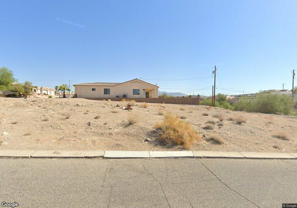
1424 Aviation Dr Lake Havasu City, AZ 86404
Estimated Value: $162,000 - $325,000
--
Bed
--
Bath
--
Sq Ft
0.33
Acres
About This Home
This home is located at 1424 Aviation Dr, Lake Havasu City, AZ 86404 and is currently estimated at $267,956. 1424 Aviation Dr is a home located in Mohave County with nearby schools including Nautilus Elementary School, Thunderbolt Middle School, and Lake Havasu High School.
Ownership History
Date
Name
Owned For
Owner Type
Purchase Details
Closed on
Mar 30, 2017
Sold by
Perna Anthony and Perna Kimberly
Bought by
Perna Anthony William and Perna Kimberly Claire
Current Estimated Value
Purchase Details
Closed on
Nov 21, 2016
Sold by
Fahrny Thomas A and Fahrny Sandy M
Bought by
Perna Anthony and Perna Kimberly
Purchase Details
Closed on
Jun 10, 2004
Sold by
Severson Ernest J and Severson Toni L
Bought by
Fahrny Thomas A and Fahrny Sandy M
Purchase Details
Closed on
Feb 24, 2004
Sold by
Dulgerian Jack and Dulgerian Penny
Bought by
Severson Ernest J and Severson Toni L
Home Financials for this Owner
Home Financials are based on the most recent Mortgage that was taken out on this home.
Original Mortgage
$71,250
Interest Rate
5.57%
Mortgage Type
Unknown
Create a Home Valuation Report for This Property
The Home Valuation Report is an in-depth analysis detailing your home's value as well as a comparison with similar homes in the area
Home Values in the Area
Average Home Value in this Area
Purchase History
| Date | Buyer | Sale Price | Title Company |
|---|---|---|---|
| Perna Anthony William | -- | None Available | |
| Perna Anthony | $145,000 | Stewart Title Arizona Agency | |
| Fahrny Thomas A | $165,000 | First American Title Ins Co | |
| Severson Ernest J | $95,000 | First American Title Ins Co |
Source: Public Records
Mortgage History
| Date | Status | Borrower | Loan Amount |
|---|---|---|---|
| Previous Owner | Severson Ernest J | $71,250 |
Source: Public Records
Tax History Compared to Growth
Tax History
| Year | Tax Paid | Tax Assessment Tax Assessment Total Assessment is a certain percentage of the fair market value that is determined by local assessors to be the total taxable value of land and additions on the property. | Land | Improvement |
|---|---|---|---|---|
| 2026 | -- | -- | -- | -- |
| 2025 | $902 | $28,071 | $0 | $0 |
| 2024 | $902 | $35,494 | $0 | $0 |
| 2023 | $902 | $27,834 | $0 | $0 |
| 2022 | $863 | $18,852 | $0 | $0 |
| 2021 | $1,017 | $17,983 | $0 | $0 |
| 2019 | $970 | $16,151 | $0 | $0 |
| 2018 | $939 | $13,859 | $0 | $0 |
| 2017 | $931 | $13,441 | $0 | $0 |
| 2016 | $849 | $12,472 | $0 | $0 |
| 2015 | $862 | $10,898 | $0 | $0 |
Source: Public Records
Map
Nearby Homes
- 1485 Wagner Dr
- 1361 Tamarack Dr
- 1790 Cessna Bay
- 1329 Piper Dr
- 1415 King Dr
- 1659 Kirk Dr
- 1811 Westport Dr
- 1851 Laramie Dr
- 1670 Kirk Dr
- 1704 Sailing Hawk Dr
- 1718 Sailing Hawks Dr
- 1351 London Bridge Rd Unit 2
- 1825 Deer Run Dr
- 1733 Sailing Hawks Dr
- 1601 Sailing Hawks Dr Unit 14
- 1650 Sailing Hawk Dr Unit 133
- 1650 Sailing Hawk Dr Unit 125
- 1881 Westport Dr
- 1651 Sailing Hawks Dr Unit 139
- 1651 Sailing Hawks Dr
- 1716 Boeing Bay
- 1716 Boeing Bay
- 1441 Aviation Dr
- 1421 Aviation Dr
- 1732 Boeing Bay
- 1701 Boeing Bay
- 1461 Aviation Dr
- 1717 Boeing Bay
- 1701 Piper Bay
- 1748 Boeing Bay
- 1721 Piper Bay
- 1401 Piper Dr
- 1700 Piper Bay
- 1747 Boeing Bay
- 1444 Electra Bay
- 1422 Electra Bay
- 1700 Lockheed Bay
- 1741 Piper Bay
- 1481 Aviation Dr
- 1466 Electra Bay