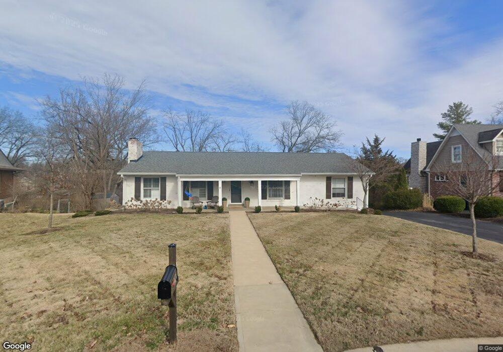
1424 Kendon Dr Saint Louis, MO 63131
Estimated Value: $546,000 - $765,000
3
Beds
3
Baths
2,222
Sq Ft
$292/Sq Ft
Est. Value
About This Home
This home is located at 1424 Kendon Dr, Saint Louis, MO 63131 and is currently estimated at $649,016, approximately $292 per square foot. 1424 Kendon Dr is a home located in St. Louis County with nearby schools including Westchester Elementary School, North Kirkwood Middle School, and Kirkwood Senior High School.
Ownership History
Date
Name
Owned For
Owner Type
Purchase Details
Closed on
Aug 7, 2020
Sold by
Baxendale Peter K and Baxendale Marietta P
Bought by
Swoboda John and Swoboda Kathryn
Current Estimated Value
Home Financials for this Owner
Home Financials are based on the most recent Mortgage that was taken out on this home.
Original Mortgage
$490,000
Outstanding Balance
$429,426
Interest Rate
2.37%
Mortgage Type
New Conventional
Estimated Equity
$219,590
Create a Home Valuation Report for This Property
The Home Valuation Report is an in-depth analysis detailing your home's value as well as a comparison with similar homes in the area
Home Values in the Area
Average Home Value in this Area
Purchase History
| Date | Buyer | Sale Price | Title Company |
|---|---|---|---|
| Swoboda John | $490,000 | Integrity Title Sln Llc |
Source: Public Records
Mortgage History
| Date | Status | Borrower | Loan Amount |
|---|---|---|---|
| Open | Swoboda John | $490,000 |
Source: Public Records
Tax History
| Year | Tax Paid | Tax Assessment Tax Assessment Total Assessment is a certain percentage of the fair market value that is determined by local assessors to be the total taxable value of land and additions on the property. | Land | Improvement |
|---|---|---|---|---|
| 2025 | $6,193 | $114,820 | $69,960 | $44,860 |
| 2024 | $6,193 | $107,060 | $51,830 | $55,230 |
| 2023 | $6,193 | $107,060 | $51,830 | $55,230 |
| 2022 | $5,426 | $88,770 | $51,830 | $36,940 |
| 2021 | $5,368 | $88,770 | $51,830 | $36,940 |
| 2020 | $5,301 | $84,280 | $47,860 | $36,420 |
| 2019 | $5,308 | $84,280 | $47,860 | $36,420 |
| 2018 | $4,898 | $69,750 | $27,170 | $42,580 |
| 2017 | $4,911 | $69,750 | $27,170 | $42,580 |
| 2016 | $4,521 | $65,020 | $23,370 | $41,650 |
| 2015 | $4,527 | $65,020 | $23,370 | $41,650 |
| 2014 | $4,638 | $65,110 | $10,430 | $54,680 |
Source: Public Records
Map
Nearby Homes
- 1507 Windridge Dr
- 1456 Fawnvalley Ct
- 1449 Fairbrook Dr
- 8 Briarbrook Trail
- 1316 Fawnvalley Dr
- 1815 Gray Dr
- 1741 Pine Hill Dr
- 1855 Ironstone Rd
- 2046 Willow Leaf Dr
- 11900 Grant Place
- 2121 East Dr
- 0 Unknown Unit MIS26025321
- 11344 Manchester Rd
- 12439 Springdale Ln Unit TBB
- 11904 Mattox Ct
- 2030 N Ballas Rd
- 1158 N Geyer Rd
- TBB
- TBB Ballas Ridge Hawthorne II
- 12224 TBB Roger Ln
- 1416 Kendon Dr
- 1432 Kendon Dr
- 1408 Kendon Dr
- 1415 Kendon Dr
- 1509 Fawnvalley Dr
- 1515 Fawnvalley Dr
- 1501 Fawnvalley Dr
- 11901 Kendon Dr
- 1401 Kendon Dr
- 1521 Fawnvalley Dr
- 1400 Kendon Dr
- 1479 Fawnvalley Dr
- 1506 Windridge Dr
- 11907 Kendon Dr
- 11908 Kendon Dr
- 11915 Hargrove Dr
- 1512 Windridge Dr
- 1471 Fawnvalley Dr
- 1500 Windridge Dr
- 1527 Fawnvalley Dr
Your Personal Tour Guide
Ask me questions while you tour the home.