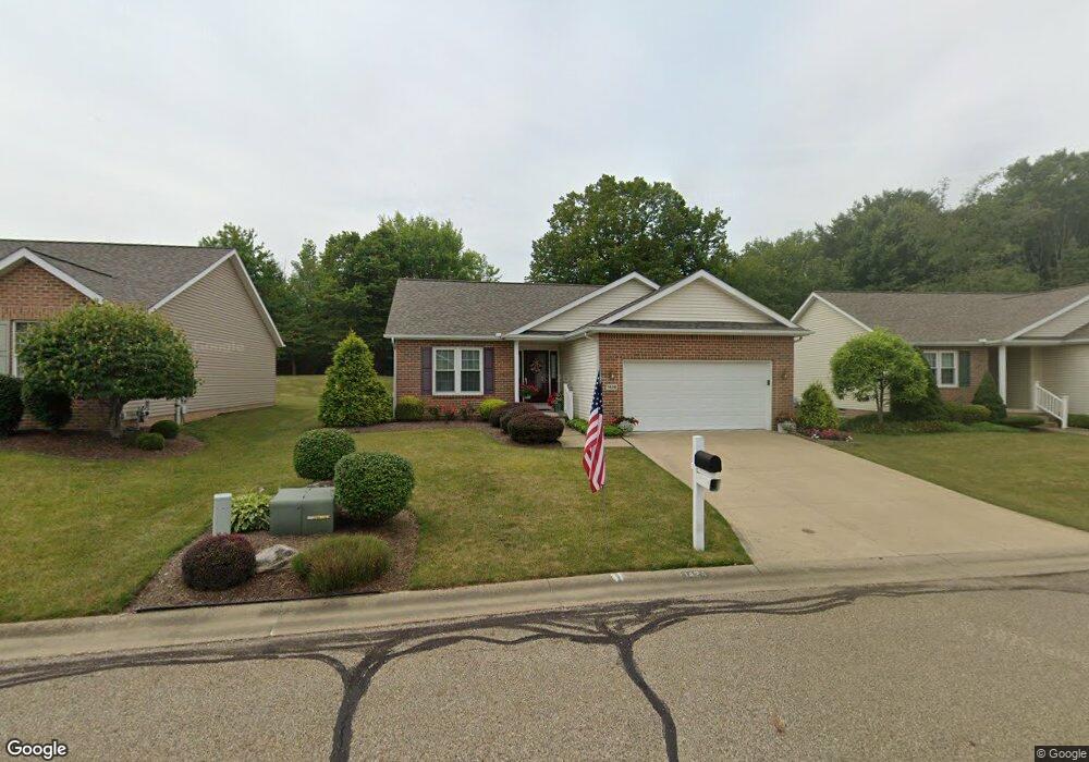
1424 Presidents St Unit 17 Louisville, OH 44641
Estimated Value: $265,000 - $290,000
2
Beds
2
Baths
1,560
Sq Ft
$178/Sq Ft
Est. Value
About This Home
This home is located at 1424 Presidents St Unit 17, Louisville, OH 44641 and is currently estimated at $278,033, approximately $178 per square foot. 1424 Presidents St Unit 17 is a home located in Stark County with nearby schools including Louisville High School and St. Thomas Aquinas High School & Middle School.
Ownership History
Date
Name
Owned For
Owner Type
Purchase Details
Closed on
Oct 18, 2018
Bought by
Thomas Kimberly D Trustee Of The Ro
Current Estimated Value
Purchase Details
Closed on
Sep 26, 2008
Sold by
Rogers William D and Rogers Kathern R
Bought by
Rogers William D and Rogers Kathern R
Purchase Details
Closed on
Dec 18, 2002
Sold by
Miranoma Inc
Bought by
Rogers William D and Rogers Kathern R
Create a Home Valuation Report for This Property
The Home Valuation Report is an in-depth analysis detailing your home's value as well as a comparison with similar homes in the area
Home Values in the Area
Average Home Value in this Area
Purchase History
| Date | Buyer | Sale Price | Title Company |
|---|---|---|---|
| Thomas Kimberly D Trustee Of The Ro | -- | -- | |
| Rogers William D | -- | Attorney | |
| Rogers William D | $166,400 | -- |
Source: Public Records
Tax History Compared to Growth
Tax History
| Year | Tax Paid | Tax Assessment Tax Assessment Total Assessment is a certain percentage of the fair market value that is determined by local assessors to be the total taxable value of land and additions on the property. | Land | Improvement |
|---|---|---|---|---|
| 2025 | -- | $86,420 | $16,210 | $70,210 |
| 2024 | -- | $86,420 | $16,210 | $70,210 |
| 2023 | $2,474 | $66,750 | $12,570 | $54,180 |
| 2022 | $1,496 | $66,750 | $12,570 | $54,180 |
| 2021 | $1,645 | $66,750 | $12,570 | $54,180 |
| 2020 | $2,048 | $60,380 | $11,310 | $49,070 |
| 2019 | $414 | $60,380 | $11,310 | $49,070 |
| 2018 | $2,054 | $60,380 | $11,310 | $49,070 |
| 2017 | $1,767 | $51,590 | $10,500 | $41,090 |
| 2016 | $1,803 | $51,590 | $10,500 | $41,090 |
| 2015 | $1,808 | $51,590 | $10,500 | $41,090 |
| 2014 | $1,817 | $48,760 | $11,100 | $37,660 |
| 2013 | $912 | $48,760 | $11,100 | $37,660 |
Source: Public Records
Map
Nearby Homes
- 908 Sand Lot Cir
- 641 S Nickelplate St
- 1715 High St
- 2110 Edmar St
- 520 S Silver St
- 1812 E Broad St
- 728 E Broad St
- 308 Superior St
- 510 S Bauman Ct
- 204 E Broad St
- 3390 Meese Rd NE
- 107 E Broad St
- 1702 View Pointe Ave
- 0 Michigan Blvd
- 1639 Horizon Dr
- 8225 Georgetown St
- 2015 E Main St
- 325 Lincoln Ave
- 1170 Winding Ridge Ave
- 910 Crosswyck Cir
- 1500 Presidents St Unit 18
- 1418 Presidents St Unit 16
- Lot 38 Presidents St
- 1506 Presidents St Unit 19
- 41 Presidents St
- 1421 Presidents St Unit 14
- 1427 Presidents St Unit 15
- 1409 Presidents St Unit 12
- 1516 Presidents St Unit 20
- 1403 Presidents St
- 1330 Presidents St Unit 9
- 1522 Presidents St Unit 21
- 1428 Edmar St
- 1418 Edmar St
- 1324 Presidents St Unit 8
- 1506 Edmar St
- 1528 Presidents St
- 1408 Edmar St
- 1534 Presidents St Unit 23
- 1400 Edmar St