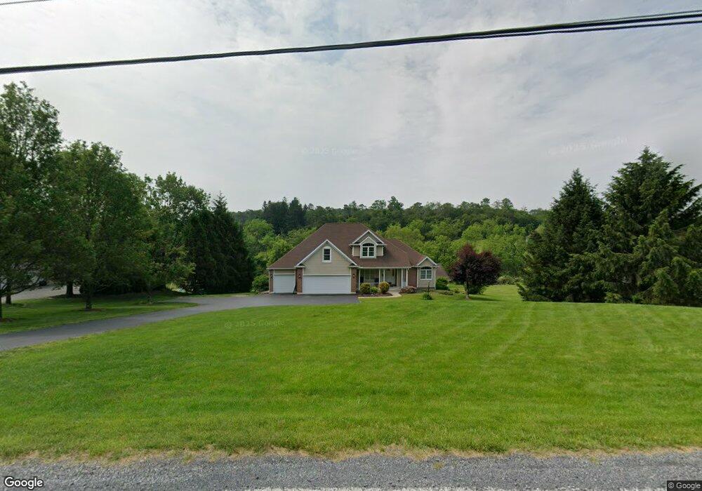
1424 Red Dale Rd Orwigsburg, PA 17961
Estimated Value: $604,000 - $805,000
4
Beds
3
Baths
2,193
Sq Ft
$313/Sq Ft
Est. Value
About This Home
This home is located at 1424 Red Dale Rd, Orwigsburg, PA 17961 and is currently estimated at $687,119, approximately $313 per square foot. 1424 Red Dale Rd is a home located in Schuylkill County with nearby schools including Blue Mountain High School.
Ownership History
Date
Name
Owned For
Owner Type
Purchase Details
Closed on
Apr 25, 2025
Sold by
Romig Timothy D and Furer-Romig Tara L
Bought by
Hart Samantha E and Hart Ryan T
Current Estimated Value
Home Financials for this Owner
Home Financials are based on the most recent Mortgage that was taken out on this home.
Original Mortgage
$535,200
Outstanding Balance
$533,312
Interest Rate
6.67%
Mortgage Type
New Conventional
Estimated Equity
$153,807
Purchase Details
Closed on
Apr 10, 2017
Sold by
Romig Timothy D and Romig Tara L Furer
Bought by
Romig Timothy D and Romig Tara L Furer
Purchase Details
Closed on
Feb 12, 2016
Sold by
Heckler Gerald and Heckler Jill
Bought by
Romig Timothy D and Furer Romig Tara L
Home Financials for this Owner
Home Financials are based on the most recent Mortgage that was taken out on this home.
Original Mortgage
$248,000
Interest Rate
3.92%
Mortgage Type
New Conventional
Create a Home Valuation Report for This Property
The Home Valuation Report is an in-depth analysis detailing your home's value as well as a comparison with similar homes in the area
Home Values in the Area
Average Home Value in this Area
Purchase History
| Date | Buyer | Sale Price | Title Company |
|---|---|---|---|
| Hart Samantha E | $669,000 | None Listed On Document | |
| Hart Samantha E | $669,000 | None Listed On Document | |
| Romig Timothy D | -- | None Available | |
| Romig Timothy D | $310,000 | None Available |
Source: Public Records
Mortgage History
| Date | Status | Borrower | Loan Amount |
|---|---|---|---|
| Open | Hart Samantha E | $535,200 | |
| Closed | Hart Samantha E | $535,200 | |
| Previous Owner | Romig Timothy D | $248,000 |
Source: Public Records
Tax History Compared to Growth
Tax History
| Year | Tax Paid | Tax Assessment Tax Assessment Total Assessment is a certain percentage of the fair market value that is determined by local assessors to be the total taxable value of land and additions on the property. | Land | Improvement |
|---|---|---|---|---|
| 2025 | $5,918 | $86,300 | $12,625 | $73,675 |
| 2024 | $5,508 | $86,300 | $12,625 | $73,675 |
| 2023 | $5,508 | $86,300 | $12,625 | $73,675 |
| 2022 | $5,508 | $86,300 | $12,625 | $73,675 |
| 2021 | $5,424 | $86,300 | $12,625 | $73,675 |
| 2020 | $5,264 | $86,300 | $12,625 | $73,675 |
| 2018 | $4,907 | $83,385 | $12,625 | $70,760 |
| 2017 | $4,640 | $80,210 | $12,625 | $67,585 |
| 2015 | -- | $80,210 | $12,625 | $67,585 |
| 2011 | -- | $80,210 | $0 | $0 |
Source: Public Records
Map
Nearby Homes
- 1161 Sunset Dr
- 37 White Birch Rd
- 102 S Hickory St
- 0 Wild Turkey Ln Unit PASK2023694
- 8 Queen Ave
- 322 Maple Blvd
- 336 Lake Front Dr
- 2101 Village Rd
- 201 Maple Blvd
- 904 Village Rd
- 1791 Centre Turnpike
- 401 Village Rd
- 107 Shiloh Rd Unit J3
- 1 Shiloh Rd Unit P
- 55 Dayspring Dr Unit J2
- 66 Shiloh Rd Unit J2
- 22 Hughes St
- Lot 5 Wild Turkey Ln
- 31 Cornerstone Dr
- 21 Cornerstone Dr
- 1414 Red Dale Rd
- 1430 Red Dale Rd
- 1410 Red Dale Rd
- 1436 Red Dale Rd
- 1463 Red Dale Rd
- 21 Walnut Dr
- 30 Walnut Dr
- 1404 Red Dale Rd
- 40 Walnut Dr
- 1396 Red Dale Rd
- 46 Walnut Dr
- 51 Walnut Dr
- 59 Walnut Dr
- 1386 Red Dale Rd
- 1454 Red Dale Rd
- 14 Sparrow Hawk Dr
- 1378 Red Dale Rd
- 15 Night Hawk Dr
- 1395 Red Dale Rd
- 1390 Red Dale Rd