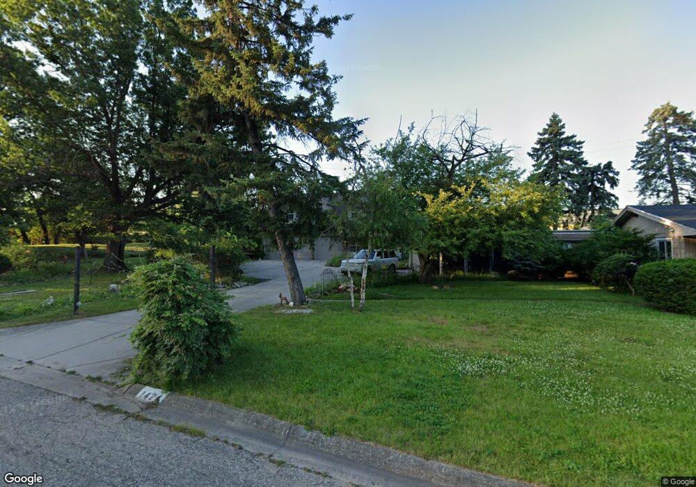
1424 Sunnyside Ave Flint, MI 48503
College Cultural Neighborhood NeighborhoodEstimated Value: $191,000 - $241,261
3
Beds
2
Baths
2,095
Sq Ft
$102/Sq Ft
Est. Value
About This Home
This home is located at 1424 Sunnyside Ave, Flint, MI 48503 and is currently estimated at $213,065, approximately $101 per square foot. 1424 Sunnyside Ave is a home located in Genesee County with nearby schools including Pierce Elementary School, Flint Southwestern Classical Academy, and Flint Cultural Center Academy.
Ownership History
Date
Name
Owned For
Owner Type
Purchase Details
Closed on
Sep 19, 2022
Sold by
Deanna Nolan
Bought by
Nolan Virginia
Current Estimated Value
Purchase Details
Closed on
Jul 11, 2003
Sold by
Houston Arthur J and Houston Ruby E
Bought by
Nolan Deanna N
Purchase Details
Closed on
Jan 3, 1983
Sold by
Beecher J Beecher B and Beecher Donald R
Bought by
Houston Arthur J and Houston Ruby E
Purchase Details
Closed on
Jun 15, 1982
Sold by
Michigan Department Of Transportation
Bought by
Houston Arthur J and Houston Ruby E
Create a Home Valuation Report for This Property
The Home Valuation Report is an in-depth analysis detailing your home's value as well as a comparison with similar homes in the area
Home Values in the Area
Average Home Value in this Area
Purchase History
| Date | Buyer | Sale Price | Title Company |
|---|---|---|---|
| Nolan Virginia | -- | -- | |
| Nolan Deanna N | $104,000 | Guaranty Title Company | |
| Houston Arthur J | $18,500 | Guaranty Title Company | |
| Houston Arthur J | -- | -- |
Source: Public Records
Tax History Compared to Growth
Tax History
| Year | Tax Paid | Tax Assessment Tax Assessment Total Assessment is a certain percentage of the fair market value that is determined by local assessors to be the total taxable value of land and additions on the property. | Land | Improvement |
|---|---|---|---|---|
| 2025 | $1,647 | $119,600 | $0 | $0 |
| 2024 | $1,469 | $113,300 | $0 | $0 |
| 2023 | $1,430 | $95,100 | $0 | $0 |
| 2022 | $0 | $79,800 | $0 | $0 |
| 2021 | $1,501 | $67,200 | $0 | $0 |
| 2020 | $1,331 | $62,800 | $0 | $0 |
| 2019 | $1,282 | $42,000 | $0 | $0 |
| 2018 | $1,332 | $36,700 | $0 | $0 |
| 2017 | $1,290 | $0 | $0 | $0 |
| 2016 | $1,280 | $0 | $0 | $0 |
Source: Public Records
Map
Nearby Homes
- 1510 S Franklin Ave
- 930 Belmont Ave
- 1601 Wayne St
- 1110 Pingree Ave
- 1018 Lafayette St
- 2010 Crocker Ave
- 2029 Aitken Ave
- 2313 Brookside Dr
- 1917 Whittlesey St
- 1840 Mcphail St
- 2122 Pierce St
- 841 E 8th St
- 911 E 7th St
- 2319 Calumet St
- 2013 E Court St
- 1937 Chelan St
- 420 Pingree Ave
- 2050 Ferris Ave
- 1623 Montclair Ave
- 9211 Owen St
- 1632 Kensington Ave
- 1441 Sunnyside Ave
- 1429 Sunnyside Ave
- 1628 Kensington Ave
- 1418 Sunnyside Ave
- 1415 Sunnyside Ave
- 1414 Sunnyside Ave
- 1618 Kensington Ave
- 1401 Sunnyside Ave
- 1625 Kensington Ave
- 1768 Brookside Dr
- 1760 Brookside Dr
- 1608 Kensington Ave
- 1772 Brookside Dr
- 1621 Kensington Ave
- 1776 Brookside Dr
- 1613 Kensington Ave
- 1609 Kensington Ave
- 1780 Brookside Dr
- 1525 Kensington Ave