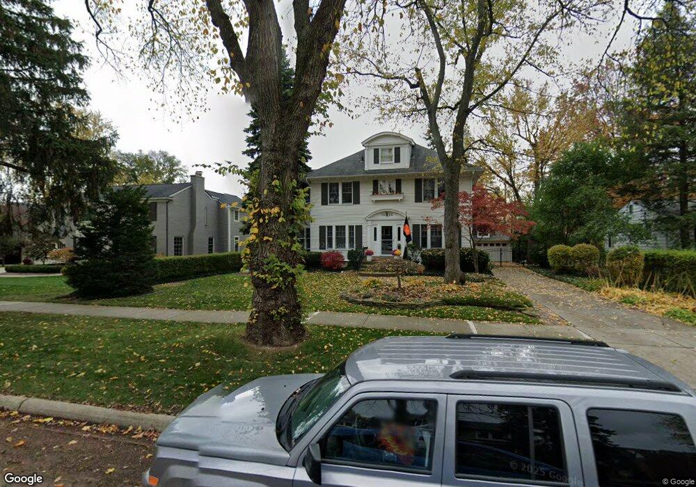
1424 Yorkshire Rd Birmingham, MI 48009
Estimated Value: $981,723 - $1,277,000
5
Beds
4
Baths
3,147
Sq Ft
$375/Sq Ft
Est. Value
About This Home
This home is located at 1424 Yorkshire Rd, Birmingham, MI 48009 and is currently estimated at $1,180,681, approximately $375 per square foot. 1424 Yorkshire Rd is a home located in Oakland County with nearby schools including Harlan Elementary School, Derby Middle School, and Ernest W. Seaholm High School.
Ownership History
Date
Name
Owned For
Owner Type
Purchase Details
Closed on
Jul 25, 2025
Sold by
Dietz Jonathan R and Dietz Gretchen G
Bought by
Jonathan And Gretchen Dietz Trust and Dietz
Current Estimated Value
Purchase Details
Closed on
Aug 22, 2007
Sold by
Early William P and Early Catherine J
Bought by
Dietz Jonathan and Dietz Gretchen
Home Financials for this Owner
Home Financials are based on the most recent Mortgage that was taken out on this home.
Original Mortgage
$417,000
Interest Rate
6.79%
Mortgage Type
Purchase Money Mortgage
Create a Home Valuation Report for This Property
The Home Valuation Report is an in-depth analysis detailing your home's value as well as a comparison with similar homes in the area
Home Values in the Area
Average Home Value in this Area
Purchase History
| Date | Buyer | Sale Price | Title Company |
|---|---|---|---|
| Jonathan And Gretchen Dietz Trust | -- | None Listed On Document | |
| Jonathan And Gretchen Dietz Trust | -- | None Listed On Document | |
| Dietz Jonathan | $545,000 | Philip R Seaver Title Co Inc |
Source: Public Records
Mortgage History
| Date | Status | Borrower | Loan Amount |
|---|---|---|---|
| Previous Owner | Dietz Jonathan | $417,000 |
Source: Public Records
Tax History Compared to Growth
Tax History
| Year | Tax Paid | Tax Assessment Tax Assessment Total Assessment is a certain percentage of the fair market value that is determined by local assessors to be the total taxable value of land and additions on the property. | Land | Improvement |
|---|---|---|---|---|
| 2024 | $8,678 | $337,130 | $0 | $0 |
| 2023 | $8,316 | $334,820 | $0 | $0 |
| 2022 | $8,916 | $332,440 | $0 | $0 |
| 2021 | $8,995 | $325,370 | $0 | $0 |
| 2020 | $8,014 | $316,090 | $0 | $0 |
| 2019 | $9,070 | $286,150 | $0 | $0 |
| 2018 | $9,000 | $276,230 | $0 | $0 |
| 2017 | $8,985 | $268,940 | $0 | $0 |
| 2016 | $9,002 | $269,090 | $0 | $0 |
| 2015 | -- | $246,720 | $0 | $0 |
| 2014 | -- | $211,860 | $0 | $0 |
| 2011 | -- | $188,550 | $0 | $0 |
Source: Public Records
Map
Nearby Homes
- 1509 Yorkshire Rd
- 1119 E Maple Rd
- 1751 Villa Rd
- 1673 Hazel St
- 1777 Hazel St
- 475 S Adams Rd
- 1180 Manchester Rd
- 1724 Graefield Rd
- 729 N Eton St
- 2051 Villa Rd Unit 304
- 2051 Villa Rd Unit 302
- 1365 Holland St
- 1324 Holland St
- 684 Madison St
- 850 N Adams Rd Unit 1 Rd
- 850 N Adams Rd
- 1225 Derby Rd Unit 1
- 1982 Haynes St
- 1060 Wimbleton Dr
- 411 S Old Woodward Ave Unit 907
- 1492 Yorkshire Rd
- 1410 Yorkshire Rd
- 1451 E Maple Rd
- 100 Rugby St
- 1506 Yorkshire Rd
- 1489 E Maple Rd
- 1443 Yorkshire Rd
- 1511 E Maple Rd
- 1386 Yorkshire Rd
- 1415 Yorkshire Rd
- 1485 Yorkshire Rd
- 1528 Yorkshire Rd
- 101 Rugby St
- 1383 Yorkshire Rd
- 1535 E Maple Rd
- 1344 Yorkshire Rd
- 1525 Yorkshire Rd
- 1351 E Maple Rd
- 1550 Yorkshire Rd
- 1492 E Maple Rd