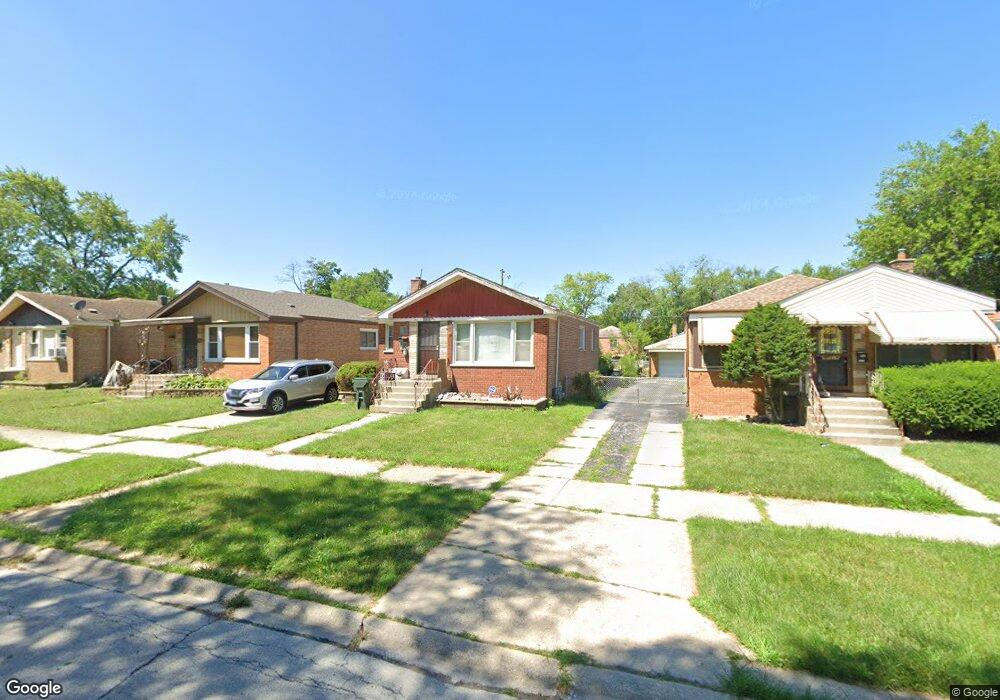
14240 Dobson Ave Dolton, IL 60419
Estimated Value: $135,000 - $185,000
3
Beds
1
Bath
1,084
Sq Ft
$147/Sq Ft
Est. Value
About This Home
This home is located at 14240 Dobson Ave, Dolton, IL 60419 and is currently estimated at $159,434, approximately $147 per square foot. 14240 Dobson Ave is a home located in Cook County with nearby schools including Lincoln Elementary School, Lincoln Junior High School, and Thornridge High School.
Ownership History
Date
Name
Owned For
Owner Type
Purchase Details
Closed on
Jan 16, 2001
Sold by
Woods Michael
Bought by
Hayes William
Current Estimated Value
Home Financials for this Owner
Home Financials are based on the most recent Mortgage that was taken out on this home.
Original Mortgage
$97,850
Interest Rate
8.87%
Purchase Details
Closed on
Sep 28, 1995
Sold by
Cap Raymond D and Cap Dorothy L
Bought by
Woods Michael
Home Financials for this Owner
Home Financials are based on the most recent Mortgage that was taken out on this home.
Original Mortgage
$78,272
Interest Rate
7.91%
Create a Home Valuation Report for This Property
The Home Valuation Report is an in-depth analysis detailing your home's value as well as a comparison with similar homes in the area
Home Values in the Area
Average Home Value in this Area
Purchase History
| Date | Buyer | Sale Price | Title Company |
|---|---|---|---|
| Hayes William | $103,000 | Lawyers Title Insurance Corp | |
| Woods Michael | $79,000 | -- |
Source: Public Records
Mortgage History
| Date | Status | Borrower | Loan Amount |
|---|---|---|---|
| Previous Owner | Hayes William | $97,850 | |
| Previous Owner | Woods Michael | $78,272 |
Source: Public Records
Tax History Compared to Growth
Tax History
| Year | Tax Paid | Tax Assessment Tax Assessment Total Assessment is a certain percentage of the fair market value that is determined by local assessors to be the total taxable value of land and additions on the property. | Land | Improvement |
|---|---|---|---|---|
| 2024 | $6,370 | $13,000 | $2,108 | $10,892 |
| 2023 | $4,451 | $13,000 | $2,108 | $10,892 |
| 2022 | $4,451 | $8,669 | $1,860 | $6,809 |
| 2021 | $4,474 | $8,668 | $1,860 | $6,808 |
| 2020 | $4,409 | $8,668 | $1,860 | $6,808 |
| 2019 | $4,137 | $8,149 | $1,736 | $6,413 |
| 2018 | $4,008 | $8,149 | $1,736 | $6,413 |
| 2017 | $3,820 | $8,149 | $1,736 | $6,413 |
| 2016 | $4,126 | $8,125 | $1,612 | $6,513 |
| 2015 | $3,910 | $8,125 | $1,612 | $6,513 |
| 2014 | $3,919 | $8,125 | $1,612 | $6,513 |
| 2013 | $3,796 | $8,483 | $1,612 | $6,871 |
Source: Public Records
Map
Nearby Homes
- 14234 Minerva Ave
- 14320 Dobson Ave
- 14214 Minerva Ave
- 1011 E 142nd St
- 14237 Minerva Ave
- 14221 Ingleside Ave
- 933 E 142nd St
- 14325 Ingleside Ave
- 14223 University Ave
- 14333 Drexel Ave
- 14238 Woodlawn Ave
- 14429 Minerva Ave
- 14248 Avalon Ave
- 14418 Drexel Ave
- 14405 Woodlawn Ave
- 14447 University Ave
- 14508 Ingleside Ave
- 14400 Shepard Dr
- 14301 Kimbark Ave
- 14409 Kimbark Ave
- 14244 Dobson Ave
- 14236 Dobson Ave
- 14234 Dobson Ave
- 14248 Dobson Ave
- 14230 Dobson Ave
- 14241 Ellis Ave
- 14245 Ellis Ave
- 14237 Ellis Ave
- 14228 Dobson Ave
- 14235 Ellis Ave
- 14247 Ellis Ave
- 14231 Ellis Ave
- 14300 Dobson Ave
- 14241 Dobson Ave
- 14245 Dobson Ave
- 14237 Dobson Ave
- 14226 Dobson Ave
- 14249 Dobson Ave
- 14235 Dobson Ave
- 14227 Ellis Ave