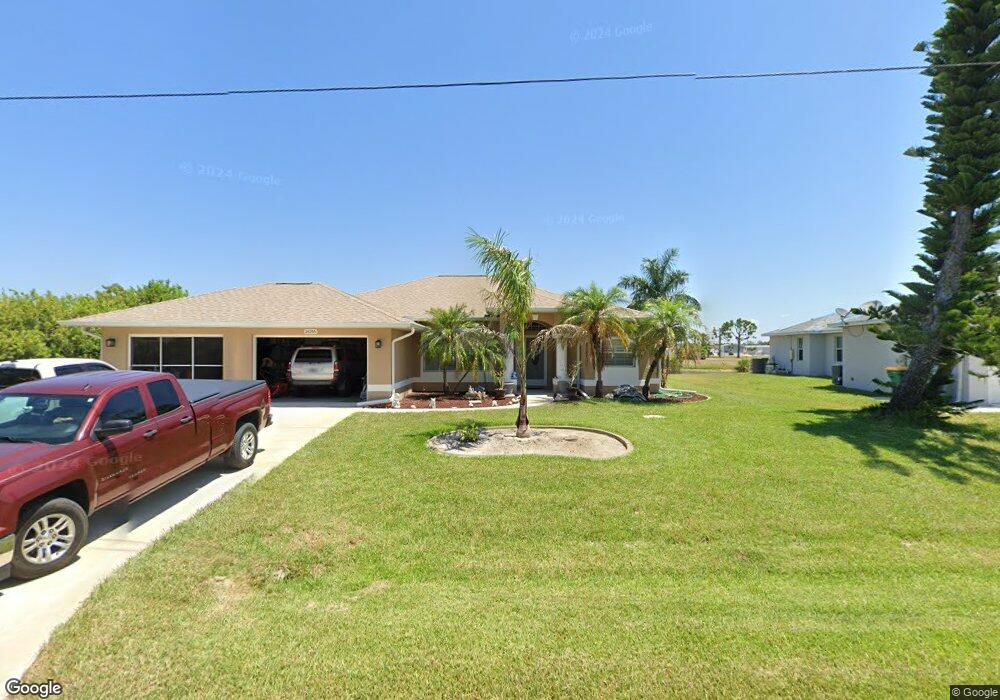
14246 Ostrom Ave Port Charlotte, FL 33981
Gulf Cove NeighborhoodEstimated Value: $428,343 - $506,000
3
Beds
2
Baths
1,723
Sq Ft
$264/Sq Ft
Est. Value
About This Home
This home is located at 14246 Ostrom Ave, Port Charlotte, FL 33981 and is currently estimated at $454,836, approximately $263 per square foot. 14246 Ostrom Ave is a home located in Charlotte County with nearby schools including Myakka River Elementary School, L.A. Ainger Middle School, and Lemon Bay High School.
Ownership History
Date
Name
Owned For
Owner Type
Purchase Details
Closed on
Mar 29, 2004
Sold by
Marinello Marcia E
Bought by
Klick James J and Klick Judie J
Current Estimated Value
Purchase Details
Closed on
Oct 11, 2002
Sold by
Sharp William Henry and Sharp Carol Margaret
Bought by
Marinello Marcia E
Home Financials for this Owner
Home Financials are based on the most recent Mortgage that was taken out on this home.
Original Mortgage
$50,310
Interest Rate
6.21%
Create a Home Valuation Report for This Property
The Home Valuation Report is an in-depth analysis detailing your home's value as well as a comparison with similar homes in the area
Home Values in the Area
Average Home Value in this Area
Purchase History
| Date | Buyer | Sale Price | Title Company |
|---|---|---|---|
| Klick James J | $84,000 | -- | |
| Marinello Marcia E | $55,900 | -- |
Source: Public Records
Mortgage History
| Date | Status | Borrower | Loan Amount |
|---|---|---|---|
| Previous Owner | Marinello Marcia E | $50,310 |
Source: Public Records
Tax History Compared to Growth
Tax History
| Year | Tax Paid | Tax Assessment Tax Assessment Total Assessment is a certain percentage of the fair market value that is determined by local assessors to be the total taxable value of land and additions on the property. | Land | Improvement |
|---|---|---|---|---|
| 2023 | $4,437 | $269,913 | $0 | $0 |
| 2022 | $4,226 | $262,051 | $0 | $0 |
| 2021 | $4,277 | $254,418 | $0 | $0 |
| 2020 | $4,129 | $247,414 | $0 | $0 |
| 2019 | $4,050 | $241,851 | $0 | $0 |
| 2018 | $3,791 | $237,342 | $0 | $0 |
| 2017 | $3,760 | $232,460 | $0 | $0 |
| 2016 | $3,745 | $227,679 | $0 | $0 |
| 2015 | $3,713 | $226,096 | $0 | $0 |
| 2014 | $3,680 | $224,302 | $0 | $0 |
Source: Public Records
Map
Nearby Homes
- 14250 Wenzel Ave
- 14206 Ostrom Ave
- 7566 Danvers Cir
- 14284 Humbold Rd
- 7491 Danvers Cir
- 7567 Danvers Cir
- 7578 Ratan Cir
- 14150 Ostrom Ave
- 14303 Cando Ave
- 7498 Danvers Cir
- 7494 Danvers Cir
- 7574 Ratan Cir
- 7475 Danvers Cir
- 7474 Danvers Cir
- 7594 Ratan Cir
- 7598 Ratan Cir
- 14147 Wenzel Ave
- 14209 Naylor Ave
- 7559 Ratan Cir
- 14130 Wenzel Ave
- 14256 Ostrom Ave
- 14222 Ostrom Ave
- 14227 Ostrom Ave
- 14219 Ostrom Ave
- 14158 Ostrom Ave
- 14171 Ostrom Ave
- 14139 Ostrom Ave
- 14211 Ostrom Ave
- 14155 Ostrom Ave
- 14163 Ostrom Ave
- 14115 Ostrom Ave
- 14203 Ostrom Ave
- 8066 Santa Cruz Dr
- 8074 Santa Cruz Dr
- 14198 Ostrom Ave
- 14316 Ponce de Leon Trail
- 8082 Santa Cruz Dr
- 14202 Wenzel Ave
- 14195 Ostrom Ave
- 7526 Danvers Cir