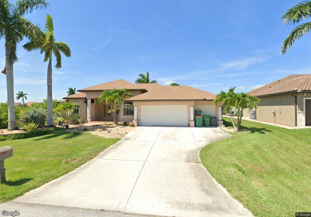
14251 Fruitport Cir Port Charlotte, FL 33981
Gulf Cove NeighborhoodEstimated Value: $632,874 - $885,000
3
Beds
2
Baths
2,519
Sq Ft
$295/Sq Ft
Est. Value
About This Home
This home is located at 14251 Fruitport Cir, Port Charlotte, FL 33981 and is currently estimated at $743,719, approximately $295 per square foot. 14251 Fruitport Cir is a home located in Charlotte County with nearby schools including Myakka River Elementary School, L.A. Ainger Middle School, and Lemon Bay High School.
Ownership History
Date
Name
Owned For
Owner Type
Purchase Details
Closed on
Jan 20, 2017
Sold by
Thurber Stanley Kyle and Klein Ruth Karen
Bought by
Siarkiewicz Robert and Siarkiewicz Paula
Current Estimated Value
Purchase Details
Closed on
Jan 15, 2014
Sold by
Thurber Stanley Kyle
Bought by
Thurber Stanley Kyle and Klein Ruth Karen
Purchase Details
Closed on
Oct 18, 2001
Sold by
Burri Erich
Bought by
Thurber Stanley and Thurber Vicki
Purchase Details
Closed on
Nov 14, 1994
Sold by
Nationsbank Fl N A
Bought by
Burri Erich
Create a Home Valuation Report for This Property
The Home Valuation Report is an in-depth analysis detailing your home's value as well as a comparison with similar homes in the area
Home Values in the Area
Average Home Value in this Area
Purchase History
| Date | Buyer | Sale Price | Title Company |
|---|---|---|---|
| Siarkiewicz Robert | $443,000 | Integrity Title Services Inc | |
| Thurber Stanley Kyle | $57,500 | None Available | |
| Thurber Stanley | $15,000 | -- | |
| Burri Erich | $52,200 | -- |
Source: Public Records
Tax History Compared to Growth
Tax History
| Year | Tax Paid | Tax Assessment Tax Assessment Total Assessment is a certain percentage of the fair market value that is determined by local assessors to be the total taxable value of land and additions on the property. | Land | Improvement |
|---|---|---|---|---|
| 2024 | $6,242 | $394,099 | -- | -- |
| 2023 | $6,242 | $382,620 | $0 | $0 |
| 2022 | $5,989 | $371,476 | $0 | $0 |
| 2021 | $6,082 | $360,656 | $0 | $0 |
| 2020 | $5,886 | $350,114 | $0 | $0 |
| 2019 | $5,754 | $342,242 | $31,450 | $310,792 |
| 2018 | $5,769 | $359,835 | $36,550 | $323,285 |
| 2017 | $4,346 | $268,937 | $0 | $0 |
| 2016 | $4,331 | $263,405 | $0 | $0 |
| 2015 | $4,306 | $261,574 | $0 | $0 |
| 2014 | $4,271 | $259,498 | $0 | $0 |
Source: Public Records
Map
Nearby Homes
- 14153 Fruit Port Cir
- 14219 Fruit Port Cir
- 14283 Fruit Port Cir
- 9944 Winnipeg St
- 9572 Singer Cir
- 14170 Bethesda Ln
- 9716 Singer Cir
- 9470 Wacker Terrace
- 9954 Audrey St
- 10071 Kingsville Dr
- 14222 Maysville Cir
- 9740 Singer Cir
- 14272 Aurella Cir
- 14230 Maysville Cir
- 14350 Maysville Cir
- 14342 Maysville Cir
- 14446 Maysville Cir
- 14550 Maysville Cir
- 9974 Calumet Blvd
- 9982 Calumet Blvd
- 14259 Fruitport Cir
- 14267 Fruitport Cir
- 9628 Singer Cir
- 9620 Singer Cir
- 14268 Fruitport Cir
- 9636 Singer Cir
- 9612 Singer Cir
- 0 Fruit Port Cir
- 14276 Fruitport Cir
- 14211 Fruitport Cir
- 9652 Singer Cir
- 9596 Singer Cir
- 9621 Singer Cir
- 14203 Fruitport Cir
- 9613 Singer Cir
- 10006 Ancona St
- 9605 Singer Cir
- 9605 Singer Cir
- 9660 Singer Cir
- 9588 Singer Cir