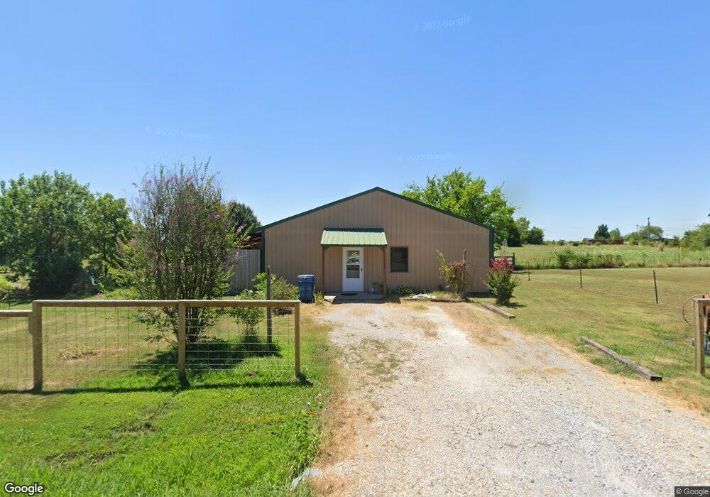
14252 E 122nd St N Collinsville, OK 74021
Estimated Value: $170,000 - $209,000
--
Bed
1
Bath
864
Sq Ft
$217/Sq Ft
Est. Value
About This Home
This home is located at 14252 E 122nd St N, Collinsville, OK 74021 and is currently estimated at $187,362, approximately $216 per square foot. 14252 E 122nd St N is a home located in Tulsa County with nearby schools including Ator Elementary School, Owasso 6th Grade Center, and Owasso 8th Grade Center.
Ownership History
Date
Name
Owned For
Owner Type
Purchase Details
Closed on
Aug 30, 2024
Sold by
Hall Clayton E
Bought by
Owens Tina M
Current Estimated Value
Home Financials for this Owner
Home Financials are based on the most recent Mortgage that was taken out on this home.
Original Mortgage
$91,575
Outstanding Balance
$90,521
Interest Rate
6.78%
Mortgage Type
FHA
Estimated Equity
$96,841
Purchase Details
Closed on
Jun 17, 2021
Sold by
Stevens Judith and Hall Clayton
Bought by
Hall Judith and Hall Clayton
Purchase Details
Closed on
Sep 26, 2005
Sold by
Salley Charles A
Bought by
Hall Clayton E
Create a Home Valuation Report for This Property
The Home Valuation Report is an in-depth analysis detailing your home's value as well as a comparison with similar homes in the area
Home Values in the Area
Average Home Value in this Area
Purchase History
| Date | Buyer | Sale Price | Title Company |
|---|---|---|---|
| Owens Tina M | $170,000 | Investors Title & Escrow | |
| Hall Judith | -- | None Available | |
| Hall Clayton E | $93,000 | -- |
Source: Public Records
Mortgage History
| Date | Status | Borrower | Loan Amount |
|---|---|---|---|
| Open | Owens Tina M | $91,575 |
Source: Public Records
Tax History Compared to Growth
Tax History
| Year | Tax Paid | Tax Assessment Tax Assessment Total Assessment is a certain percentage of the fair market value that is determined by local assessors to be the total taxable value of land and additions on the property. | Land | Improvement |
|---|---|---|---|---|
| 2024 | $2,008 | $9,230 | $3,910 | $5,320 |
| 2023 | $102 | $10,230 | $4,334 | $5,896 |
| 2022 | $102 | $9,230 | $3,910 | $5,320 |
| 2021 | $102 | $9,230 | $3,910 | $5,320 |
| 2020 | $1,037 | $9,230 | $3,910 | $5,320 |
| 2019 | $1,032 | $9,230 | $3,910 | $5,320 |
| 2018 | $1,000 | $9,230 | $3,910 | $5,320 |
| 2017 | $1,106 | $10,230 | $4,334 | $5,896 |
| 2016 | $1,107 | $10,230 | $4,334 | $5,896 |
| 2015 | $1,113 | $10,230 | $4,334 | $5,896 |
| 2014 | $1,122 | $10,230 | $4,334 | $5,896 |
Source: Public Records
Map
Nearby Homes
- 13812 E 122nd St N
- 13802 E 122nd St N
- 14208 E 126th St N
- 001 N 143rd East Ave
- 13520 E 122nd St N
- 13509 E 122nd St N
- 13901 E 126th St N
- 13510 E 122nd St N
- 12212 N 135th East Ave
- 13420 E 122nd St N
- 13316 E 122nd St N
- 13402 E 124th St N
- 13402 E 124th St N
- 12501 N 134th E Ave
- 12501 N 134th East Ave
- 12711 N 135th East Ave
- The Tahoe Plan at Morrow Place - III
- The Tacoma Plan at Morrow Place - III
- The Grant Plan at Morrow Place - III
- The Vermont Plan at Morrow Place - III
- 12147 N 171st East Ave
- 14124 E 122nd St N
- 14321 E 122nd St N
- 14123 E 122nd St N
- 14114 E 122nd St N
- 14119 E 122nd St N
- 14119 E 122nd St S
- 14111 E 122nd St N
- 12034 N 145th East Ave
- 12122 N 145th East Ave
- 12204 N 145th East Ave
- 12240 N 145th East Ave
- 14056 E 122nd St N
- 12206 N 145th East Ave
- 14024 E 122nd St N
- 12131 N 145th East Ave
- 7104 E 141st St N
- 7115 E 141st St N
- 12404 N 145th East Ave
- 13911 E 122nd St N