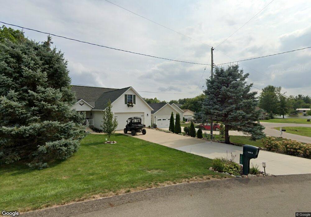
14256 View Dr Camden, MI 49232
Estimated Value: $403,000 - $495,000
Studio
--
Bath
1,568
Sq Ft
$286/Sq Ft
Est. Value
About This Home
This home is located at 14256 View Dr, Camden, MI 49232 and is currently estimated at $449,007, approximately $286 per square foot. 14256 View Dr is a home with nearby schools including Camden-Frontier K-8 School and Camden-Frontier High School.
Ownership History
Date
Name
Owned For
Owner Type
Purchase Details
Closed on
Oct 23, 2025
Sold by
Johnson Timothy and Johnson Robin
Bought by
Johnson Timothy and Johnson Robin
Current Estimated Value
Purchase Details
Closed on
Feb 5, 2018
Sold by
Johnson Timothy and Johnson Robin
Bought by
Johnson Timothy and Johnson Robin
Home Financials for this Owner
Home Financials are based on the most recent Mortgage that was taken out on this home.
Original Mortgage
$181,000
Interest Rate
3.99%
Mortgage Type
Commercial
Purchase Details
Closed on
Jun 20, 2016
Sold by
Johnson Timothy E and Johnson Robin L
Bought by
Timothy Johnson and Timothy Robin Johnson
Purchase Details
Closed on
Jul 1, 1993
Bought by
Johnson
Create a Home Valuation Report for This Property
The Home Valuation Report is an in-depth analysis detailing your home's value as well as a comparison with similar homes in the area
Purchase History
| Date | Buyer | Sale Price | Title Company |
|---|---|---|---|
| Johnson Timothy | -- | None Listed On Document | |
| Johnson Timothy | -- | None Available | |
| Timothy Johnson | -- | Attorney | |
| Johnson | $19,000 | -- |
Source: Public Records
Mortgage History
| Date | Status | Borrower | Loan Amount |
|---|---|---|---|
| Previous Owner | Johnson Timothy | $181,000 |
Source: Public Records
Tax History
| Year | Tax Paid | Tax Assessment Tax Assessment Total Assessment is a certain percentage of the fair market value that is determined by local assessors to be the total taxable value of land and additions on the property. | Land | Improvement |
|---|---|---|---|---|
| 2025 | $1,689 | $214,500 | $0 | $0 |
| 2024 | $15 | $191,500 | $0 | $0 |
| 2023 | $1,471 | $163,100 | $0 | $0 |
| 2022 | $3,834 | $136,900 | $0 | $0 |
| 2021 | $5,837 | $122,200 | $0 | $0 |
| 2020 | $5,551 | $122,100 | $0 | $0 |
| 2019 | $5,353 | $116,200 | $0 | $0 |
| 2018 | $1,235 | $32,400 | $0 | $0 |
| 2017 | $756 | $32,410 | $0 | $0 |
| 2016 | $752 | $26,350 | $0 | $0 |
| 2015 | $198 | $26,350 | $0 | $0 |
| 2013 | $192 | $37,650 | $0 | $0 |
| 2012 | $187 | $37,600 | $0 | $0 |
Source: Public Records
Map
Nearby Homes
- 14364 Horn Dr
- 14934 Heather Ct
- 13551 Hillsdale Rd
- 623-624 Yuma Trail
- 460 Seneca Dr
- 0 Pontiac Trail Unit 10001711
- 988-989 Seneca Dr
- 207 Modoc Trail
- 155 Navajo Trail
- 0 W Territorial Rd Unit 11603977
- 169 Seneca Dr
- 600 Seneca Dr
- 1601 W Territorial Rd
- 638 Seneca Dr
- 4002 & 4014 Meadowlawn Dr
- 14621 Laura Ln
- 145 Lumbee Ln
- 2249 E Montgomery Rd
- 2342 E Montgomery Rd
- 2582 E Montgomery Rd
Your Personal Tour Guide
Ask me questions while you tour the home.