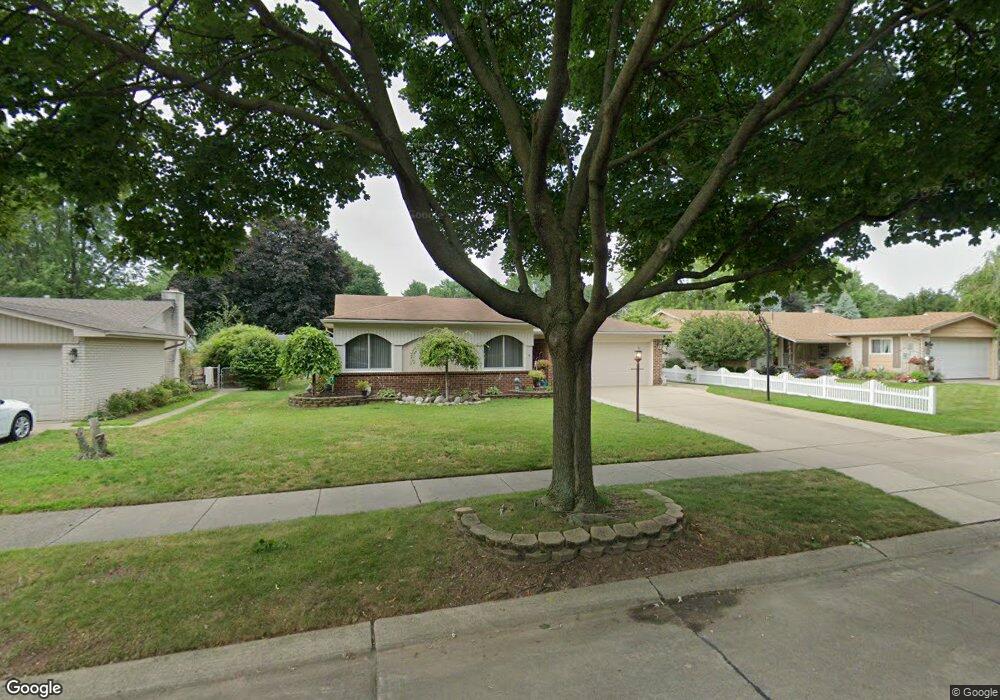
14259 Adams St Livonia, MI 48154
Estimated Value: $339,808 - $355,000
--
Bed
2
Baths
1,184
Sq Ft
$292/Sq Ft
Est. Value
About This Home
This home is located at 14259 Adams St, Livonia, MI 48154 and is currently estimated at $346,202, approximately $292 per square foot. 14259 Adams St is a home located in Wayne County with nearby schools including Randolph Elementary School, Johnson Upper Elementary School, and Frost Middle School.
Ownership History
Date
Name
Owned For
Owner Type
Purchase Details
Closed on
Apr 27, 2023
Sold by
Gomez Rita M
Bought by
Gomez Joseph and Gomez Ashley
Current Estimated Value
Purchase Details
Closed on
Sep 27, 2013
Sold by
Gomez Joseph S
Bought by
Gomez Rita M
Home Financials for this Owner
Home Financials are based on the most recent Mortgage that was taken out on this home.
Original Mortgage
$139,000
Interest Rate
4.5%
Mortgage Type
New Conventional
Purchase Details
Closed on
Apr 4, 2003
Sold by
Houghtby David E and Houghtby Janet L
Bought by
Gomez Joseph S
Purchase Details
Closed on
May 13, 1996
Sold by
Larry R and Thomas Kelly R
Bought by
Dennis M and Dennis Josephine Egan
Create a Home Valuation Report for This Property
The Home Valuation Report is an in-depth analysis detailing your home's value as well as a comparison with similar homes in the area
Home Values in the Area
Average Home Value in this Area
Purchase History
| Date | Buyer | Sale Price | Title Company |
|---|---|---|---|
| Gomez Joseph | -- | None Listed On Document | |
| Gomez Rita M | -- | None Available | |
| Gomez Joseph S | $210,000 | American Title Company Of Li | |
| Dennis M | $137,500 | -- |
Source: Public Records
Mortgage History
| Date | Status | Borrower | Loan Amount |
|---|---|---|---|
| Previous Owner | Gomez Rita M | $139,000 |
Source: Public Records
Tax History Compared to Growth
Tax History
| Year | Tax Paid | Tax Assessment Tax Assessment Total Assessment is a certain percentage of the fair market value that is determined by local assessors to be the total taxable value of land and additions on the property. | Land | Improvement |
|---|---|---|---|---|
| 2025 | $2,011 | $148,600 | $0 | $0 |
| 2024 | $2,011 | $141,300 | $0 | $0 |
| 2023 | $1,918 | $134,600 | $0 | $0 |
| 2022 | $3,442 | $127,800 | $0 | $0 |
| 2021 | $3,347 | $115,400 | $0 | $0 |
| 2019 | $3,226 | $104,000 | $0 | $0 |
| 2018 | $1,622 | $95,900 | $0 | $0 |
| 2017 | $3,039 | $90,200 | $0 | $0 |
| 2016 | $3,100 | $87,300 | $0 | $0 |
| 2015 | $7,114 | $80,630 | $0 | $0 |
| 2012 | -- | $67,780 | $18,950 | $48,830 |
Source: Public Records
Map
Nearby Homes
- 14285 Adams St
- 14469 Bassett St
- 39050 Lyndon St
- 39237 Grennada St
- 14367 Houghton St
- 38502 Summers St
- 14411 Nola St
- 39175 Parkhurst St
- 15111 Houghton St
- 37800 Schoolcraft Rd
- 37656 Schoolcraft Rd
- 37642 Scone Ct
- 37633 Scone Ct
- 38540 5 Mile (Service Drive) Rd
- 14557 Richfield St
- 14677 Newburgh Rd
- 9410 Annalia Dr
- 15916 Swathmore Ln
- 40764 Crabtree Ln
- 41134 Russet Ln
- 14262 Pere St
- 39026 Grennada St
- 39012 Grennada St
- 14284 Pere St
- 39040 Grennada St
- 38996 Grennada St
- 14372 Adams St
- 14311 Adams St
- 14361 Pere St
- 39054 Grennada St
- 38980 Grennada St
- 14337 Adams St
- 14306 Pere St
- 14402 Adams St
- 39068 Grennada St
- 14365 Adams St
- 14385 Pere St
- 38966 Grennada St
- 14389 Adams St
- 14328 Pere St