Estimated Value: $184,000 - $208,000
3
Beds
2
Baths
1,397
Sq Ft
$143/Sq Ft
Est. Value
About This Home
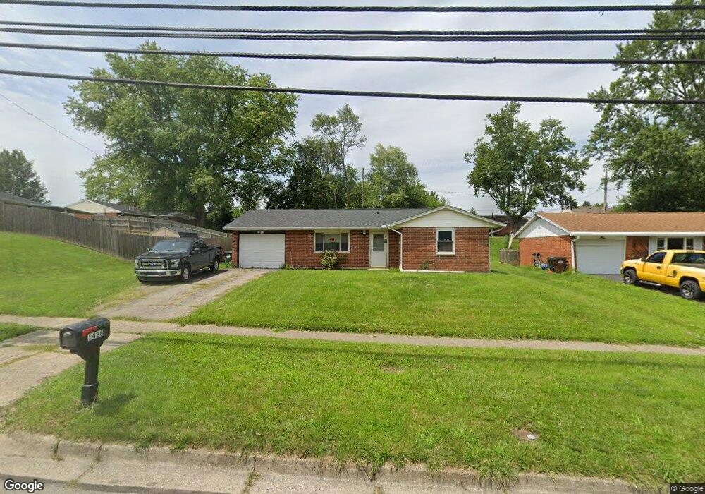
This home is located at 1426 Bellbrook Ave, Xenia, OH 45385 and is currently estimated at $200,452, approximately $143 per square foot. 1426 Bellbrook Ave is a home located in Greene County with nearby schools including Xenia High School, Summit Academy Community School for Alternative Learners - Xenia, and Legacy Christian Academy.
Ownership History
Date
Name
Owned For
Owner Type
Purchase Details
Closed on
Apr 27, 2001
Sold by
Norris Thomas R and Norris Jamie L
Bought by
Dafler Roger S
Current Estimated Value
Home Financials for this Owner
Home Financials are based on the most recent Mortgage that was taken out on this home.
Original Mortgage
$80,000
Outstanding Balance
$29,695
Interest Rate
6.95%
Estimated Equity
$170,757
Purchase Details
Closed on
Dec 18, 1998
Sold by
Smith Sean P and Smith Jeni A
Bought by
Norris Thomas R
Home Financials for this Owner
Home Financials are based on the most recent Mortgage that was taken out on this home.
Original Mortgage
$69,000
Interest Rate
6.96%
Purchase Details
Closed on
Mar 2, 1998
Sold by
Smith Sean P
Bought by
Smith Sean P and Smih Jeni A
Home Financials for this Owner
Home Financials are based on the most recent Mortgage that was taken out on this home.
Original Mortgage
$56,150
Interest Rate
7.14%
Create a Home Valuation Report for This Property
The Home Valuation Report is an in-depth analysis detailing your home's value as well as a comparison with similar homes in the area
Home Values in the Area
Average Home Value in this Area
Purchase History
| Date | Buyer | Sale Price | Title Company |
|---|---|---|---|
| Dafler Roger S | $80,000 | -- | |
| Norris Thomas R | $75,000 | -- | |
| Smith Sean P | -- | -- |
Source: Public Records
Mortgage History
| Date | Status | Borrower | Loan Amount |
|---|---|---|---|
| Open | Dafler Roger S | $80,000 | |
| Previous Owner | Norris Thomas R | $69,000 | |
| Previous Owner | Smith Sean P | $56,150 |
Source: Public Records
Tax History Compared to Growth
Tax History
| Year | Tax Paid | Tax Assessment Tax Assessment Total Assessment is a certain percentage of the fair market value that is determined by local assessors to be the total taxable value of land and additions on the property. | Land | Improvement |
|---|---|---|---|---|
| 2024 | $2,231 | $53,500 | $11,690 | $41,810 |
| 2023 | $2,231 | $53,500 | $11,690 | $41,810 |
| 2022 | $1,864 | $38,110 | $6,880 | $31,230 |
| 2021 | $1,889 | $38,110 | $6,880 | $31,230 |
| 2020 | $1,808 | $38,110 | $6,880 | $31,230 |
| 2019 | $1,564 | $31,030 | $6,630 | $24,400 |
| 2018 | $1,570 | $31,030 | $6,630 | $24,400 |
| 2017 | $1,524 | $31,030 | $6,630 | $24,400 |
| 2016 | $1,436 | $27,870 | $6,630 | $21,240 |
| 2015 | $1,440 | $27,870 | $6,630 | $21,240 |
| 2014 | $1,378 | $27,870 | $6,630 | $21,240 |
Source: Public Records
Map
Nearby Homes
- 1272 Bellbrook Ave
- 1208 Bellbrook Ave
- 1778 Arapaho Dr
- 1403 Texas Dr
- 1866 Roxbury Dr
- 1618 Navajo Dr
- 1144 Rockwell Dr
- 1769 Gayhart Dr
- 1653 Seneca Dr
- 1829 Gayhart Dr
- 1908 Whitt St
- 1255 Colorado Dr
- 1568 Cheyenne Dr
- 1107 Arkansas Dr
- 523 Newport Rd
- 1342 Kylemore Dr
- 2499 Jenny Marie Dr
- 2758 Wyoming Dr
- 910 Wright Ave
- 2142 Michigan Dr
- 1412 Bellbrook Ave
- 1482 Maumee Dr
- 1508 Pueblo Dr
- 1398 Bellbrook Ave
- 1516 Pueblo Dr
- 1512 Maumee Dr
- 1524 Pueblo Dr
- 1384 Bellbrook Ave
- 1532 Pueblo Dr
- 1547 Pueblo Dr
- 1544 Maumee Dr
- 1483 Maumee Dr
- 1497 Maumee Dr
- 1358 Bellbrook Ave
- 1540 Pueblo Dr
- 1135 Buckskin Trail
- 1561 Pueblo Dr
- 1558 Maumee Dr
- 1554 Pueblo Dr
- 1127 Buckskin Trail