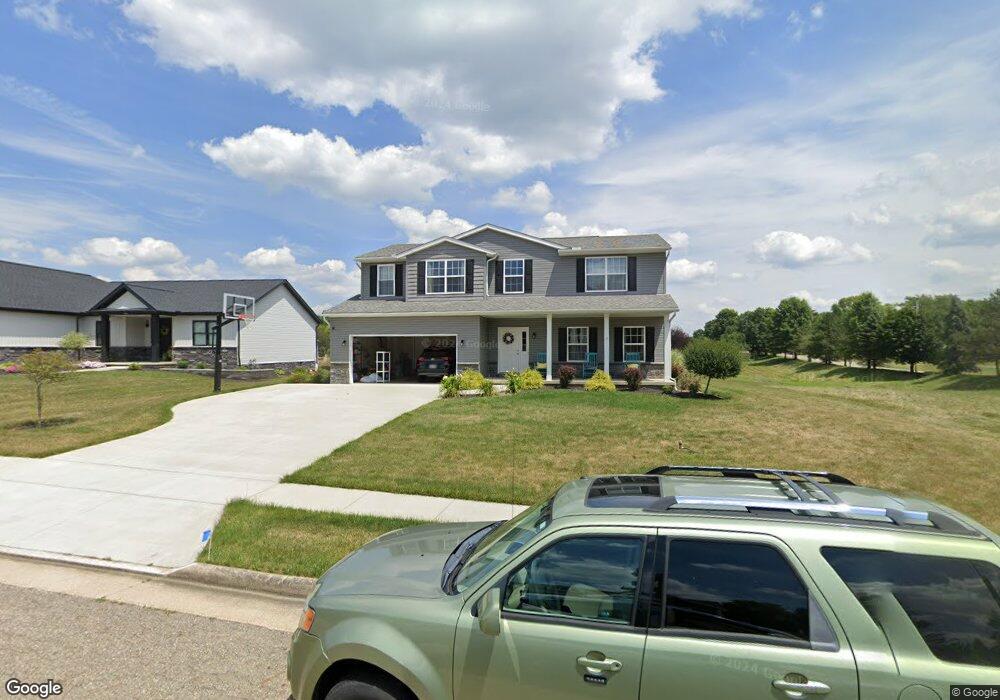
1426 Brookridge Ave Louisville, OH 44641
Estimated Value: $339,000 - $393,000
4
Beds
3
Baths
2,464
Sq Ft
$149/Sq Ft
Est. Value
About This Home
This home is located at 1426 Brookridge Ave, Louisville, OH 44641 and is currently estimated at $366,148, approximately $148 per square foot. 1426 Brookridge Ave is a home with nearby schools including Louisville High School and St. Thomas Aquinas High School & Middle School.
Ownership History
Date
Name
Owned For
Owner Type
Purchase Details
Closed on
Jul 30, 2020
Sold by
Kauth Development Company Llc
Bought by
Simmons Lorrie and Simmons Shane
Current Estimated Value
Home Financials for this Owner
Home Financials are based on the most recent Mortgage that was taken out on this home.
Original Mortgage
$279,745
Outstanding Balance
$250,150
Interest Rate
3.1%
Mortgage Type
Future Advance Clause Open End Mortgage
Estimated Equity
$115,998
Create a Home Valuation Report for This Property
The Home Valuation Report is an in-depth analysis detailing your home's value as well as a comparison with similar homes in the area
Home Values in the Area
Average Home Value in this Area
Purchase History
| Date | Buyer | Sale Price | Title Company |
|---|---|---|---|
| Simmons Lorrie | $42,000 | None Available |
Source: Public Records
Mortgage History
| Date | Status | Borrower | Loan Amount |
|---|---|---|---|
| Open | Simmons Lorrie | $279,745 |
Source: Public Records
Tax History Compared to Growth
Tax History
| Year | Tax Paid | Tax Assessment Tax Assessment Total Assessment is a certain percentage of the fair market value that is determined by local assessors to be the total taxable value of land and additions on the property. | Land | Improvement |
|---|---|---|---|---|
| 2025 | -- | $119,810 | $23,210 | $96,600 |
| 2024 | -- | $119,810 | $23,210 | $96,600 |
| 2023 | $3,794 | $88,310 | $18,660 | $69,650 |
| 2022 | $3,801 | $88,310 | $18,660 | $69,650 |
| 2021 | $2,059 | $46,520 | $18,660 | $27,860 |
| 2020 | $342 | $8,400 | $8,400 | $0 |
| 2019 | $344 | $11,590 | $11,590 | $0 |
| 2018 | $479 | $11,590 | $11,590 | $0 |
| 2017 | $413 | $9,770 | $9,770 | $0 |
| 2016 | $422 | $9,770 | $9,770 | $0 |
| 2015 | $429 | $9,770 | $9,770 | $0 |
| 2014 | $440 | $9,450 | $9,450 | $0 |
| 2013 | $220 | $9,450 | $9,450 | $0 |
Source: Public Records
Map
Nearby Homes
- 0 Brookridge Ave
- 0 Glenbar St
- 614 Reno Dr
- 524 Glenbar St
- 3580 Brookridge Ave Lot 15
- 1175 Sturbridge Dr
- 1149 Sturbridge Dr
- 300 Kennedy St
- 5474 Ravenna Ave
- 428 Honeycrisp Dr NE
- 3047 Mcintosh Dr NE
- 432 Honeycrisp Dr NE
- 2962 Mcintosh Dr NE
- 2963 Mcintosh Dr NE
- 430 Honeycrisp Dr NE
- 2957 Mcintosh Dr NE
- 316 E Reno Dr
- 910 Crosswyck Cir
- 1170 Winding Ridge Ave
- 325 Lincoln Ave
- 1446 Brookridge Ave
- 3578 Brookridge Ave Lot 13 NW
- 3575 Glenbar St Lot 10
- 3571 Glenbar St Lot 6
- 0 W Reno Dr
- 813 Reno Dr
- 803 Reno Dr
- 906 Reno Dr
- 1453 Brookridge Ave
- 1457 Brookridge Ave
- 1312 Baier Ave
- 1459 Brookridge Ave
- 716 Glenbar St
- 1000 Reno Dr
- 724 Glenbar St
- 830 Glenbar St
- 1304 Baier Ave
- 1427 Brookridge Ave
- 7027 Reno Dr
- 1313 Baier Ave