Estimated Value: $228,973 - $265,000
3
Beds
2
Baths
1,200
Sq Ft
$206/Sq Ft
Est. Value
About This Home
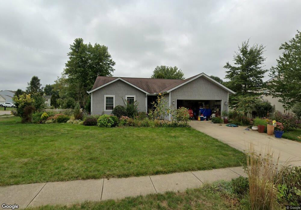
This home is located at 1426 Sterling Commons Blvd, Xenia, OH 45385 and is currently estimated at $247,743, approximately $206 per square foot. 1426 Sterling Commons Blvd is a home located in Greene County with nearby schools including Xenia High School, Summit Academy Community School for Alternative Learners - Xenia, and Legacy Christian Academy.
Ownership History
Date
Name
Owned For
Owner Type
Purchase Details
Closed on
Jun 3, 1997
Sold by
Crossmann Communities Of
Bought by
Coughell Dianne L
Current Estimated Value
Home Financials for this Owner
Home Financials are based on the most recent Mortgage that was taken out on this home.
Original Mortgage
$95,000
Outstanding Balance
$13,935
Interest Rate
8.27%
Mortgage Type
New Conventional
Estimated Equity
$233,808
Create a Home Valuation Report for This Property
The Home Valuation Report is an in-depth analysis detailing your home's value as well as a comparison with similar homes in the area
Home Values in the Area
Average Home Value in this Area
Purchase History
| Date | Buyer | Sale Price | Title Company |
|---|---|---|---|
| Coughell Dianne L | $105,615 | -- |
Source: Public Records
Mortgage History
| Date | Status | Borrower | Loan Amount |
|---|---|---|---|
| Open | Coughell Dianne L | $95,000 |
Source: Public Records
Tax History Compared to Growth
Tax History
| Year | Tax Paid | Tax Assessment Tax Assessment Total Assessment is a certain percentage of the fair market value that is determined by local assessors to be the total taxable value of land and additions on the property. | Land | Improvement |
|---|---|---|---|---|
| 2024 | $2,165 | $61,730 | $16,370 | $45,360 |
| 2023 | $2,165 | $61,730 | $16,370 | $45,360 |
| 2022 | $1,831 | $46,190 | $10,910 | $35,280 |
| 2021 | $1,856 | $46,190 | $10,910 | $35,280 |
| 2020 | $1,776 | $46,190 | $10,910 | $35,280 |
| 2019 | $1,467 | $37,870 | $6,770 | $31,100 |
| 2018 | $1,473 | $37,870 | $6,770 | $31,100 |
| 2017 | $1,431 | $37,870 | $6,770 | $31,100 |
| 2016 | $1,432 | $36,540 | $6,770 | $29,770 |
| 2015 | $718 | $36,540 | $6,770 | $29,770 |
| 2014 | $687 | $36,540 | $6,770 | $29,770 |
Source: Public Records
Map
Nearby Homes
- 2784 Greystoke Dr
- 2821 Raxit Ct
- 0 Berkshire Dr Unit 942854
- 2540 Cornwall Dr
- 2540 Jenny Marie Dr
- 2421 Louisiana Dr
- 1318 Prem Place
- 2499 Jenny Marie Dr
- 1304 Baybury Ave
- 1298 Baybury Ave
- 2705 Tennessee Dr
- 1248 Prem Place
- 1282 Baybury Ave
- 2345 Tennessee Dr
- 1213 Prem Place
- 1293 Baybury Ave
- 1272 Baybury Ave
- 1292 Baybury Ave
- 2692 Kingman Dr
- Chatham Plan at Edenbridge
- 1418 Sterling Commons Blvd
- 1412 Sterling Commons Blvd
- 2718 Greystoke Dr
- 2668 Greystoke Ct
- 2705 Barnhill Ct
- 2701 Greystoke Dr
- 2707 Greystoke Dr
- 1406 Sterling Commons Blvd
- 2669 Ketki Ct
- 2726 Greystoke Dr
- 2715 Greystoke Dr
- 2713 Barnhill Ct
- 2660 Greystoke Ct
- 2669 Greystoke Ct
- 2723 Greystoke Dr
- 2661 Ketki Ct
- 1388 Sterling Commons Blvd
- 2700 Barnhill Ct
- 0 Lower Bellbrook Rd
- 2736 Greystoke Dr