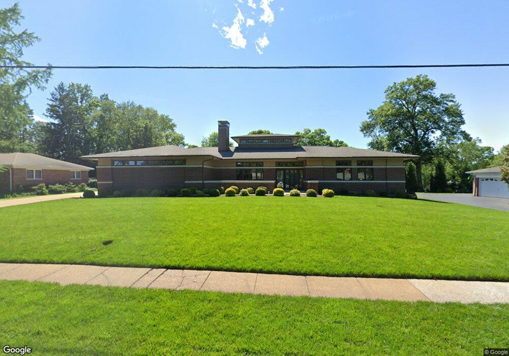
1427 Bopp Rd Saint Louis, MO 63131
Estimated Value: $595,000 - $1,588,714
4
Beds
4
Baths
5,478
Sq Ft
$224/Sq Ft
Est. Value
About This Home
This home is located at 1427 Bopp Rd, Saint Louis, MO 63131 and is currently estimated at $1,224,429, approximately $223 per square foot. 1427 Bopp Rd is a home located in St. Louis County with nearby schools including Westchester Elementary School, North Kirkwood Middle School, and Kirkwood Senior High School.
Ownership History
Date
Name
Owned For
Owner Type
Purchase Details
Closed on
Aug 16, 2023
Sold by
Zlatic Amy Margaret
Bought by
Zlatic Revocable Trust and Zlatic
Current Estimated Value
Purchase Details
Closed on
Apr 16, 2002
Sold by
Brown Otis M
Bought by
Zlatic Michael Richard and Zlatic Amy Margaret
Home Financials for this Owner
Home Financials are based on the most recent Mortgage that was taken out on this home.
Original Mortgage
$72,324
Interest Rate
6.83%
Purchase Details
Closed on
Apr 14, 2002
Sold by
Meine Charles W and Meine Carolyn
Bought by
Meine Charles W and Meine Carolyn B
Home Financials for this Owner
Home Financials are based on the most recent Mortgage that was taken out on this home.
Original Mortgage
$72,324
Interest Rate
6.83%
Create a Home Valuation Report for This Property
The Home Valuation Report is an in-depth analysis detailing your home's value as well as a comparison with similar homes in the area
Home Values in the Area
Average Home Value in this Area
Purchase History
| Date | Buyer | Sale Price | Title Company |
|---|---|---|---|
| Zlatic Revocable Trust | -- | None Listed On Document | |
| Zlatic Michael Richard | $250,000 | -- | |
| Meine Charles W | -- | -- |
Source: Public Records
Mortgage History
| Date | Status | Borrower | Loan Amount |
|---|---|---|---|
| Previous Owner | Zlatic Michael Richard | $72,324 |
Source: Public Records
Tax History Compared to Growth
Tax History
| Year | Tax Paid | Tax Assessment Tax Assessment Total Assessment is a certain percentage of the fair market value that is determined by local assessors to be the total taxable value of land and additions on the property. | Land | Improvement |
|---|---|---|---|---|
| 2025 | $12,671 | $257,490 | $70,300 | $187,190 |
| 2024 | $12,671 | $219,550 | $52,440 | $167,110 |
| 2023 | $12,474 | $219,550 | $52,440 | $167,110 |
| 2022 | $11,054 | $181,300 | $52,440 | $128,860 |
| 2021 | $10,935 | $181,300 | $52,440 | $128,860 |
| 2020 | $11,764 | $187,570 | $48,410 | $139,160 |
| 2019 | $11,779 | $187,570 | $48,410 | $139,160 |
| 2018 | $8,790 | $125,500 | $27,230 | $98,270 |
| 2017 | $8,814 | $125,500 | $27,230 | $98,270 |
| 2016 | $8,691 | $125,350 | $23,430 | $101,920 |
| 2015 | $8,701 | $125,350 | $23,430 | $101,920 |
| 2014 | -- | $134,060 | $10,580 | $123,480 |
Source: Public Records
Map
Nearby Homes
- 1126 Bopp Rd
- 8 Briarbrook Trail
- 1090 Kinstern Dr
- 1029 Kinstern Dr
- 1345 Woodgate Dr
- 1728 Folkstone Dr
- 723 Oak Valley Dr
- 12439 Springdale Ln Unit TBB
- 918 N Ballas Rd
- 811 Cherry St
- 11913 Lillian Ave
- 1741 Pine Hill Dr
- 11909 Lillian Ave
- 12006 Montour Dr
- 12224 TBB Roger Ln
- The Hawthorne Plan at Ballas Ridge
- The Roclare II Plan at Ballas Ridge
- The Westchester IV Plan at Ballas Ridge
- The Nottingham II Plan at Ballas Ridge
- The Hawthorne II Plan at Ballas Ridge
- 1415 Bopp Rd
- 1439 Bopp Rd
- 1416 Christine Ave
- 1424 Christine Ave
- 1408 Christine Ave
- 1424 Bopp Rd
- 1432 Bopp Rd
- 1447 Bopp Rd
- 1416 Bopp Rd
- 1401 Bopp Rd
- 1432 Christine Ave
- 11960 Kendon Dr
- 1400 Christine Ave
- 1417 Christine Ave
- 1425 Christine Ave
- 1409 Christine Ave
- 1400 Bopp Rd
- 1409 Marlann Dr
- 12100 Saint Clement
- 11963 Kendon Dr