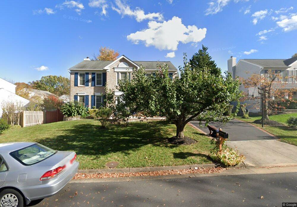
1427 Fishers Mill Ct Herndon, VA 20170
Estimated Value: $811,775 - $904,000
4
Beds
3
Baths
2,418
Sq Ft
$356/Sq Ft
Est. Value
About This Home
This home is located at 1427 Fishers Mill Ct, Herndon, VA 20170 and is currently estimated at $861,694, approximately $356 per square foot. 1427 Fishers Mill Ct is a home located in Fairfax County with nearby schools including Dranesville Elementary, Herndon Middle School, and Herndon High School.
Ownership History
Date
Name
Owned For
Owner Type
Purchase Details
Closed on
Feb 24, 2021
Sold by
Williams Samuel Anslem and Williams Patricia Pamela
Bought by
Samuel Anslem Williams And Patricia Pamela Wi and Williams
Current Estimated Value
Purchase Details
Closed on
Mar 28, 1989
Bought by
Williams Samuel A and Williams Patricia P
Create a Home Valuation Report for This Property
The Home Valuation Report is an in-depth analysis detailing your home's value as well as a comparison with similar homes in the area
Home Values in the Area
Average Home Value in this Area
Purchase History
| Date | Buyer | Sale Price | Title Company |
|---|---|---|---|
| Samuel Anslem Williams And Patricia Pamela Wi | -- | None Listed On Document | |
| Williams Samuel Anslem | -- | None Available | |
| Williams Samuel A | $224,400 | -- |
Source: Public Records
Tax History Compared to Growth
Tax History
| Year | Tax Paid | Tax Assessment Tax Assessment Total Assessment is a certain percentage of the fair market value that is determined by local assessors to be the total taxable value of land and additions on the property. | Land | Improvement |
|---|---|---|---|---|
| 2025 | $8,271 | $726,670 | $244,000 | $482,670 |
| 2024 | $8,271 | $713,910 | $244,000 | $469,910 |
| 2023 | $7,527 | $667,030 | $239,000 | $428,030 |
| 2022 | $7,178 | $627,760 | $239,000 | $388,760 |
| 2021 | $6,504 | $554,230 | $204,000 | $350,230 |
| 2020 | $6,360 | $537,360 | $194,000 | $343,360 |
| 2019 | $6,143 | $519,060 | $189,000 | $330,060 |
| 2018 | $5,723 | $497,610 | $184,000 | $313,610 |
| 2017 | $5,719 | $492,560 | $184,000 | $308,560 |
| 2016 | $5,632 | $486,140 | $184,000 | $302,140 |
| 2015 | $5,271 | $472,320 | $184,000 | $288,320 |
| 2014 | $5,282 | $474,380 | $184,000 | $290,380 |
Source: Public Records
Map
Nearby Homes
- 12592 Rock Ridge Rd
- 2007 Jonathan Dr
- 1551 Brownsville Dr
- 12535 Misty Water Dr
- 1407 Skyhaven Ct
- 400 Gary Ct
- 1402 Bakers Creek Ct
- 12703 Longleaf Ln
- 1314 E Holly Ave
- 1377 Rock Chapel Rd
- 1307 E Holly Ave
- 1305 E Maple Ave
- 1372 Dominion Ridge Ln
- 11 Butternut Way
- 113 N Harrison Rd
- 19 Butternut Way
- 316 Hanford Ct
- 131 N Garfield Rd
- 104 N Garfield Rd
- 21921 Myrtlewood Square
- 1429 Fishers Mill Ct
- 1425 Fishers Mill Ct
- 1402 Rock Ridge Ct
- 12632 Terrymill Dr
- 1404 Rock Ridge Ct
- 1428 Fishers Mill Ct
- 1431 Fishers Mill Ct
- 1430 Fishers Mill Ct
- 12634 Terrymill Dr
- 12628 Terrymill Dr
- 1400 Rock Ridge Ct
- 1432 Fishers Mill Ct
- 1406 Rock Ridge Ct
- 1433 Fishers Mill Ct
- 12636 Terrymill Dr
- 12631 Terrymill Dr
- 12633 Terrymill Dr
- 12626 Terrymill Dr
- 1401 Rock Ridge Ct
- 1437 Millikens Bend Rd