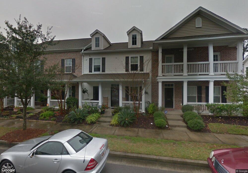
1427 Nautical Chart Dr Charleston, SC 29414
West Ashley NeighborhoodEstimated Value: $421,000 - $518,000
3
Beds
3
Baths
1,622
Sq Ft
$288/Sq Ft
Est. Value
About This Home
This home is located at 1427 Nautical Chart Dr, Charleston, SC 29414 and is currently estimated at $466,604, approximately $287 per square foot. 1427 Nautical Chart Dr is a home located in Charleston County with nearby schools including Oakland Elementary School, West Ashley High School, and Evangel Christian School.
Ownership History
Date
Name
Owned For
Owner Type
Purchase Details
Closed on
Mar 15, 2010
Sold by
The Ryland Group Inc
Bought by
Baker Ernest J and Baker Barbara K
Current Estimated Value
Home Financials for this Owner
Home Financials are based on the most recent Mortgage that was taken out on this home.
Original Mortgage
$102,000
Interest Rate
4.97%
Mortgage Type
New Conventional
Purchase Details
Closed on
Nov 28, 2007
Sold by
The Ryland Group Inc
Bought by
The City Of Charleston South Carolina
Create a Home Valuation Report for This Property
The Home Valuation Report is an in-depth analysis detailing your home's value as well as a comparison with similar homes in the area
Home Values in the Area
Average Home Value in this Area
Purchase History
| Date | Buyer | Sale Price | Title Company |
|---|---|---|---|
| Baker Ernest J | $170,000 | -- | |
| The City Of Charleston South Carolina | -- | -- |
Source: Public Records
Mortgage History
| Date | Status | Borrower | Loan Amount |
|---|---|---|---|
| Previous Owner | Baker Ernest J | $102,000 |
Source: Public Records
Tax History Compared to Growth
Tax History
| Year | Tax Paid | Tax Assessment Tax Assessment Total Assessment is a certain percentage of the fair market value that is determined by local assessors to be the total taxable value of land and additions on the property. | Land | Improvement |
|---|---|---|---|---|
| 2024 | $957 | $6,540 | $0 | $0 |
| 2023 | $957 | $6,540 | $0 | $0 |
| 2022 | $866 | $6,540 | $0 | $0 |
| 2021 | $905 | $6,540 | $0 | $0 |
| 2020 | $936 | $6,540 | $0 | $0 |
| 2019 | $804 | $5,420 | $0 | $0 |
| 2017 | $779 | $7,420 | $0 | $0 |
| 2016 | $749 | $7,420 | $0 | $0 |
| 2015 | $772 | $7,420 | $0 | $0 |
| 2014 | $712 | $0 | $0 | $0 |
| 2011 | -- | $0 | $0 | $0 |
Source: Public Records
Map
Nearby Homes
- 1410 Roustabout Way
- 1615 Seabago Dr
- 3030 Scuba Dr
- 1585 Seabago Dr
- 1607 Roustabout Way
- 1576 Nautical Chart Dr
- 3201 Moonlight Dr
- 3221 Moonlight Dr
- 2864 Conservancy Ln
- 1615 Evening Star Place
- 2823 Conservancy Ln
- 709 Pepperbush St
- 1507 Dawn Mist Way
- Maxwell Plan at Ashley Walk Townes
- Addison Plan at Ashley Walk Townes
- 423 Queenview Ln
- 422 Queenview Ln
- 430 Queenview Ln
- 197 Claret Cup Way
- 425 Queenview Ln
- 1429 Nautical Chart Dr
- 1425 Nautical Chart Dr
- 1431 Nautical Chart Dr
- 1421 Nautical Chart Dr
- 1419 Nautical Chart Dr
- 1435 Nautical Chart Dr
- 1417 Nautical Chart Dr
- 3026 Lazarette Ln
- 1415 Nautical Chart Dr
- 3024 Lazarette Ln
- 3050 Moonlight Dr
- 1413 Nautical Chart Dr
- 3022 Lazarette Ln
- 3046 Moonlight Dr
- 1441 Nautical Chart Dr
- 2222 Moonlight Dr
- 1411 Nautical Chart Dr
- 3020 Lazarette Ln
- 1443 Nautical Chart Dr
- 3018 Lazarette Ln