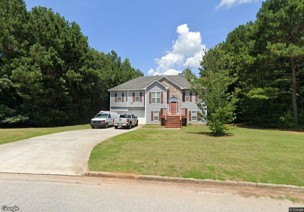
1427 Stag Run Dr Mansfield, GA 30055
Jasper County NeighborhoodEstimated Value: $293,124 - $340,000
--
Bed
3
Baths
1,516
Sq Ft
$206/Sq Ft
Est. Value
About This Home
This home is located at 1427 Stag Run Dr, Mansfield, GA 30055 and is currently estimated at $312,531, approximately $206 per square foot. 1427 Stag Run Dr is a home located in Jasper County with nearby schools including Jasper County Primary School, Washington Park Elementary School, and Jasper County Middle School.
Ownership History
Date
Name
Owned For
Owner Type
Purchase Details
Closed on
Mar 28, 2018
Sold by
Airington Christopher
Bought by
Cole David B
Current Estimated Value
Home Financials for this Owner
Home Financials are based on the most recent Mortgage that was taken out on this home.
Original Mortgage
$144,530
Outstanding Balance
$124,264
Interest Rate
4.43%
Mortgage Type
New Conventional
Estimated Equity
$188,267
Purchase Details
Closed on
Mar 30, 2006
Sold by
Kitchens Kenneth W
Bought by
Airington Christopher Keith
Purchase Details
Closed on
Jul 8, 2004
Sold by
Jones Estates Llc
Bought by
Kitchens Kenneth W
Create a Home Valuation Report for This Property
The Home Valuation Report is an in-depth analysis detailing your home's value as well as a comparison with similar homes in the area
Home Values in the Area
Average Home Value in this Area
Purchase History
| Date | Buyer | Sale Price | Title Company |
|---|---|---|---|
| Cole David B | $149,000 | -- | |
| Airington Christopher Keith | $166,850 | -- | |
| Kitchens Kenneth W | $132,500 | -- |
Source: Public Records
Mortgage History
| Date | Status | Borrower | Loan Amount |
|---|---|---|---|
| Open | Cole David B | $144,530 |
Source: Public Records
Tax History Compared to Growth
Tax History
| Year | Tax Paid | Tax Assessment Tax Assessment Total Assessment is a certain percentage of the fair market value that is determined by local assessors to be the total taxable value of land and additions on the property. | Land | Improvement |
|---|---|---|---|---|
| 2024 | $3,506 | $129,120 | $13,600 | $115,520 |
| 2023 | $3,341 | $122,640 | $12,000 | $110,640 |
| 2022 | $3,378 | $115,440 | $4,800 | $110,640 |
| 2021 | $2,499 | $81,800 | $3,600 | $78,200 |
| 2020 | $2,448 | $77,120 | $3,600 | $73,520 |
| 2019 | $1,946 | $71,360 | $2,000 | $69,360 |
| 2018 | $2,083 | $62,760 | $2,000 | $60,760 |
| 2017 | $2,021 | $59,880 | $2,000 | $57,880 |
| 2016 | $1,734 | $51,280 | $2,000 | $49,280 |
| 2015 | $1,629 | $46,240 | $2,000 | $44,240 |
| 2014 | $1,439 | $41,120 | $2,000 | $39,120 |
Source: Public Records
Map
Nearby Homes
- 1042 Stag Run Dr
- 52 Armstrong Dr Unit 83
- 72 Armstrong Dr Unit 85
- 62 Armstrong Dr Unit 84
- 82 Armstrong Dr Unit 86
- 122 Armstrong Dr Unit 90
- 92 Armstrong Dr Unit 87
- 132 Armstrong Dr Unit 91
- 102 Armstrong Dr Unit 88
- 768 Stag Run Dr
- 112 Armstrong Dr Unit 89
- 138 Sourwood Dr
- 115 Sourwood Dr
- 31 Sourwood Dr
- 100 Sourwood Dr
- 2.8 AC Bear Creek Point
- 867 Bear Creek Point
- 575 Doe Ln
- LOTS 48,49,50 Doe Ln
- 277 Doe Ln
- 218 Hamilton Dr
- 1379 Stag Run Dr
- 1428 Stag Run Dr
- 243 Hamilton Dr
- 1398 Stag Run Dr
- 1380 Stag Run Dr
- 290 Hamilton Dr
- 205 Hamilton Dr
- 259 Hamilton Dr
- 1341 Stag Run Dr
- 1360 Stag Run Dr
- 299 Hamilton Dr
- 1323 Stag Run Dr
- 308 Hamilton Dr
- 1340 Stag Run Dr
- 909 Stag Run Dr
- 909 Stag Run Dr Unit 72
- 926 Stag Run Dr
- 926 Stag Run Dr Unit 71
- 1322 Stag Run Dr Unit 55