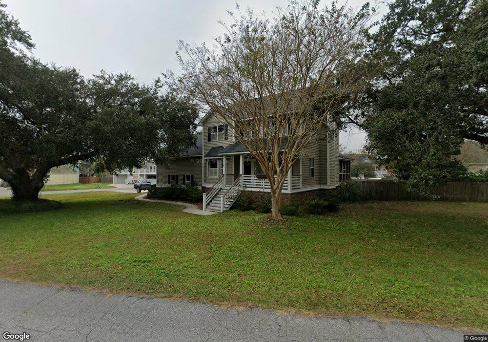
1428 Fort Lamar Rd Charleston, SC 29412
James Island NeighborhoodEstimated Value: $776,000 - $892,000
4
Beds
4
Baths
2,508
Sq Ft
$335/Sq Ft
Est. Value
About This Home
This home is located at 1428 Fort Lamar Rd, Charleston, SC 29412 and is currently estimated at $840,667, approximately $335 per square foot. 1428 Fort Lamar Rd is a home located in Charleston County with nearby schools including James Island Elementary School, Camp Road Middle, and Septima P Clark Corporate Academy.
Ownership History
Date
Name
Owned For
Owner Type
Purchase Details
Closed on
May 24, 2019
Sold by
Bain James
Bought by
Hyams Clayton Joseph and Hyams Naomi Bain
Current Estimated Value
Home Financials for this Owner
Home Financials are based on the most recent Mortgage that was taken out on this home.
Original Mortgage
$320,000
Outstanding Balance
$281,345
Interest Rate
4.2%
Mortgage Type
New Conventional
Estimated Equity
$559,322
Purchase Details
Closed on
May 13, 2002
Sold by
Martin Thomas M and Martin Dale O
Bought by
Bain James
Create a Home Valuation Report for This Property
The Home Valuation Report is an in-depth analysis detailing your home's value as well as a comparison with similar homes in the area
Home Values in the Area
Average Home Value in this Area
Purchase History
| Date | Buyer | Sale Price | Title Company |
|---|---|---|---|
| Hyams Clayton Joseph | $400,000 | First American Mortgage Sln | |
| Bain James | $247,000 | -- |
Source: Public Records
Mortgage History
| Date | Status | Borrower | Loan Amount |
|---|---|---|---|
| Open | Hyams Clayton Joseph | $320,000 |
Source: Public Records
Tax History Compared to Growth
Tax History
| Year | Tax Paid | Tax Assessment Tax Assessment Total Assessment is a certain percentage of the fair market value that is determined by local assessors to be the total taxable value of land and additions on the property. | Land | Improvement |
|---|---|---|---|---|
| 2024 | $2,124 | $16,000 | $0 | $0 |
| 2023 | $2,124 | $16,000 | $0 | $0 |
| 2022 | $1,973 | $16,000 | $0 | $0 |
| 2021 | $2,069 | $16,000 | $0 | $0 |
| 2020 | $2,145 | $16,000 | $0 | $0 |
| 2019 | $1,818 | $13,210 | $0 | $0 |
| 2017 | $1,756 | $13,210 | $0 | $0 |
| 2016 | $1,683 | $13,210 | $0 | $0 |
| 2015 | $1,739 | $13,210 | $0 | $0 |
| 2014 | $1,657 | $0 | $0 | $0 |
| 2011 | -- | $0 | $0 | $0 |
Source: Public Records
Map
Nearby Homes
- 1427 Battle Ground Rd
- 1447 Fort Lamar Rd
- 1410 Ordinance Point
- 1685 Old Military Rd
- 1338 Garrison St
- 1087 Clearspring Dr
- 1601 Secessionville Rd
- 0 Cooper Judge Ln Unit 20007881
- 0 Cooper Judge Ln Unit 20007879
- 1714 Lotus Ln
- 1144 Clearspring Dr
- 1245 Lakefront Dr
- 1153 Clearspring Dr
- 746 Goodlet Cir
- 1582 Teal Marsh Rd
- 1566 Folly Rd
- 114 Sea Cotton Cir
- 1028 Hills Plantation Dr
- 1821 Folly Rd
- 1588 Terns Nest Rd
- 1422 Fort Lamar Rd
- 1435 Battle Ground Rd
- 1448 Battle Ground Rd
- 1440 Battle Ground Rd
- 1444 Battle Ground Rd
- 1436 Battle Ground Rd
- 1416 Fort Lamar Rd
- 1431 Battle Ground Rd
- 1427 Fort Lamar Rd
- 1442 Fort Lamar Rd
- 0 Battleground Rd
- 1432 Battle Ground Rd
- 1412 Fort Lamar Rd
- 1446 Fort Lamar Rd
- 1415 Fort Lamar Rd
- 1428 Battle Ground Rd
- 1408 Fort Lamar Rd
- 1423 Battle Ground Rd
- 1450 Fort Lamar Rd
- 1420 Battle Ground Rd