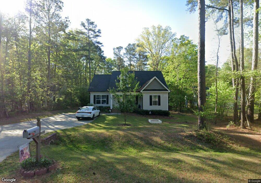
1429 Andersonwood Dr Fuquay-Varina, NC 27526
Estimated Value: $368,000 - $417,744
3
Beds
2
Baths
1,287
Sq Ft
$306/Sq Ft
Est. Value
About This Home
This home is located at 1429 Andersonwood Dr, Fuquay-Varina, NC 27526 and is currently estimated at $393,436, approximately $305 per square foot. 1429 Andersonwood Dr is a home located in Wake County.
Ownership History
Date
Name
Owned For
Owner Type
Purchase Details
Closed on
Mar 15, 2018
Sold by
Robert Crabtree Blvd Inc
Bought by
Harney Connor B and Harney Allyson E
Current Estimated Value
Home Financials for this Owner
Home Financials are based on the most recent Mortgage that was taken out on this home.
Original Mortgage
$202,900
Outstanding Balance
$173,205
Interest Rate
4.22%
Mortgage Type
New Conventional
Estimated Equity
$220,231
Purchase Details
Closed on
Oct 5, 2017
Sold by
The Anderson Family Lp
Bought by
Robert Crabtree Builders Inc
Home Financials for this Owner
Home Financials are based on the most recent Mortgage that was taken out on this home.
Original Mortgage
$142,500
Interest Rate
3.86%
Mortgage Type
Commercial
Create a Home Valuation Report for This Property
The Home Valuation Report is an in-depth analysis detailing your home's value as well as a comparison with similar homes in the area
Home Values in the Area
Average Home Value in this Area
Purchase History
| Date | Buyer | Sale Price | Title Company |
|---|---|---|---|
| Harney Connor B | $210,000 | None Available | |
| Robert Crabtree Builders Inc | $12,000 | None Available |
Source: Public Records
Mortgage History
| Date | Status | Borrower | Loan Amount |
|---|---|---|---|
| Open | Harney Connor B | $202,900 | |
| Previous Owner | Robert Crabtree Builders Inc | $142,500 |
Source: Public Records
Tax History Compared to Growth
Tax History
| Year | Tax Paid | Tax Assessment Tax Assessment Total Assessment is a certain percentage of the fair market value that is determined by local assessors to be the total taxable value of land and additions on the property. | Land | Improvement |
|---|---|---|---|---|
| 2025 | $2,665 | $413,512 | $105,000 | $308,512 |
| 2024 | $2,588 | $413,512 | $105,000 | $308,512 |
| 2023 | $2,100 | $266,833 | $45,000 | $221,833 |
| 2022 | $1,947 | $266,833 | $45,000 | $221,833 |
| 2021 | $1,534 | $215,498 | $45,000 | $170,498 |
| 2020 | $1,509 | $215,498 | $45,000 | $170,498 |
| 2019 | $1,353 | $163,218 | $44,000 | $119,218 |
| 2018 | $867 | $8,800 | $8,800 | $0 |
| 2017 | $63 | $8,800 | $8,800 | $0 |
| 2016 | $0 | $8,800 | $8,800 | $0 |
| 2015 | -- | $7,600 | $7,600 | $0 |
| 2014 | -- | $7,600 | $7,600 | $0 |
Source: Public Records
Map
Nearby Homes
- Lot 67 Sage Ct
- 506 Donnegal Farm Dr
- 209 Providence Springs Ln
- 301 Providence Springs Ln
- 223 Bridle Brook Way
- 213 Bridle Brook Way
- 321 Bridle Brook Way
- 528 Providence Springs Ln
- 433 Providence Springs Ln
- 516 Providence Springs Ln
- 309 Highland Forest Dr
- 312 Bridle Brook Way
- 2301 Edenberry Ln
- 2309 Edenberry Ln
- 300 Bridle Brook Way
- 240 Bridle Brook Way
- 1616 Bowling Rd
- 143 Rusty Hook Ln Unit Lot 23
- 2305 Edenberry Ln
- 2313 Edenberry Ln
- 1425 Andersonwood Dr
- 1501 Andersonwood Dr
- 1421 Andersonwood Dr
- 1424 Andersonwood Dr
- 1505 Andersonwood Dr
- 1417 Andersonwood Dr
- 1420 Andersonwood Dr
- 1416 Andersonwood Dr
- 521 Sloping Hill Ln
- 1413 Andersonwood Dr
- 1509 Andersonwood Dr
- 528 Sloping Hill Ln
- 1412 Andersonwood Dr
- 1409 Walking Trail
- 1409 Andersonwood Dr
- 1504 Andersonwood Dr
- 1513 Andersonwood Dr
- 517 Sloping Hill Ln
- 1405 Walking Trail
- 1408 Walking Trail