
Seller's Agent in 2025
Allison Brown
Coldwell Banker Realty
(614) 759-0808
1 in this area
15 Total Sales
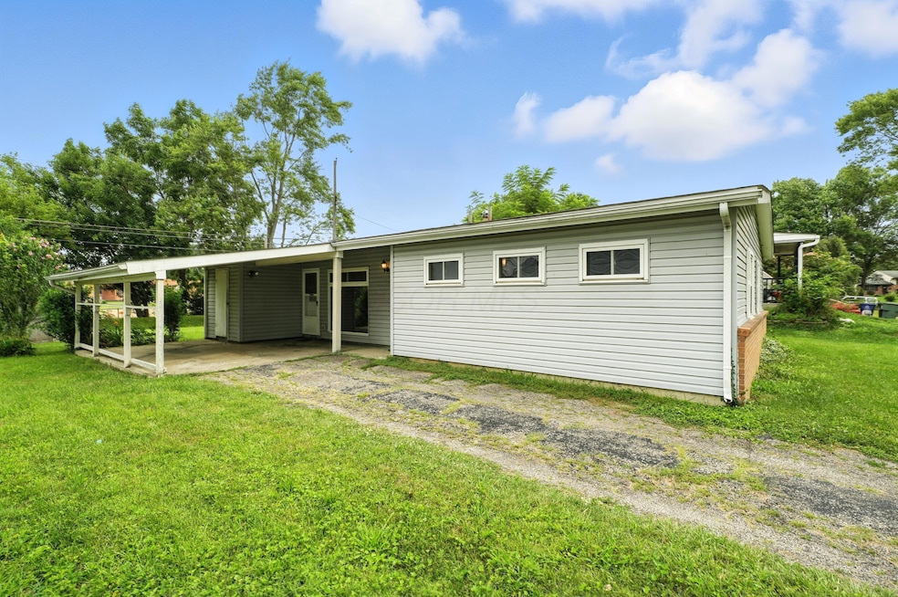


Welcome to this beautifully updated 3-bedroom, 2-bath ranch located in the desirable Lea Wood Gardens subdivision. Boasting an open floor plan and 1,283 square feet of comfortable living space, this home features fresh paint and brand-new flooring throughout.
Enjoy ample-sized rooms with great flow for everyday living and entertaining. The spacious living area connects seamlessly to the dining spaces - perfect for modern lifestyles.
This property qualifies for the Park National Bank $15,000 grant program. Don't miss your chance to own this updated gem—schedule your showing today! No sign at property.
Last Agent to Sell the Property
Coldwell Banker Realty License #2015004377 Listed on: 07/17/2025
| Date | Type | Sale Price | Title Company |
|---|---|---|---|
| Warranty Deed | $195,000 | Vault Title | |
| Warranty Deed | $69,000 | Amerititle East |
| Date | Status | Loan Amount | Loan Type |
|---|---|---|---|
| Previous Owner | $68,435 | FHA |
| Date | Event | Price | List to Sale | Price per Sq Ft |
|---|---|---|---|---|
| 09/12/2025 09/12/25 | Sold | $195,000 | -9.3% | $152 / Sq Ft |
| 08/11/2025 08/11/25 | For Sale | $215,000 | +10.3% | $168 / Sq Ft |
| 08/10/2025 08/10/25 | Off Market | $195,000 | -- | -- |
| 08/01/2025 08/01/25 | Price Changed | $215,000 | -2.3% | $168 / Sq Ft |
| 07/17/2025 07/17/25 | For Sale | $220,000 | -- | $171 / Sq Ft |
| Year | Tax Paid | Tax Assessment Tax Assessment Total Assessment is a certain percentage of the fair market value that is determined by local assessors to be the total taxable value of land and additions on the property. | Land | Improvement |
|---|---|---|---|---|
| 2024 | $2,281 | $60,620 | $17,150 | $43,470 |
| 2023 | $2,280 | $60,620 | $17,150 | $43,470 |
| 2022 | $990 | $27,830 | $6,440 | $21,390 |
| 2021 | $991 | $27,830 | $6,440 | $21,390 |
| 2020 | $993 | $27,830 | $6,440 | $21,390 |
| 2019 | $799 | $21,920 | $5,150 | $16,770 |
| 2018 | $753 | $21,920 | $5,150 | $16,770 |
| 2017 | $798 | $21,920 | $5,150 | $16,770 |
| 2016 | $780 | $20,520 | $5,570 | $14,950 |
| 2015 | $708 | $20,520 | $5,570 | $14,950 |
| 2014 | $710 | $20,520 | $5,570 | $14,950 |
| 2013 | $457 | $24,115 | $6,545 | $17,570 |
Seller's Agent in 2025
Allison Brown
Coldwell Banker Realty
(614) 759-0808
1 in this area
15 Total Sales
Buyer's Agent in 2025
James Nutor
Red 1 Realty
(614) 554-0104
3 in this area
25 Total Sales
Source: Columbus and Central Ohio Regional MLS
MLS Number: 225026583
APN: 010-116705
Disclaimer: Certain information contained herein is derived from information provided by parties other than Homes.com. All information provided is deemed reliable, but is not guaranteed to be accurate and should be independently verified.
![]() IDX information is provided exclusively for personal, non-commercial use, and may not be used for any purpose other than to identify prospective properties consumers may be interested in purchasing.
IDX information is provided exclusively for personal, non-commercial use, and may not be used for any purpose other than to identify prospective properties consumers may be interested in purchasing.
Information is deemed reliable but not guaranteed.