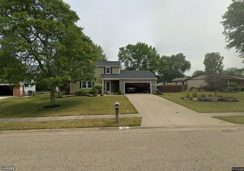
1429 South St Louisville, OH 44641
Estimated Value: $258,000 - $276,000
4
Beds
3
Baths
1,822
Sq Ft
$145/Sq Ft
Est. Value
About This Home
This home is located at 1429 South St, Louisville, OH 44641 and is currently estimated at $263,663, approximately $144 per square foot. 1429 South St is a home located in Stark County with nearby schools including Louisville High School and St. Thomas Aquinas High School & Middle School.
Ownership History
Date
Name
Owned For
Owner Type
Purchase Details
Closed on
Jan 13, 2017
Sold by
Mayle Richard S
Bought by
Mayle Michele R
Current Estimated Value
Purchase Details
Closed on
Mar 20, 2009
Sold by
Mayle Richard S and Mayle Michele R
Bought by
Mayle Richard S and Mayle Michele R
Home Financials for this Owner
Home Financials are based on the most recent Mortgage that was taken out on this home.
Original Mortgage
$107,000
Outstanding Balance
$27,355
Interest Rate
5.11%
Mortgage Type
Stand Alone Refi Refinance Of Original Loan
Estimated Equity
$236,308
Purchase Details
Closed on
Mar 31, 1995
Sold by
Bostjancic Jim F
Bought by
Mayle Richard S and King Michele
Home Financials for this Owner
Home Financials are based on the most recent Mortgage that was taken out on this home.
Original Mortgage
$112,100
Interest Rate
8.91%
Mortgage Type
New Conventional
Purchase Details
Closed on
Feb 26, 1990
Create a Home Valuation Report for This Property
The Home Valuation Report is an in-depth analysis detailing your home's value as well as a comparison with similar homes in the area
Home Values in the Area
Average Home Value in this Area
Purchase History
| Date | Buyer | Sale Price | Title Company |
|---|---|---|---|
| Mayle Michele R | -- | None Available | |
| Mayle Richard S | -- | Lsi | |
| Mayle Richard S | $118,000 | -- | |
| -- | $84,900 | -- |
Source: Public Records
Mortgage History
| Date | Status | Borrower | Loan Amount |
|---|---|---|---|
| Open | Mayle Richard S | $107,000 | |
| Closed | Mayle Richard S | $112,100 |
Source: Public Records
Tax History Compared to Growth
Tax History
| Year | Tax Paid | Tax Assessment Tax Assessment Total Assessment is a certain percentage of the fair market value that is determined by local assessors to be the total taxable value of land and additions on the property. | Land | Improvement |
|---|---|---|---|---|
| 2025 | -- | $72,460 | $20,130 | $52,330 |
| 2024 | -- | $72,460 | $20,130 | $52,330 |
| 2023 | $2,665 | $62,020 | $18,970 | $43,050 |
| 2022 | $2,671 | $62,020 | $18,970 | $43,050 |
| 2021 | $2,679 | $62,020 | $18,970 | $43,050 |
| 2020 | $2,216 | $55,730 | $17,120 | $38,610 |
| 2019 | $2,225 | $56,920 | $16,560 | $40,360 |
| 2018 | $2,264 | $56,920 | $16,560 | $40,360 |
| 2017 | $2,145 | $50,580 | $14,560 | $36,020 |
| 2016 | $2,189 | $50,580 | $14,560 | $36,020 |
| 2015 | $2,195 | $50,580 | $14,560 | $36,020 |
| 2014 | $40 | $43,690 | $12,570 | $31,120 |
| 2013 | $1,023 | $43,690 | $12,570 | $31,120 |
Source: Public Records
Map
Nearby Homes
- 1715 High St
- 641 S Nickelplate St
- 308 Superior St
- 1812 E Broad St
- 520 S Silver St
- 728 E Broad St
- 0 Michigan Blvd
- 2110 Edmar St
- 510 S Bauman Ct
- 204 E Broad St
- 107 E Broad St
- 908 Sand Lot Cir
- 2015 E Main St
- 325 Lincoln Ave
- 1170 Winding Ridge Ave
- 1702 View Pointe Ave
- 3390 Meese Rd NE
- 910 Crosswyck Cir
- 1639 Horizon Dr
- 428 Honeycrisp Dr NE