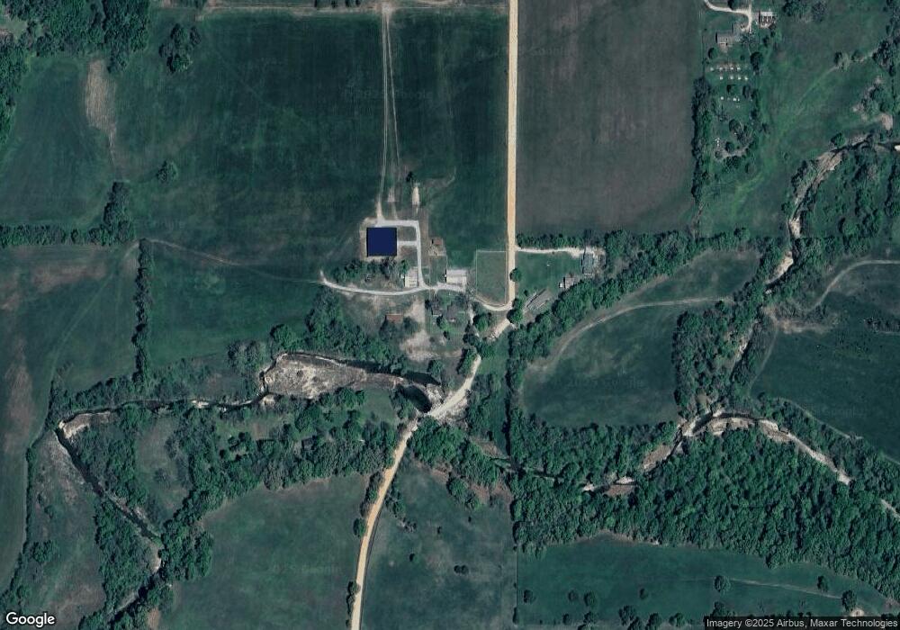
14291 S 690 Rd Wyandotte, OK 74370
Estimated Value: $320,000 - $902,000
3
Beds
2
Baths
2,107
Sq Ft
$290/Sq Ft
Est. Value
About This Home
This home is located at 14291 S 690 Rd, Wyandotte, OK 74370 and is currently estimated at $611,189, approximately $290 per square foot. 14291 S 690 Rd is a home located in Ottawa County with nearby schools including Wyandotte Middle School and Wyandotte High School.
Ownership History
Date
Name
Owned For
Owner Type
Purchase Details
Closed on
Oct 31, 2024
Sold by
Geraldine Dupre Williams Revocable Trust and Dupre Williams Geraldine
Bought by
Williams Jay Bryan
Current Estimated Value
Purchase Details
Closed on
Apr 15, 2021
Sold by
Cox Johnnie Len and Meeuws Debra Ann
Bought by
Williams Geraldine Dupre and Williams Revoc Geraldine Dupre
Home Financials for this Owner
Home Financials are based on the most recent Mortgage that was taken out on this home.
Original Mortgage
$487,300
Interest Rate
3%
Mortgage Type
Seller Take Back
Purchase Details
Closed on
Sep 30, 2002
Bought by
Cox John L and Debra Ann Meeuws
Purchase Details
Closed on
Apr 27, 1994
Bought by
Roberts Royden and Roberts Sandra
Create a Home Valuation Report for This Property
The Home Valuation Report is an in-depth analysis detailing your home's value as well as a comparison with similar homes in the area
Home Values in the Area
Average Home Value in this Area
Purchase History
| Date | Buyer | Sale Price | Title Company |
|---|---|---|---|
| Williams Jay Bryan | $500,000 | None Listed On Document | |
| Williams Geraldine Dupre | $690,166 | None Available | |
| Cox John L | $185,000 | -- | |
| Roberts Royden | -- | -- |
Source: Public Records
Mortgage History
| Date | Status | Borrower | Loan Amount |
|---|---|---|---|
| Previous Owner | Williams Geraldine Dupre | $487,300 |
Source: Public Records
Tax History Compared to Growth
Tax History
| Year | Tax Paid | Tax Assessment Tax Assessment Total Assessment is a certain percentage of the fair market value that is determined by local assessors to be the total taxable value of land and additions on the property. | Land | Improvement |
|---|---|---|---|---|
| 2024 | $1,875 | $22,404 | $2,937 | $19,467 |
| 2023 | $1,875 | $22,404 | $2,937 | $19,467 |
| 2022 | $1,782 | $22,404 | $2,937 | $19,467 |
| 2021 | $556 | $7,918 | $2,391 | $5,527 |
| 2020 | $541 | $7,687 | $2,382 | $5,305 |
| 2019 | $527 | $7,463 | $2,375 | $5,088 |
| 2018 | $511 | $7,246 | $2,369 | $4,877 |
| 2017 | $499 | $7,035 | $2,363 | $4,672 |
| 2016 | $487 | $6,830 | $2,356 | $4,474 |
| 2015 | $487 | $6,132 | $2,784 | $3,348 |
| 2014 | $441 | $6,632 | $2,288 | $4,344 |
Source: Public Records
Map
Nearby Homes
- 42 E 152 Rd
- 0 Business 60
- 20540 State Route 43
- 22 Oak Hill Dr
- 907 Warnall Cir
- 10.54+/- Acres Old Highway 60
- 2288 U S 60
- 205 Oak Ridge Dr
- 65400 E 155 Rd
- TBD Washington St
- 1418 Cherokee Ave
- 67041 E 166 Rd
- TBD 18.24 Acres K Hwy
- 001 Washington (Old Hwy 60) Ave
- 1619 Roark Ave
- 1020 Seneca Ave
- 742 Cemetery Rd
- 2004 Elm St
- 1826 Sherry Ave
- TBD Tract 1 Old 60 Dr
- 14291 S 690 Rd
- 14401 S 690 Rd
- 14250 S 690 Rd
- 68867 E Highway 60
- 68921 U S 60
- 68927 E Highway 60
- 68859 E Highway 60
- 68859 U S 60
- 68921 E Highway 60
- 68855 U S 60
- 14600 S 690 Rd
- 68857 U S 60
- 68851 E Highway 60
- 68851 U S 60
- 68950 U S 60
- 68950 E Highway 60
- 68857 E Highway 60
- 68855 E Highway 60
- 68900 E Highway 60
- 68851 E Highway 60
