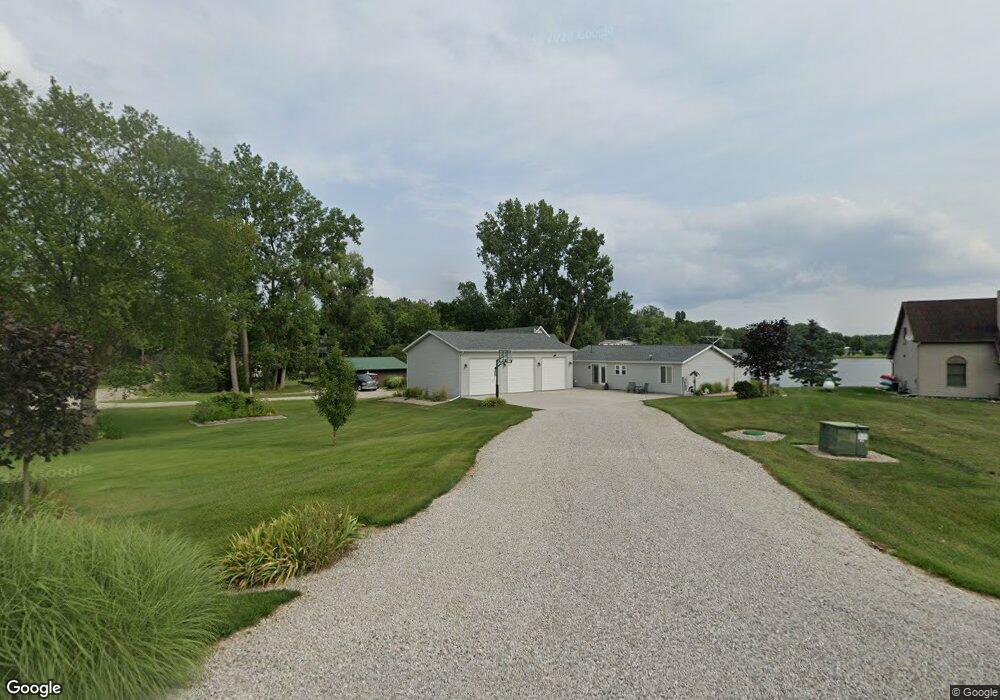
14295 Suelynn Cir Camden, MI 49232
Estimated Value: $373,258 - $423,000
--
Bed
1
Bath
1,419
Sq Ft
$286/Sq Ft
Est. Value
About This Home
This home is located at 14295 Suelynn Cir, Camden, MI 49232 and is currently estimated at $405,815, approximately $285 per square foot. 14295 Suelynn Cir is a home located in Hillsdale County with nearby schools including Camden-Frontier K-8 School and Camden-Frontier High School.
Ownership History
Date
Name
Owned For
Owner Type
Purchase Details
Closed on
Nov 7, 2022
Sold by
Doherty Dean A and Doherty Pam M
Bought by
Doherty Dean A and Doherty Pam M
Current Estimated Value
Purchase Details
Closed on
Apr 13, 2007
Sold by
Smith Brad A and Smith Joni K
Bought by
Doherty Dean A and Doherty Pam M
Purchase Details
Closed on
Sep 26, 2003
Sold by
Laprad David L and Laprad Vicki K
Bought by
Doherty Dean A and Doherty Pam M
Purchase Details
Closed on
Aug 3, 2001
Sold by
Billy Joyce L
Bought by
Billy Joyce L and Laprad Vicki K
Purchase Details
Closed on
Jul 14, 1998
Bought by
Billy Joyce L
Create a Home Valuation Report for This Property
The Home Valuation Report is an in-depth analysis detailing your home's value as well as a comparison with similar homes in the area
Home Values in the Area
Average Home Value in this Area
Purchase History
| Date | Buyer | Sale Price | Title Company |
|---|---|---|---|
| Doherty Dean A | -- | Not Available | |
| Doherty Dean A | -- | None Available | |
| Doherty Dean A | $70,000 | -- | |
| Billy Joyce L | $39,900 | -- | |
| Billy Joyce L | -- | -- |
Source: Public Records
Tax History Compared to Growth
Tax History
| Year | Tax Paid | Tax Assessment Tax Assessment Total Assessment is a certain percentage of the fair market value that is determined by local assessors to be the total taxable value of land and additions on the property. | Land | Improvement |
|---|---|---|---|---|
| 2025 | $3,240 | $177,100 | $0 | $0 |
| 2024 | $1,268 | $165,800 | $0 | $0 |
| 2023 | $1,208 | $140,900 | $0 | $0 |
| 2022 | $3,120 | $120,500 | $0 | $0 |
| 2021 | $3,018 | $108,500 | $0 | $0 |
| 2020 | $2,950 | $106,700 | $0 | $0 |
| 2019 | $2,756 | $99,300 | $0 | $0 |
| 2018 | $2,649 | $96,200 | $0 | $0 |
| 2017 | $2,526 | $95,970 | $0 | $0 |
| 2016 | $2,508 | $93,380 | $0 | $0 |
| 2015 | $994 | $93,380 | $0 | $0 |
| 2013 | $972 | $89,820 | $0 | $0 |
| 2012 | $949 | $86,640 | $0 | $0 |
Source: Public Records
Map
Nearby Homes
- 13857 E Diane Dr
- 13791 E Diane Dr
- 14600 W Diane Dr
- 14401 Woodbridge Rd
- 13551 Hillsdale Rd
- 14934 Heather Ct
- 623-624 Yuma Trail
- 362 Wasco Trail
- 199 Shoshone Trail
- 155 Navajo Trail
- 988-989 Seneca Dr
- 207 Modoc Trail
- 11794 Clark Rd
- 213 Navajo Trail
- 131 Choctaw Trail
- 0 Seneca Dr
- 4002 & 4014 Meadowlawn Dr
- 14165 Crampton Rd
- 14621 Laura Ln
- 234 Seneca Dr
- 14313 E Diane Dr
- 14289 Sue Lynn
- 14289 Suelynn Cir
- 14317 E Diane Dr
- 14285 Sue Lynn
- 14285 Suelynn Cir
- E Diane Dr
- 14275 Suelynn Cir
- 14279 Suelynn Cir
- 14321 E Diane Dr
- 14384 View Dr
- 14344 View Dr S
- 14249 E Diane Dr
- 14376 View Dr
- 14368 View Dr
- 14233 E Diane Dr
- 14248 E Diane Dr
- 14360 View Dr
- 14390 Tyson Trail
- 14396 Tyson Trail