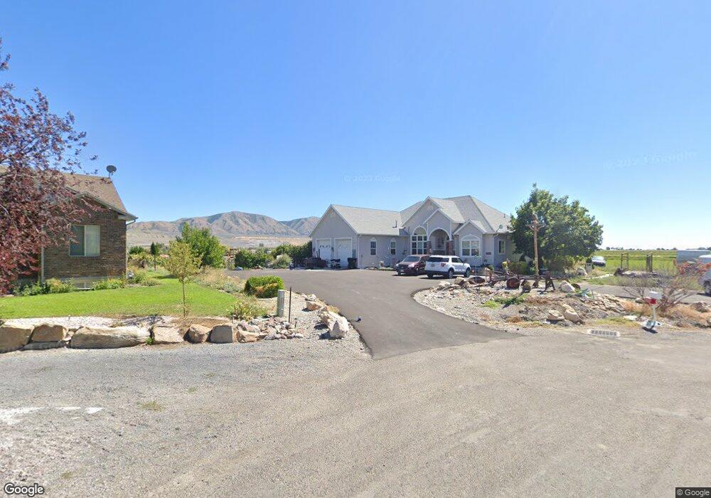
14296 N 5350 W Garland, UT 84312
Estimated Value: $379,000 - $432,000
--
Bed
--
Bath
1,080
Sq Ft
$374/Sq Ft
Est. Value
About This Home
This home is located at 14296 N 5350 W, Garland, UT 84312 and is currently estimated at $404,313, approximately $374 per square foot. 14296 N 5350 W is a home located in Box Elder County with nearby schools including Fielding School, Bear River Middle School, and Alice C. Harris Intermediate School.
Ownership History
Date
Name
Owned For
Owner Type
Purchase Details
Closed on
Jul 8, 2024
Sold by
Cardenaz Burnett Shirleen Marriott and Cardenaz Paul Brandon
Bought by
Rgs Properties Llc
Current Estimated Value
Purchase Details
Closed on
Nov 18, 2022
Sold by
Cardenez Burnett Shirleen Marriott
Bought by
Burnett Shirleen Marriott Car and Cardenez Brandon Paul
Purchase Details
Closed on
Jan 29, 2021
Sold by
Burnett Shirleen Mariott Cardenez and Burnett Gary R
Bought by
Burnett Shirleen Marriott Cardenez
Purchase Details
Closed on
Jul 23, 2020
Sold by
Marriott Charles E and Marriott Family Trust
Bought by
Burnett Shirleen Marriott Cardenez and Burnett Gary R
Purchase Details
Closed on
Mar 7, 2014
Sold by
Marriott Charles E and Marriott Kathleen B
Bought by
Marriott Family Trust
Create a Home Valuation Report for This Property
The Home Valuation Report is an in-depth analysis detailing your home's value as well as a comparison with similar homes in the area
Home Values in the Area
Average Home Value in this Area
Purchase History
| Date | Buyer | Sale Price | Title Company |
|---|---|---|---|
| Rgs Properties Llc | -- | Heritage West Title | |
| Burnett Shirleen Marriott Car | -- | -- | |
| Burnett Shirleen Marriott Cardenez | -- | Northern Title Company | |
| Burnett Shirleen Marriott Cardenez | -- | Northern Title Company | |
| Marriott Family Trust | -- | None Available |
Source: Public Records
Tax History Compared to Growth
Tax History
| Year | Tax Paid | Tax Assessment Tax Assessment Total Assessment is a certain percentage of the fair market value that is determined by local assessors to be the total taxable value of land and additions on the property. | Land | Improvement |
|---|---|---|---|---|
| 2025 | $1,535 | $298,119 | $130,000 | $168,119 |
| 2024 | $1,348 | $296,884 | $130,000 | $166,884 |
| 2023 | $1,409 | $313,045 | $130,000 | $183,045 |
| 2022 | $1,265 | $265,053 | $65,000 | $200,053 |
| 2021 | $1,098 | $205,577 | $40,000 | $165,577 |
| 2020 | $1,133 | $205,577 | $40,000 | $165,577 |
| 2019 | $1,021 | $97,890 | $22,000 | $75,890 |
| 2018 | $983 | $87,991 | $22,000 | $65,991 |
| 2017 | $1,019 | $159,984 | $22,000 | $119,984 |
| 2016 | $975 | $84,849 | $22,000 | $62,849 |
| 2015 | $889 | $79,135 | $22,000 | $57,135 |
| 2014 | $889 | $76,414 | $22,000 | $54,414 |
| 2013 | -- | $71,468 | $22,000 | $49,468 |
Source: Public Records
Map
Nearby Homes
- 14296 N 5350 W
- 13189 N Brookside Dr
- 14360 N 6000 W
- 14376 N 6000 W
- 14345 N 6000 W
- 4770 W 13600 N
- 15270 N 5475 W
- 15125 N 4400 W
- 13200 N 6000 W
- 16449 N 6000 W
- 627 N Main St
- 112 S Main St
- 318 N 900 W
- 282 N 900 W
- 270 W 200 S
- 35 W 300 S
- 884 W Factory St
- 15920 N 4000 W Unit 14
- 16115 N 6000 W
- 3536 W 14100 N
- 14310 N 5350 W
- 14295 N 5350 W Unit 6
- 14309 N 5350 W
- 14309 N 5350 W Unit 5
- 14315 N 5350 W
- 14315 N 5350 W Unit 4
- 14338 N 5350 W
- 5325 W 14400 N
- 14335 N 5350 W
- 13527 N Brookside Dr Unit 2
- 13168 N Brookside Dr
- 13351 N Brookside Dr Unit 26
- 13333 N Brookside Dr Unit 27
- 13315 N Brookside Dr Unit 10
- 13189 N Brookside Dr Unit 14
- 13275 N Brookside Dr Unit 12
- 13297 N Brookside Dr Unit 11
- 13333 N Brookside Dr Unit 27
- 13351 N Brookside Dr
- 13297 N Brookside Dr