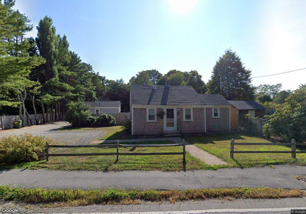
143-A Main St Centerville, MA 2632
Centerville NeighborhoodEstimated Value: $392,000 - $575,000
2
Beds
1
Bath
572
Sq Ft
$796/Sq Ft
Est. Value
About This Home
This home is located at 143-A Main St, Centerville, MA 2632 and is currently estimated at $455,195, approximately $795 per square foot. 143-A Main St is a home located in Barnstable County with nearby schools including Centerville Elementary School, Barnstable United Elementary School, and Barnstable Intermediate School.
Ownership History
Date
Name
Owned For
Owner Type
Purchase Details
Closed on
Jul 23, 2009
Sold by
Litchfield Kathleen
Bought by
Meyer John D
Current Estimated Value
Purchase Details
Closed on
Jan 2, 2009
Sold by
Phyllis S Litchfield R and Litchfield Kathleen
Bought by
Litchfield Kathleen
Purchase Details
Closed on
Apr 7, 1989
Sold by
Mccarrick Patrick J
Bought by
Hanrahan Donald M
Home Financials for this Owner
Home Financials are based on the most recent Mortgage that was taken out on this home.
Original Mortgage
$67,500
Interest Rate
10.71%
Mortgage Type
Purchase Money Mortgage
Create a Home Valuation Report for This Property
The Home Valuation Report is an in-depth analysis detailing your home's value as well as a comparison with similar homes in the area
Home Values in the Area
Average Home Value in this Area
Purchase History
| Date | Buyer | Sale Price | Title Company |
|---|---|---|---|
| Meyer John D | $165,000 | -- | |
| Litchfield Kathleen | -- | -- | |
| Hanrahan Donald M | $90,000 | -- | |
| Hanrahan Donald M | $90,000 | -- |
Source: Public Records
Mortgage History
| Date | Status | Borrower | Loan Amount |
|---|---|---|---|
| Previous Owner | Hanrahan Donald M | $67,500 |
Source: Public Records
Tax History
| Year | Tax Paid | Tax Assessment Tax Assessment Total Assessment is a certain percentage of the fair market value that is determined by local assessors to be the total taxable value of land and additions on the property. | Land | Improvement |
|---|---|---|---|---|
| 2025 | $2,959 | $365,800 | $228,100 | $137,700 |
| 2024 | $2,833 | $362,800 | $228,100 | $134,700 |
| 2023 | $2,831 | $339,500 | $225,700 | $113,800 |
| 2022 | $2,334 | $242,100 | $144,600 | $97,500 |
| 2021 | $2,409 | $229,600 | $153,600 | $76,000 |
| 2020 | $2,569 | $234,400 | $162,700 | $71,700 |
| 2019 | $2,628 | $233,000 | $171,700 | $61,300 |
| 2018 | $2,474 | $220,500 | $171,200 | $49,300 |
| 2017 | $2,388 | $221,900 | $176,000 | $45,900 |
| 2016 | $2,582 | $236,900 | $191,000 | $45,900 |
| 2015 | $2,440 | $224,900 | $175,400 | $49,500 |
Source: Public Records
Map
Nearby Homes
- 156 S Main St
- 40 Sachem Dr
- 290 Riverview Ln
- 149 Old Stage Rd
- 52 Meadow Farm Rd
- 53 Meadow Farm Rd
- 443 Elliott Rd
- 198 Great Marsh Rd
- 10 Sail a Way
- 10 Sail -A-way
- 498 Elliott Rd
- 82 Yacht Club Rd
- 576 Strawberry Hill Rd
- 855 W Main St Unit 7
- 58 Loomis Ln
- 1060 Craigville Beach Rd
- 33 Edgewood Rd
- 12 S Cedar Rd
- 60 Richards Ln
- 780 Craigville Beach Rd Unit D-2