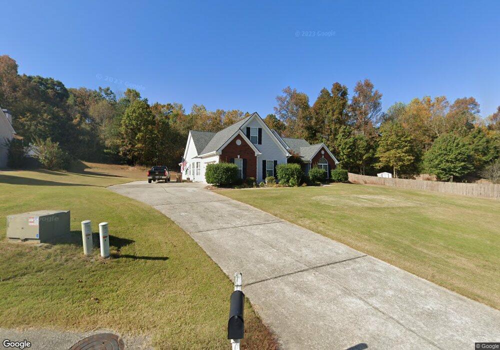
143 Arbor Trace Braselton, GA 30517
Estimated Value: $428,000 - $480,257
--
Bed
2
Baths
2,515
Sq Ft
$177/Sq Ft
Est. Value
About This Home
This home is located at 143 Arbor Trace, Braselton, GA 30517 and is currently estimated at $445,064, approximately $176 per square foot. 143 Arbor Trace is a home located in Jackson County with nearby schools including West Jackson Elementary School, West Jackson Middle School, and Jackson County High School.
Ownership History
Date
Name
Owned For
Owner Type
Purchase Details
Closed on
Aug 12, 2005
Sold by
M & T Homes Llc
Bought by
Roche Francis Thomas
Current Estimated Value
Home Financials for this Owner
Home Financials are based on the most recent Mortgage that was taken out on this home.
Original Mortgage
$128,900
Outstanding Balance
$67,495
Interest Rate
5.61%
Mortgage Type
New Conventional
Estimated Equity
$377,569
Purchase Details
Closed on
Jan 28, 2004
Sold by
Arbor Pointe Llc
Bought by
M & T Homes Llc
Create a Home Valuation Report for This Property
The Home Valuation Report is an in-depth analysis detailing your home's value as well as a comparison with similar homes in the area
Home Values in the Area
Average Home Value in this Area
Purchase History
| Date | Buyer | Sale Price | Title Company |
|---|---|---|---|
| Roche Francis Thomas | $188,900 | -- | |
| M & T Homes Llc | $909,000 | -- |
Source: Public Records
Mortgage History
| Date | Status | Borrower | Loan Amount |
|---|---|---|---|
| Open | Roche Francis Thomas | $128,900 |
Source: Public Records
Tax History Compared to Growth
Tax History
| Year | Tax Paid | Tax Assessment Tax Assessment Total Assessment is a certain percentage of the fair market value that is determined by local assessors to be the total taxable value of land and additions on the property. | Land | Improvement |
|---|---|---|---|---|
| 2024 | $2,919 | $138,160 | $27,200 | $110,960 |
| 2023 | $2,919 | $126,440 | $27,200 | $99,240 |
| 2022 | $2,415 | $107,640 | $27,200 | $80,440 |
| 2021 | $2,435 | $107,640 | $27,200 | $80,440 |
| 2020 | $1,786 | $82,520 | $16,000 | $66,520 |
| 2019 | $1,810 | $82,520 | $16,000 | $66,520 |
| 2018 | $1,722 | $79,240 | $16,000 | $63,240 |
| 2017 | $1,605 | $75,652 | $16,000 | $59,652 |
| 2016 | $1,334 | $67,652 | $8,000 | $59,652 |
| 2015 | $1,340 | $67,652 | $8,000 | $59,652 |
| 2014 | $2,189 | $63,028 | $8,000 | $55,028 |
| 2013 | -- | $63,028 | $8,000 | $55,028 |
Source: Public Records
Map
Nearby Homes
- 21 Duck Rd
- 53 Ednaville Rd
- 5068 Highway 53
- 6647 Hwy 53
- 6647 Highway 53
- 532 Davenport Rd
- 880 Duck Rd
- 0 Davenport Rd Unit 10583908
- 0 Davenport Rd Unit 16748330
- 1384 Pocket Rd
- 1745 Liberty Park Dr
- 298 Fox Creek Dr
- 111 Horned Owl Ave
- 156 Reisling Dr
- 1316 Sunny Valley Ln
- 691 Walnut Woods Dr
- 651 Walnut Woods Dr
- 498 Walnut Woods Dr
- 1390 Sunny Valley Ln
- 0 Arbor Trace Unit 8605732
- S Arbor Trace
- 175 Arbor Trace
- 115 Arbor Trace
- 199 Arbor Trace
- 97 Arbor Trace
- 94 Arbor Trace
- 140 Arbor Trace
- 73 Arbor Trace
- 223 Arbor Trace
- 172 Arbor Trace
- 77 Trellis Way
- 196 Arbor Trace
- 247 Arbor Trace
- 34 Arbor Trace
- 47 Arbor Trace
- 218 Arbor Trace
- 46 Trellis Way
- 87 Trellis Way
- 252 Arbor Trace Unit A