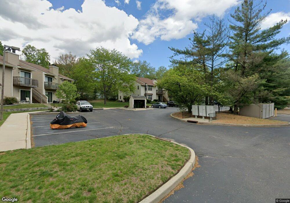
143 Ashton Ct Unit 143 West Deptford, NJ 08051
West Deptford Township NeighborhoodEstimated Value: $201,000 - $215,426
--
Bed
--
Bath
812
Sq Ft
$256/Sq Ft
Est. Value
About This Home
This home is located at 143 Ashton Ct Unit 143, West Deptford, NJ 08051 and is currently estimated at $207,607, approximately $255 per square foot. 143 Ashton Ct Unit 143 is a home located in Gloucester County with nearby schools including Green-Fields Elementary School, Oakview Elementary School, and Red Bank Elementary School.
Ownership History
Date
Name
Owned For
Owner Type
Purchase Details
Closed on
Mar 29, 2002
Sold by
Reynolds Michael L and Reynolds Cheryl K
Bought by
Fox Steven G
Current Estimated Value
Home Financials for this Owner
Home Financials are based on the most recent Mortgage that was taken out on this home.
Original Mortgage
$65,450
Outstanding Balance
$27,268
Interest Rate
6.88%
Mortgage Type
FHA
Estimated Equity
$180,339
Purchase Details
Closed on
Jan 16, 1997
Sold by
Hud
Bought by
Reynolds Michael L
Home Financials for this Owner
Home Financials are based on the most recent Mortgage that was taken out on this home.
Original Mortgage
$49,850
Interest Rate
7.36%
Mortgage Type
FHA
Purchase Details
Closed on
Apr 10, 1996
Sold by
Gill Charles W
Bought by
Hud
Home Financials for this Owner
Home Financials are based on the most recent Mortgage that was taken out on this home.
Original Mortgage
$67,170
Interest Rate
8.22%
Create a Home Valuation Report for This Property
The Home Valuation Report is an in-depth analysis detailing your home's value as well as a comparison with similar homes in the area
Home Values in the Area
Average Home Value in this Area
Purchase History
| Date | Buyer | Sale Price | Title Company |
|---|---|---|---|
| Fox Steven G | $67,000 | -- | |
| Reynolds Michael L | $51,000 | Surety Title Corporation | |
| Hud | -- | -- |
Source: Public Records
Mortgage History
| Date | Status | Borrower | Loan Amount |
|---|---|---|---|
| Open | Fox Steven G | $65,450 | |
| Previous Owner | Reynolds Michael L | $49,850 | |
| Previous Owner | Hud | $67,170 |
Source: Public Records
Tax History Compared to Growth
Tax History
| Year | Tax Paid | Tax Assessment Tax Assessment Total Assessment is a certain percentage of the fair market value that is determined by local assessors to be the total taxable value of land and additions on the property. | Land | Improvement |
|---|---|---|---|---|
| 2025 | $3,646 | $104,400 | $40,000 | $64,400 |
| 2024 | $3,599 | $104,400 | $40,000 | $64,400 |
| 2023 | $3,599 | $104,400 | $40,000 | $64,400 |
| 2022 | $3,582 | $104,400 | $40,000 | $64,400 |
| 2021 | $3,569 | $104,400 | $40,000 | $64,400 |
| 2020 | $3,561 | $104,400 | $40,000 | $64,400 |
| 2019 | $3,462 | $104,400 | $40,000 | $64,400 |
| 2018 | $3,368 | $104,400 | $40,000 | $64,400 |
| 2017 | $3,290 | $104,400 | $40,000 | $64,400 |
| 2016 | $3,198 | $104,400 | $40,000 | $64,400 |
| 2015 | $3,210 | $110,000 | $40,000 | $70,000 |
| 2014 | $3,050 | $110,000 | $40,000 | $70,000 |
Source: Public Records
Map
Nearby Homes
- 213 Barclay Ct
- 807 Saint Regis Ct
- 411 Durham Ct Unit 411
- 827 Saint Regis Ct
- 463 Durham Ct
- 629 Vassar Rd
- 751 Garrison Ct
- 7 Manchester Ct
- 111 Cove Rd
- 125 Ivy Ln
- 114 Buddy Powell Ln
- 100 Buddy Powell Ln
- 75 Hickory Ave
- 748 Dartmouth Dr
- 916 Georgetown Rd
- 136 Vanderbilt Ave
- 313 Ogden Station Rd
- 15 Ash Ave
- 315 Ogden Station Rd
- 711 Howard Ave
- 144 Ashton Ct Unit 144
- 142 Ashton Ct Unit 142
- 145 Ashton Ct Unit 145
- 141 Ashton Ct Unit 141
- 146 Ashton Ct Unit 146
- 147 Ashton Ct Unit 147
- 148 Ashton Ct
- 151 Ashton Ct
- 136 Ashton Ct Unit 136
- 134 Ashton Ct
- 152 Ashton Ct Unit 152
- 133 Ashton Ct
- 135 Ashton Ct Unit 135
- 892 Dante Ct
- 207 Barclay Ct Unit 207
- 891 Dante Ct
- 153 Ashton Ct Unit 153
- 208 Barclay Ct Unit 208
- 154 Ashton Ct
- 890 Dante Ct
