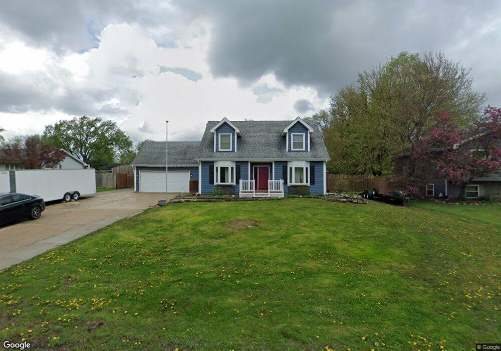
143 Branchaw Blvd New Lenox, IL 60451
Estimated Value: $323,000 - $498,000
4
Beds
2
Baths
--
Sq Ft
--
Built
About This Home
This home is located at 143 Branchaw Blvd, New Lenox, IL 60451 and is currently estimated at $379,141. 143 Branchaw Blvd is a home located in Will County with nearby schools including Oster-Oakview School, Haines Elementary School, and Lincoln Way West.
Ownership History
Date
Name
Owned For
Owner Type
Purchase Details
Closed on
Aug 6, 2019
Sold by
Shrake Gayle L
Bought by
Gomez Christopher and Gomez Kelly L
Current Estimated Value
Home Financials for this Owner
Home Financials are based on the most recent Mortgage that was taken out on this home.
Original Mortgage
$213,750
Outstanding Balance
$187,398
Interest Rate
3.75%
Mortgage Type
New Conventional
Estimated Equity
$191,743
Purchase Details
Closed on
Sep 25, 2000
Sold by
Stark Ronald L and Stark Cindy L
Bought by
Shrake Gayle L
Home Financials for this Owner
Home Financials are based on the most recent Mortgage that was taken out on this home.
Original Mortgage
$107,000
Interest Rate
7.98%
Create a Home Valuation Report for This Property
The Home Valuation Report is an in-depth analysis detailing your home's value as well as a comparison with similar homes in the area
Home Values in the Area
Average Home Value in this Area
Purchase History
| Date | Buyer | Sale Price | Title Company |
|---|---|---|---|
| Gomez Christopher | $225,000 | Attorneys Ttl Guaranty Fund | |
| Shrake Gayle L | $158,000 | Chicago Title Insurance Co |
Source: Public Records
Mortgage History
| Date | Status | Borrower | Loan Amount |
|---|---|---|---|
| Open | Gomez Christopher | $213,750 | |
| Previous Owner | Shrake Gayle L | $107,000 |
Source: Public Records
Tax History Compared to Growth
Tax History
| Year | Tax Paid | Tax Assessment Tax Assessment Total Assessment is a certain percentage of the fair market value that is determined by local assessors to be the total taxable value of land and additions on the property. | Land | Improvement |
|---|---|---|---|---|
| 2024 | $6,330 | $88,897 | $20,863 | $68,034 |
| 2023 | $6,330 | $81,036 | $19,018 | $62,018 |
| 2022 | $5,726 | $74,653 | $17,520 | $57,133 |
| 2021 | $5,426 | $70,209 | $16,477 | $53,732 |
| 2020 | $5,264 | $67,704 | $15,889 | $51,815 |
| 2019 | $5,029 | $65,604 | $15,396 | $50,208 |
| 2018 | $4,905 | $63,342 | $14,865 | $48,477 |
| 2017 | $4,650 | $61,521 | $14,438 | $47,083 |
| 2016 | $4,508 | $59,875 | $14,052 | $45,823 |
| 2015 | $4,356 | $57,991 | $13,610 | $44,381 |
| 2014 | $4,356 | $57,275 | $13,442 | $43,833 |
| 2013 | $4,356 | $58,047 | $13,623 | $44,424 |
Source: Public Records
Map
Nearby Homes
- 1344 N Cedar Rd
- 133 Barbara Ln
- 200 Redwood Ave
- 208 Redwood Ave
- 1231 Town Crest Dr Unit E
- 1999 Silver Cross Blvd
- 217 Aspen Dr
- 0 Silver Cross Blvd
- 1301 Silver Cross Blvd
- 12001 W Route 6
- 807 Picardy Place
- 338 Willow St
- 224 Hauser Ct
- 125 Kimber Dr
- 1261 S Regan Rd
- 1920 Edmonds Ave
- 203 Fir St
- 331 Old Hickory Rd
- 13621 W Maple Rd
- 13741 Elizabeth Ln
- 139 Branchaw Blvd
- 149 Branchaw Blvd
- 150 Michael Ln
- 154 Michael Ln
- 146 Michael Ln
- 144 Branchaw Blvd
- 158 Michael Ln
- 135 Branchaw Blvd
- 151 Branchaw Blvd
- 142 Michael Ln
- 1750 Elm Dr
- 131 Branchaw Blvd
- 138 Michael Ln
- 149 Michael Ln
- 153 Michael Ln
- 153 Michael Ln
- 145 Michael Ln
- 134 Michael Ln
- 157 Michael Ln
- 141 Michael Ln