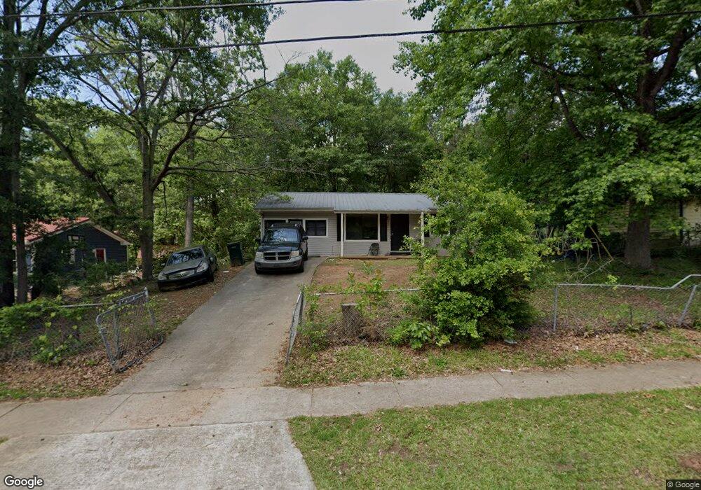
143 Carter St Carrollton, GA 30117
Estimated Value: $205,612 - $257,000
3
Beds
2
Baths
1,248
Sq Ft
$176/Sq Ft
Est. Value
About This Home
This home is located at 143 Carter St, Carrollton, GA 30117 and is currently estimated at $219,653, approximately $176 per square foot. 143 Carter St is a home located in Carroll County with nearby schools including Carrollton Elementary School, Carrollton Upper Elementary School, and Carrollton Middle School.
Ownership History
Date
Name
Owned For
Owner Type
Purchase Details
Closed on
Jul 7, 2003
Sold by
Daniels David and Daniels Shannon
Bought by
Crook Keelyn and Crook Donna
Current Estimated Value
Home Financials for this Owner
Home Financials are based on the most recent Mortgage that was taken out on this home.
Original Mortgage
$80,400
Outstanding Balance
$34,027
Interest Rate
5.2%
Mortgage Type
New Conventional
Estimated Equity
$185,626
Purchase Details
Closed on
Nov 13, 2002
Sold by
Jmp Properties Llc
Bought by
Daniels David and Daniels Shannon
Purchase Details
Closed on
Aug 30, 2002
Sold by
Brown Braddon L
Bought by
Jmp Properties Llc
Purchase Details
Closed on
Dec 2, 1997
Sold by
Guardians Reid G and Guardians J
Bought by
Brown Braddon L
Purchase Details
Closed on
Jan 28, 1997
Sold by
Swint Swint T and Swint W
Bought by
Brown Braddon L
Purchase Details
Closed on
Jan 24, 1997
Sold by
Swint Ray and Swint Rahmone
Bought by
Brown Braddon L
Purchase Details
Closed on
Jan 13, 1997
Bought by
Brown Braddon L
Create a Home Valuation Report for This Property
The Home Valuation Report is an in-depth analysis detailing your home's value as well as a comparison with similar homes in the area
Home Values in the Area
Average Home Value in this Area
Purchase History
| Date | Buyer | Sale Price | Title Company |
|---|---|---|---|
| Crook Keelyn | $80,000 | -- | |
| Daniels David | -- | -- | |
| Daniels David | $76,000 | -- | |
| Jmp Properties Llc | $42,500 | -- | |
| Brown Braddon L | -- | -- | |
| Brown Braddon L | -- | -- | |
| Brown Braddon L | -- | -- | |
| Brown Braddon L | -- | -- |
Source: Public Records
Mortgage History
| Date | Status | Borrower | Loan Amount |
|---|---|---|---|
| Open | Crook Keelyn | $80,400 |
Source: Public Records
Tax History Compared to Growth
Tax History
| Year | Tax Paid | Tax Assessment Tax Assessment Total Assessment is a certain percentage of the fair market value that is determined by local assessors to be the total taxable value of land and additions on the property. | Land | Improvement |
|---|---|---|---|---|
| 2024 | $1,580 | $57,840 | $4,000 | $53,840 |
| 2023 | $1,580 | $53,036 | $4,000 | $49,036 |
| 2022 | $1,263 | $43,260 | $4,000 | $39,260 |
| 2021 | $1,101 | $37,716 | $4,000 | $33,716 |
| 2020 | $986 | $33,756 | $4,000 | $29,756 |
| 2019 | $919 | $31,165 | $4,000 | $27,165 |
| 2018 | $825 | $27,555 | $4,000 | $23,555 |
| 2017 | $829 | $27,555 | $4,000 | $23,555 |
| 2016 | $834 | $27,555 | $4,000 | $23,555 |
| 2015 | $1,027 | $33,263 | $6,000 | $27,264 |
| 2014 | $1,032 | $33,264 | $6,000 | $27,264 |
Source: Public Records
Map
Nearby Homes
- 654 King St
- 109 7th St
- 250 Riversong Rd
- 250 Riversong Rd Unit 55
- 149 River Dr
- 149 River Dr Unit 42
- 405 N Park St
- TRACT1-7 Us Highway 27
- 102 Avalon Dr
- 108 Springwood Dr
- 109 Chalfont Cir
- 160 Watson St
- 109 S Park St
- 103 W Chandler St
- 0 Ward St Unit 10390499
- 205 Johnson Ave Unit 231
- 110 Town Walk Ln
- 219 Broad St
- 330 Avalon Dr
- 301 C4 Bradley St
- 141 Carter St
- 145 Carter St
- 139 Carter St
- 147 Carter St
- 114 Robert Hendrix Dr
- 112 Robert Hendrix Dr
- 142 Carter St
- 116 Robert Hendrix Dr
- 137 Carter St
- 110 Robert Hendrix Dr
- 140 Beall St
- 144 Carter St
- 118 Robert Hendrix Dr
- 148 Carter St
- 148 Carter St
- 148 Carter St
- 148 Carter St
- 148 Carter St
- 148 Carter St
- 148 Carter St