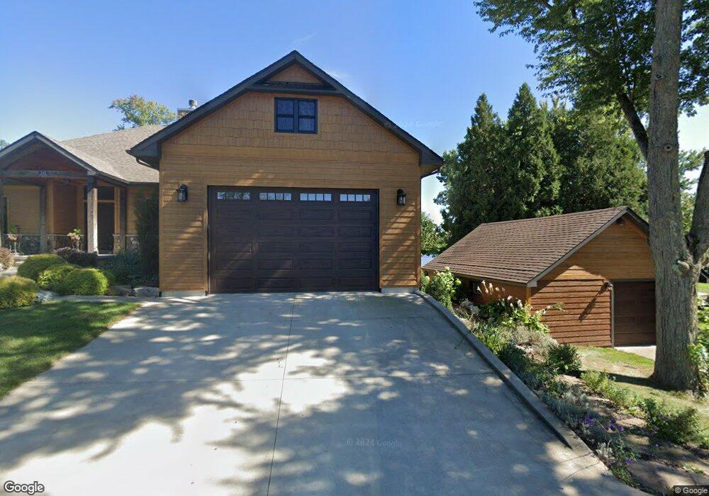
143 Crauns Beach Dr Quincy, MI 49082
Estimated Value: $528,000 - $862,000
3
Beds
3
Baths
1,944
Sq Ft
$362/Sq Ft
Est. Value
About This Home
This home is located at 143 Crauns Beach Dr, Quincy, MI 49082 and is currently estimated at $703,925, approximately $362 per square foot. 143 Crauns Beach Dr is a home located in Branch County with nearby schools including Jennings Elementary School, Quincy Middle School, and Quincy High School.
Ownership History
Date
Name
Owned For
Owner Type
Purchase Details
Closed on
Mar 6, 2019
Sold by
Daniel John S and Auer Beverly A
Bought by
Daniel John S and Auer Beverly A
Current Estimated Value
Purchase Details
Closed on
Jun 26, 2017
Sold by
Auger Beverly A and Daniel John S
Bought by
Daniel John S and Auger Beverly A
Purchase Details
Closed on
Nov 18, 2016
Sold by
Auger Beverly A
Bought by
Auger Beverly A and Daniel John S
Purchase Details
Closed on
Mar 14, 2006
Sold by
Auger Beverly A and Auger Julie A
Bought by
Auger Beverly A
Purchase Details
Closed on
Jan 10, 2002
Sold by
Auger Larry T and Auger Beverly A
Bought by
Auger, Larry T Trust
Create a Home Valuation Report for This Property
The Home Valuation Report is an in-depth analysis detailing your home's value as well as a comparison with similar homes in the area
Home Values in the Area
Average Home Value in this Area
Purchase History
| Date | Buyer | Sale Price | Title Company |
|---|---|---|---|
| Daniel John S | -- | None Available | |
| Daniel John S | -- | Attorney | |
| Auger Beverly A | -- | Attorney | |
| Auger Beverly A | $180,720 | None Available | |
| Auger, Larry T Trust | -- | -- |
Source: Public Records
Tax History Compared to Growth
Tax History
| Year | Tax Paid | Tax Assessment Tax Assessment Total Assessment is a certain percentage of the fair market value that is determined by local assessors to be the total taxable value of land and additions on the property. | Land | Improvement |
|---|---|---|---|---|
| 2025 | $12,743 | $401,788 | $0 | $0 |
| 2024 | $2,901 | $387,052 | $0 | $0 |
| 2023 | $2,636 | $351,410 | $0 | $0 |
| 2022 | $11,599 | $340,345 | $0 | $0 |
| 2021 | -- | $310,695 | $0 | $0 |
| 2020 | -- | $290,372 | $0 | $0 |
| 2019 | -- | $285,560 | $0 | $0 |
| 2018 | -- | $266,390 | $0 | $0 |
| 2017 | -- | $94,042 | $0 | $0 |
| 2016 | -- | $124,163 | $0 | $0 |
| 2015 | -- | $120,605 | $0 | $0 |
| 2014 | -- | $99,509 | $0 | $0 |
| 2013 | -- | $85,741 | $0 | $0 |
Source: Public Records
Map
Nearby Homes
- 117 Ridge Rd
- 804 Cornell Rd
- 181 Dons Dr
- 202 Dons Dr
- 180 Crockett Dr
- 204 Dons Dr
- 808 Rolling Meadows Dr
- 905 Fisher Rd
- 204 Crockett Dr
- 757 Lake Shore Point
- 216 Sandalwood Dr
- 727 Skipper Ln
- 211 S Ray Quincy Rd
- 283 S Fremont Rd
- 242 Bickford Dr
- 297 Winhoven Dr
- 0 Brocklebank Rd
- 988 Williams Dr
- 912 Beckwith Shore
- 0 Wildwood Rd
- 139 Crauns Beach Dr
- 843 Teal Dr
- 137 Crauns Beach Dr
- 136 Crauns Beach Dr
- 135 Crauns Beach Dr
- 841 Teal Dr
- 133 Crauns Beach Dr
- 132 Crauns Beach Dr
- 839 Teal Dr
- 839 Teal Dr
- 846 Whistler Dr
- 129 Crauns Beach Dr
- 837 Teal Dr
- 837 Teal Dr
- 132 Craun's Beach Dr
- 835 Teal Dr
- 835 Teal Dr
- 127 Crauns Beach Dr
- 836 Whistler Dr
- 837 Crauns Ln