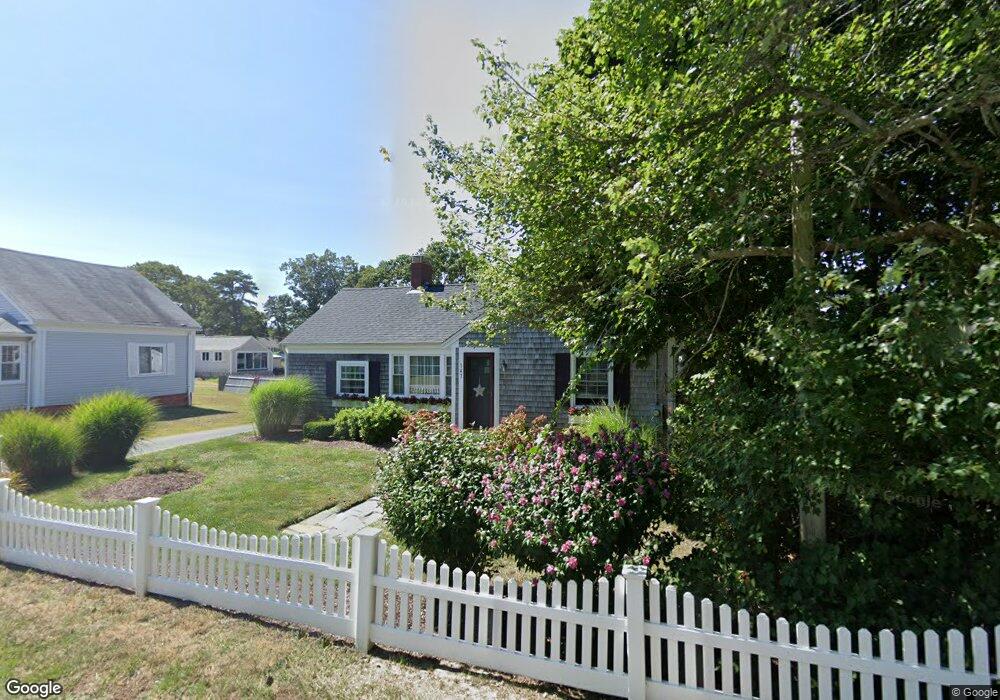
143 Depot St Unit G Dennis Port, MA 02639
Dennis Port NeighborhoodEstimated Value: $367,010 - $406,000
2
Beds
1
Bath
650
Sq Ft
$589/Sq Ft
Est. Value
About This Home
This home is located at 143 Depot St Unit G, Dennis Port, MA 02639 and is currently estimated at $382,753, approximately $588 per square foot. 143 Depot St Unit G is a home located in Barnstable County with nearby schools including Dennis-Yarmouth Regional High School and St. Pius X. School.
Ownership History
Date
Name
Owned For
Owner Type
Purchase Details
Closed on
Dec 19, 2023
Sold by
Downie Todd W and Downie Michelle
Bought by
Downie Michelle
Current Estimated Value
Purchase Details
Closed on
Jul 7, 2021
Sold by
Downie Cheryl Lee Est and Downie
Bought by
Downie Todd W and Downie Michelle
Purchase Details
Closed on
Jan 21, 2005
Sold by
Reyburn Nancy C and Reyburn Scott J
Bought by
Downie Cheryl L and Downie David A
Home Financials for this Owner
Home Financials are based on the most recent Mortgage that was taken out on this home.
Original Mortgage
$140,000
Interest Rate
5.71%
Mortgage Type
Purchase Money Mortgage
Create a Home Valuation Report for This Property
The Home Valuation Report is an in-depth analysis detailing your home's value as well as a comparison with similar homes in the area
Home Values in the Area
Average Home Value in this Area
Purchase History
| Date | Buyer | Sale Price | Title Company |
|---|---|---|---|
| Downie Michelle | -- | None Available | |
| Downie Michelle | -- | None Available | |
| Downie Todd W | -- | None Available | |
| Downie Todd W | -- | None Available | |
| Downie Cheryl L | $179,500 | -- | |
| Downie Cheryl L | $179,500 | -- |
Source: Public Records
Mortgage History
| Date | Status | Borrower | Loan Amount |
|---|---|---|---|
| Previous Owner | Downie Cheryl L | $140,000 |
Source: Public Records
Tax History Compared to Growth
Tax History
| Year | Tax Paid | Tax Assessment Tax Assessment Total Assessment is a certain percentage of the fair market value that is determined by local assessors to be the total taxable value of land and additions on the property. | Land | Improvement |
|---|---|---|---|---|
| 2025 | $1,585 | $366,000 | $0 | $366,000 |
| 2024 | $1,494 | $340,400 | $0 | $340,400 |
| 2023 | $1,303 | $279,000 | $0 | $279,000 |
| 2022 | $1,260 | $225,000 | $0 | $225,000 |
| 2021 | $1,222 | $202,700 | $0 | $202,700 |
| 2020 | $1,201 | $196,900 | $0 | $196,900 |
| 2019 | $1,195 | $193,700 | $0 | $193,700 |
| 2018 | $1,171 | $184,700 | $0 | $184,700 |
| 2017 | $1,140 | $185,300 | $0 | $185,300 |
| 2016 | $799 | $122,400 | $0 | $122,400 |
| 2015 | $783 | $122,400 | $0 | $122,400 |
| 2014 | $649 | $102,200 | $0 | $102,200 |
Source: Public Records
Map
Nearby Homes
- 12 Cross St
- 159 Center St Unit 22
- 26 Manning Rd
- 10 Candlewood Ln
- 12 Candlewood Ln Unit 2-9
- 221 Upper County Rd Unit 2A
- 221 Upper County Rd Unit 2A
- 73 Division St
- 9 Country Ln
- 47 Telegraph Rd Unit 1
- 166 Upper County Rd Unit 1-4
- 102 Sea St
- 148 Belmont Rd
- 72 Bassett Ln
- 141 Division St
- 268 Main St
- 141 Division St
- 22 Ferncliff Rd
- 11 Ocean Park W
- 143 Depot St Unit Q
- 143 Depot St Unit N
- 143 Depot St Unit M
- 143 Depot St Unit L
- 143 Depot St Unit K
- 143 Depot St Unit J
- 143 Depot St Unit H
- 143 Depot St Unit E
- 143 Depot St Unit D
- 143 Depot St Unit C
- 143 Depot St Unit A
- 143 Depot St Unit U-A
- 143 Depot St Unit F
- 143 Depot St
- 228 Sea St
- 117 Center St
- 228 Sea St
- 230 Sea St
- 123 Center St
- 123 Center St Unit A