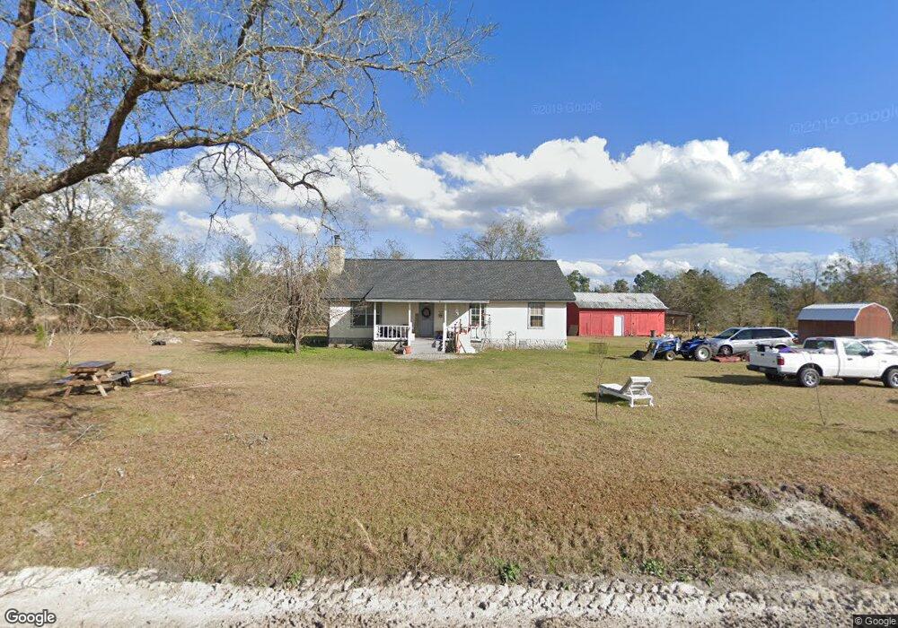
143 Frank Bryant Rd Folkston, GA 31537
Estimated Value: $289,799 - $321,000
2
Beds
2
Baths
2,000
Sq Ft
$151/Sq Ft
Est. Value
About This Home
This home is located at 143 Frank Bryant Rd, Folkston, GA 31537 and is currently estimated at $302,933, approximately $151 per square foot. 143 Frank Bryant Rd is a home with nearby schools including Charlton County High School.
Ownership History
Date
Name
Owned For
Owner Type
Purchase Details
Closed on
Mar 25, 2021
Sold by
Walters Douglas
Bought by
Craft Christopher Thomas and Craft Ashley Diane
Current Estimated Value
Purchase Details
Closed on
Aug 8, 2016
Sold by
Keith Douglas
Bought by
Walters Douglas Keith and Walters Debra
Home Financials for this Owner
Home Financials are based on the most recent Mortgage that was taken out on this home.
Original Mortgage
$125,500
Interest Rate
3.41%
Mortgage Type
New Conventional
Purchase Details
Closed on
Jun 9, 2015
Sold by
Walters Douglas
Bought by
Walters Randall K
Purchase Details
Closed on
Dec 13, 2013
Sold by
Walters Douglas Keith
Bought by
Dawson Christopher M and Dawson Billie F
Create a Home Valuation Report for This Property
The Home Valuation Report is an in-depth analysis detailing your home's value as well as a comparison with similar homes in the area
Home Values in the Area
Average Home Value in this Area
Purchase History
| Date | Buyer | Sale Price | Title Company |
|---|---|---|---|
| Craft Christopher Thomas | -- | -- | |
| Walters Douglas Keith | -- | -- | |
| Walters Randall K | -- | -- | |
| Dawson Christopher M | $22,000 | -- |
Source: Public Records
Mortgage History
| Date | Status | Borrower | Loan Amount |
|---|---|---|---|
| Previous Owner | Walters Douglas Keith | $125,500 |
Source: Public Records
Tax History Compared to Growth
Tax History
| Year | Tax Paid | Tax Assessment Tax Assessment Total Assessment is a certain percentage of the fair market value that is determined by local assessors to be the total taxable value of land and additions on the property. | Land | Improvement |
|---|---|---|---|---|
| 2024 | $1,929 | $69,444 | $26,800 | $42,644 |
| 2023 | $1,836 | $63,096 | $20,320 | $42,776 |
| 2022 | $1,461 | $49,856 | $15,600 | $34,256 |
| 2021 | $2,248 | $62,168 | $26,440 | $35,728 |
| 2020 | $2,215 | $62,168 | $26,440 | $35,728 |
| 2019 | $1,478 | $40,528 | $5,520 | $35,008 |
| 2018 | $1,472 | $39,888 | $4,880 | $35,008 |
| 2017 | $1,425 | $39,088 | $4,880 | $34,208 |
| 2016 | $1,421 | $39,088 | $4,880 | $34,208 |
| 2015 | -- | $39,088 | $4,880 | $34,208 |
Source: Public Records
Map
Nearby Homes
- 3047 John Burch Rd
- 475 Mattox Rd
- 181040 Autumn Rd
- 3204 Second St S
- 0 Janells River Dr Unit 10577636
- 1296 Janells River Dr
- 28727 Tracy Rd
- 0 Broken Arrow Rd Unit 2061426
- 2742 Second St S
- 559 Lake Deborah Dr
- 850 Lake Deborah Dr
- 48 Lasalle St
- 12 Buchanan Landing Dr
- 241834 County Road 121
- 0 Church Dr
- 0 Church Dr Unit 2119266
- 315 Martin St
- 17539 Hodges Rd
- 0 Knight Rd 33-4n-23-1637-0002-0000
- 593 Henri St
- 227 Frank Bryant Rd
- 556 Tracys Ferry Rd
- Lot 16 Tracey's Ferry Rd
- 678 Tracys Ferry Rd
- 274 Frank Bryant Rd
- 30918 Highway 121
- 695 Tracys Ferry Rd
- (Lot 15) Tracy's Ferry Rd
- (Lot 16) Tracy's Ferry Rd
- 504 Harold White Rd
- 341 Tracys Ferry Rd
- (Lot 9) Tracy's Ferry Rd
- 802 Tracys Ferry Rd
- (Lot 17) Tracy's Ferry Rd
- (Lot 13) Tracy's Ferry Rd
- 108 Pioneer Ridge Rd
- 243 Pioneer Ridge Rd
- (Lot 18) Tracy's Ferry Rd
- (Lot 23) Tracy's Ferry Rd